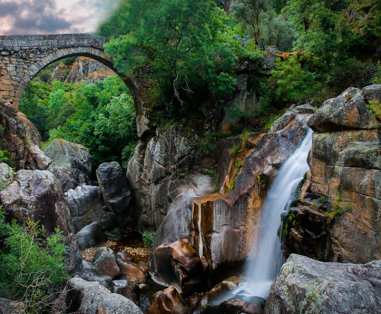
Valença is a historic-walled city perched on the left bank of the River Minho, just 25 kilometers from the Atlantic coast. Its strategic position has shaped its story for centuries, guarding Portugal’s northern frontier and keeping watch over the river that separates it from Spain.
To the north, the wide Minho serves as both a natural boundary and a cultural bridge with the Galician town of Tui, just across the water. To the south and southeast lies the rolling countryside of Paredes de Coura, famous for its music festival and rural landscapes. To the southwest, Valença connects with Vila Nova de Cerveira, known for its art, markets, and river views, while to the east it borders Monção, another fortress town deeply tied to the history of the Minho Valley.
Surrounded by these neighbors and framed by the river and the sea, Valença blends the atmosphere of a frontier town with the charm of a riverside settlement. Its walls and streets still tell the story of centuries of defense, trade, and cultural exchange, making it an essential stop for anyone exploring northern Portugal.

Valença’s story reaches back to Roman times, when two ancient highways crossed the region: the Via IV of the Antonine Itinerary XIX, used for military purposes, and the per loca maritima (Itinerary XX), a commercial route. A Roman milestone marking the 42nd mile of the road between Braga and Tui still stands today, preserved within the town’s defensive walls.
In the 12th century, King Sancho I fortified the settlement, which was then called Contrasta—a name meaning “a settlement facing another,” in reference to its position opposite Tui in Spain. By the 13th century, King Afonso III gave it the name Valença.
For centuries, the fortress was vital to Portugal’s defence and sovereignty against its neighbor across the Minho. Today, the atmosphere is far more welcoming: Spanish visitors cross the river not as enemies, but as tourists and shoppers. Even so, the fortifications remain an active military site, a living reminder of Valença’s strategic past.
Things to do and see:
-
Church of Saint Stephen

The Church of Santo Estêvão is a graceful Neoclassical building with a traditional three-aisled layout. Once home to the Collegiate Church of Santo Estêvão de Valença and the Bishopric of Ceuta, it still preserves remarkable treasures from those times. Inside, you can admire the bishop’s chair in Gothic-Mudejar style, along with painted panels depicting scenes from the life of Saint Stephen.
One of the church’s unique features is a rare painting of the Virgin breastfeeding the Christ Child—the only example of its kind in Portugal to survive the Inquisition. For visitors, it’s not just a place of worship but also a window into centuries of faith, artistry, and resilience.
Insider Tip: Step inside during the quieter morning hours, when the light filters softly through the nave—it’s the best time to take in the details without distraction.
-
- GPS: 42º1’54.02” N | 8º38´41.49” W
-
Church of Saint Mary of Angels

The Mother Church of Valença, dating back to the 13th century, is a fine example of Romanesque architecture with a classic longitudinal layout. Step inside, and you will find five beautifully carved and painted altarpieces in both Neoclassical and Baroque styles. Two sit beside the triumphal arch, while the chancel holds another richly decorated Neoclassical piece. Don’t miss the adjoining funerary chapel, where delicate fragments of 16th-century mural paintings have survived, offering a glimpse into the artistry of the past.
-
Military chapel of Bom Jesus. Baroque chapel, 17th and 18th centuries

The Chapel of Bom Jesus do Bonfim is a striking example of Baroque and Rococo religious architecture. Its simple rectangular nave and chancel give way to an interior rich in detail. At the heart of the chapel is the revered image of Our Lady of Mount Carmel, patron saint of Valença’s 21st Infantry Regiment. Take a moment to notice the intricate decorations and the side frame dedicated to the regiment, a symbol of both devotion and protection that connects faith with the town’s military history.
GPS: 42º1’42.45”N | 8º38’43.62”W
-
Statue of São Teotónio

In Valença you’ll find a 20th-century sculpture honoring Portugal’s first saint, born in the nearby parish of Ganfei in 1082. He became known as both an inspirer and a protector of the emerging Portuguese nation. Passing away in Coimbra in 1162, he is remembered above all as the patron saint of imprisoned Christians, credited with helping free a thousand Mozarabic men, women, and children during King Afonso Henriques’ campaign in Andalusia. Today, the sculpture stands as both a work of art and a tribute to one of Valença’s most remarkable sons—worth pausing to reflect on the deep history tied to this place.
-
Manor house, 15th-century (Eirado house)

Manor house is one of the oldest in the fort. It stands out for its merlons, the Jewish marks on the doors and its window. The window of Casa Do Eirado is one of the first hallmarks of the Portuguese Manueline architectural style. Underneath the window is the figure of a head, in granite, with the inscription FEAL: ME FEZ 1448. The villagers say that it symbolizes a Galician who has had his throat cut.
GPS: N 42º1’51.4” | W 8º38’40.4”
-
Marshal’s House, 19th Century XVIII. Champalimaud Nussane Portal
The house in the shape of an inverted L, on Rua Mouzinho de Albuquerque, is one of the most important buildings in the Historic Center in terms of architectural interest. An example of late-Baroque architecture belonged to Marshal Champalimaud de Nussane, a prominent figure in the Portuguese Army who was also governor of Praça Forte de Valença.
GPS: 42º1’54.11″ N | 8º38’43.11″ W
-
The historic international bridge
Portugal and Spain decided to build a bi-functional (road and railway) bridge in 1879. Eiffel’s work inspired the design of the bridge. Although the bridge is still in use, a new bridge was erected south of the old one.
-
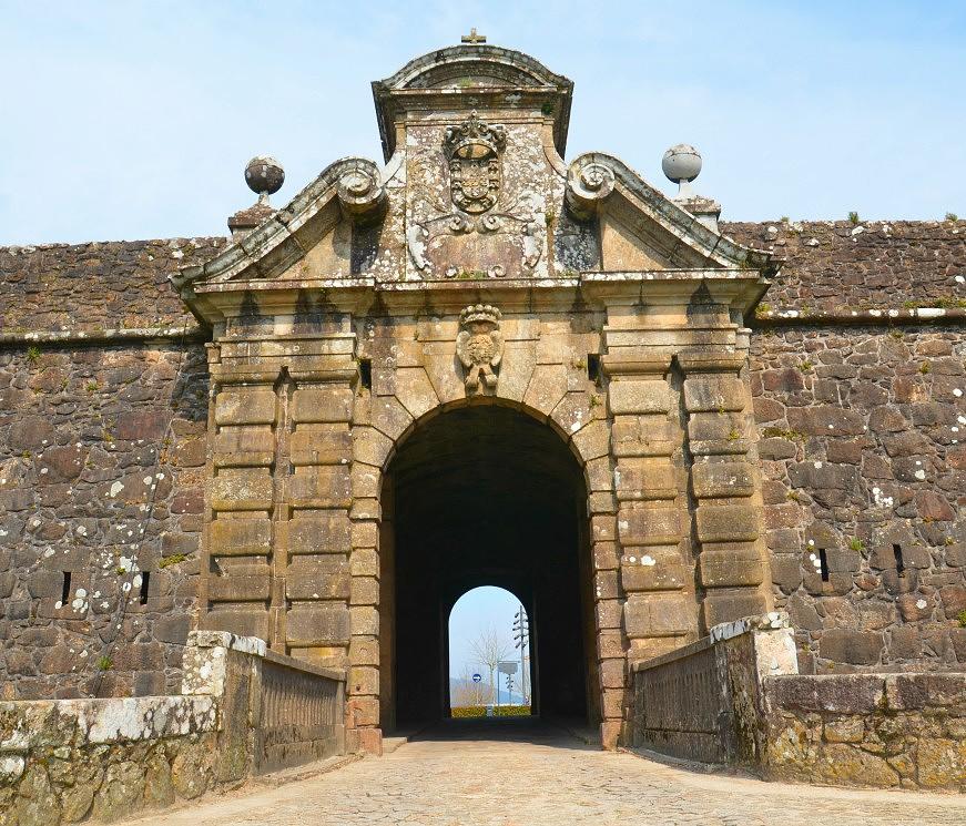
Valencia’s fortress


The Valença Fortress is one of the main military fortifications in Europe, with about 5 km of walled perimeter overlooking the river Minho, opposite Tui. A space of Galician-Minhoto coexistence, commercial and tourist par excellence.
A work of bastioned military architecture, whose first walls date back to an Iron Age settlement and which currently has a bastioned system, was built in the 17th and 18th centuries.
The fortification is located on top of two hills and is formed by two polygons: the Magistral (older) and the Coroada, separated by a moat with false-bragas.
10 bulwarks and 2 half bulwarks, 5 ravelins, 5 repairs, 6 slats, 2 counterguards, 2 faceplates, 1 tenalha, 34 watchtowers, 214 gunboats, 6 forts, 3 posterns, 2 magazines, 10 pillboxes, are some of the elements of the bastioned military architecture that are projected and it is possible to appreciate in this fortification.
-
The cannons
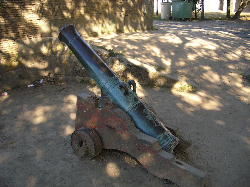
Along the north wall, several old cannons very well maintained are positioned pointing to the river and Galicia as if to remind of their old purpose.
-
Village fountain

It is a fountain of mediaeval antiquity, located outside the walls on the west side of the castle, that was repaired in the 18th century, as shown by the royal weapons put over the water tank. A lovely picturesque spot with a fountain and old washing tanks, sheltered by the ravelin of Fonte da Vila. On land, the ravelin contains gunboats made of granite masonry and a casemate buried in the collar.
GPS coordinates: 42o1’49.57″ N | 8o38’43.74″ W
-
Field of Mars Magazine. Paiol, 19th Century XVIII

Built-in 1715, it is located in the southern part of the fort. With two rectangular rooms surrounded by a high wall, a portal between pilasters topped by the Stone of Arms of Portugal and, below, by the Ataídes Stone, lies Lieutenant General João Vitoria Miron de Sabione, Governor of the Square and founder of the Aula Real de Artilharia.
1’39.62” N | 8°38’46.24” W
-
Butcher Shop. Magazine of 1774

Dating back to 1774, it served as a collection of war material for the 8th Machine Gun Group. It has a rectangular floor plan and a vaulted upper system, protected by high walls. It is one of the emblematic buildings that mark the centuries of the strategic military function of the fortress of Valença.
-
Roman milestone

It marks the 42-mile distance from Braga to Tui and was built by Emperor Cláudio in the 19th century. I DC Over time, it also served as a pillory. The XIXth century Roman road enters Valença through Fontoura, crosses Cerdal at the Pedreira bridge, and arrives at the Valença valley, where the passage to Tui was made. A route for military, commercial, and territory pacification purposes.
GPS: 42º1’54.4” N | 8º38’41.34” W
Viewpoints
-
Capela Sant’ana Viewpoint

One of the most privileged viewpoints in Alto Minho, with a fabulous view over Valença and Tui, with the bridge that joins them and the river Minho, up to its mouth, in Caminha. It is located next to the chapels of Nossa Sra. do Faro and Santa Ana and is set in a natural park with pleasant leisure spaces and picnic areas.
-
The viewpoint of Santo Ovid

Sanfins: next to the chapel of Santo Ovídeo, there is a panoramic bridge to appreciate the upper part of the Portuguese Minho Valley and the lands of Condado, in the south of Galicia.
-
The viewpoint of Sao Lourenco

Taião: A place of great scenic value, the Capela de S. Lourenço viewpoint is located at one of the highest points in the region. Panoramic views of the sea, overlooking Portugal and Spain.
-
The viewpoint of São Sebastião

A long staircase takes visitors to the Sanctuary of São Sebastião. Here, the view reaches the entire southern part of the municipality of Valença and the lands of Galicia.

-
TAIÃO viewpoint
A privileged viewpoint for the southern part of the municipality of Valença and Vale do Minho Transfronteiriço

-
Furna castle viewpoint

From the majesty of the granite agglomeration, the view extends through valleys and hills, from Boulhosa to the lands of Galicia.
-
Socorro viewpoint

Fortaleza: Located at the northern end of the fortress, the Baluarte do Socorro has the best view over Tui, the International Bridge, the River Minho and the agricultural fields, all in perfect harmony with the surroundings.
ECOTRAIL OF THE MINHO RIVER
The Ecopista of Valença is a celebrated greenway, recognized as one of the top routes in Europe. Winding along the River Minho, it takes you past vineyards, cultivated fields, and streams, offering stunning views as well as glimpses of the region’s architectural heritage.
Along the way, you’ll discover fisheries, river islands, and the Veiga da Mira biotope—protected areas that form part of the Natura 2000 Network and create peaceful natural retreats.
There are several perfect spots to pause: the picnic parks of Verdoejo, Ganfei, and Senhora da Cabeça (Cristelo Côvo), or the leisure area at Foz do Manco (Friestas), all surrounded by beautiful scenery.
Whether on foot, by bike, on inline skates, or even on a skateboard, the Ecopista is easy to explore and ideal for both solo visitors and families.
Getting There: Valença is easy to reach. By car, it’s about an hour’s drive north from Porto on the A3, or less than half an hour south from Vigo, Spain. Trains also connect Valença with both cities, making it a convenient cross-border stop. Its location on the Camino de Santiago routes adds another layer of appeal for walkers and pilgrims heading toward Santiago de Compostela.
Best Time to Visit: Spring (April to June) and early autumn (September to October) are ideal, with mild weather and fewer crowds, perfect for walking the fortress walls or exploring the riverfront. Summer brings festivals, outdoor concerts, and lively markets, while winter offers a quieter experience with fewer visitors and a more intimate feel inside the walled town.