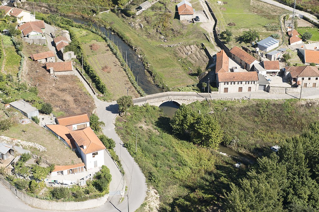
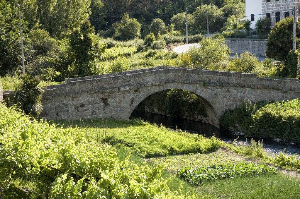
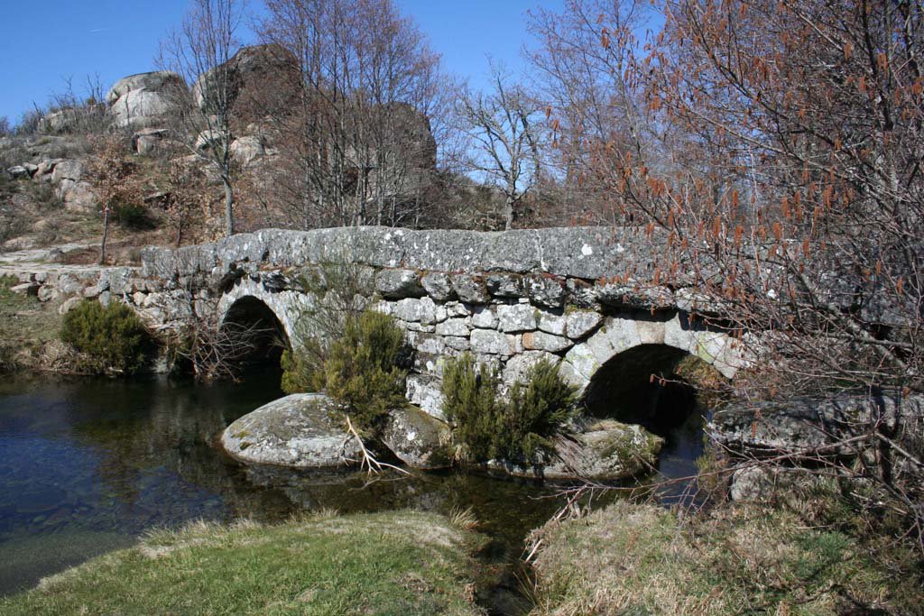
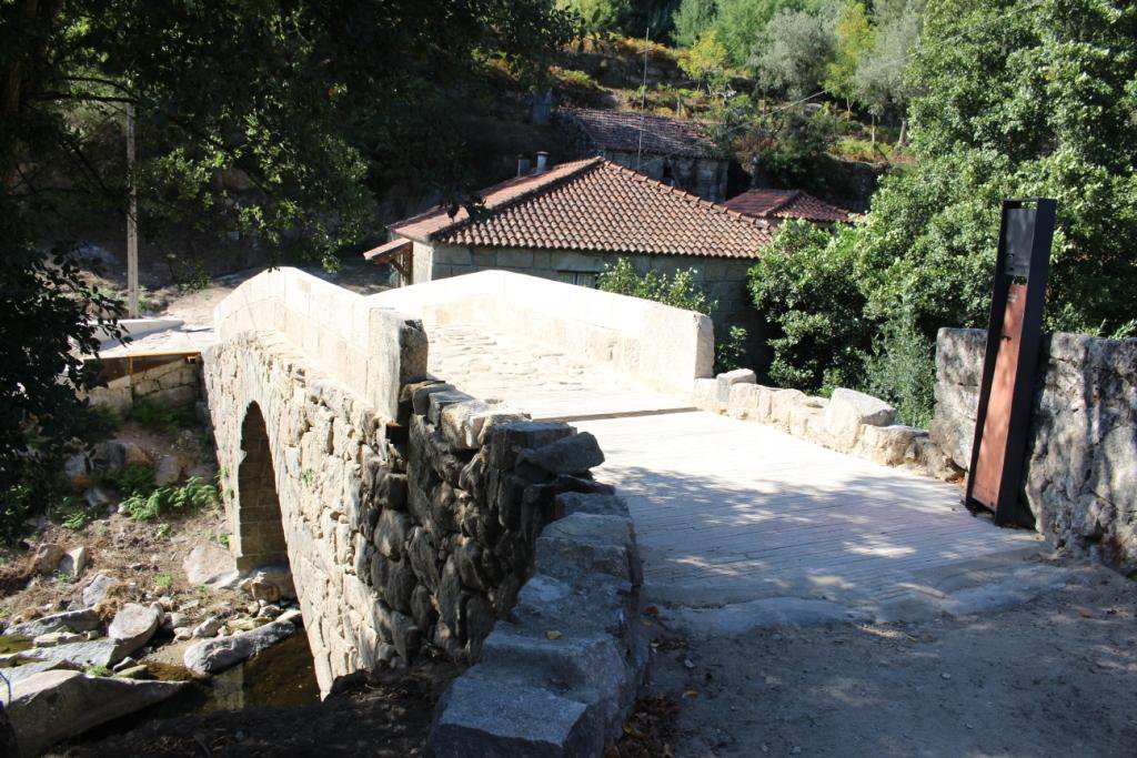
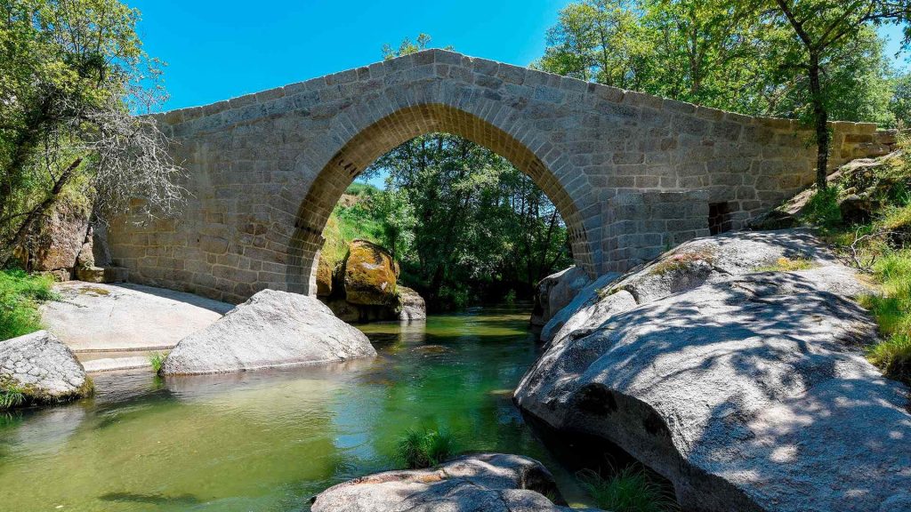
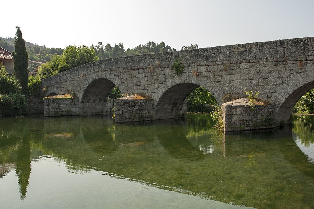
Bridge of Veiga

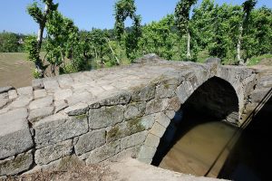
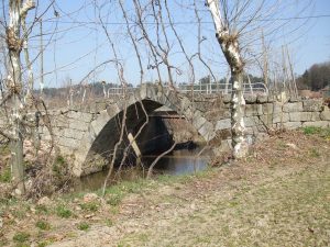
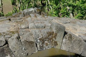
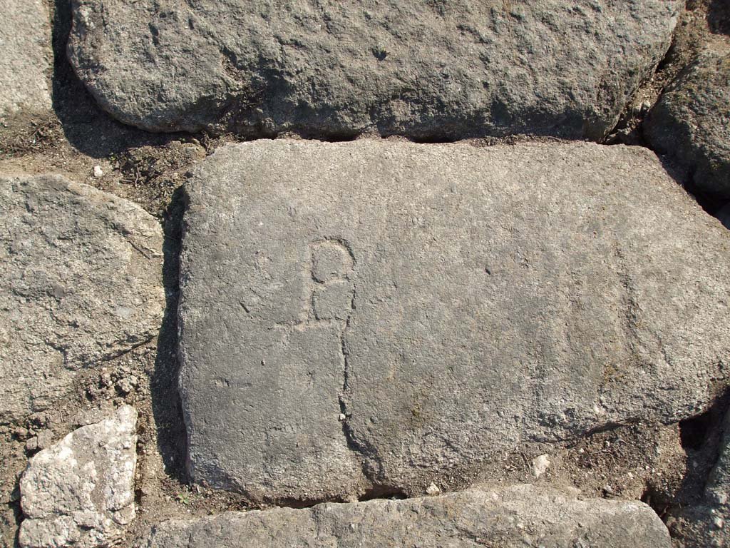
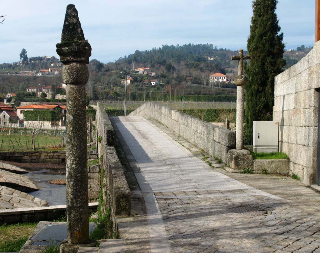
The Ponte da Veiga, located in the village of Torno in the municipality of Lousada, Portugal, is a remarkable example of Gothic architecture from the early 15th century. This single-arch stone bridge spans the River Sousa and is characterised by its slightly broken arch with narrow and elongated voussoirs (wedge-shaped stones that form the arch), which bear distinctive masonry marks.
Historically, the bridge was under the protection of the Pombeiro Monastery in Felgueiras. Its construction probably facilitated local and regional transit across the River Sousa, serving its secular and religious interests. The surrounding area is known as the “Veiga”. It is a fertile plain that was intensively cultivated during the Middle Ages.
In the 20th century, the bridge began to decay due to traffic and was finally replaced by a concrete structure. In recognition of its historical importance, in 2010, the Ponte da Veiga was included in the Rota do Românico (Romanesque Route), a series of cultural itineraries that explore the rich Romanesque heritage of the Sousa Valley region.
The bridge is open to the public and partially accessible to persons with reduced mobility. For a more immersive experience and a deeper understanding of the region’s Romanesque architecture, the nearby Centro de Interpretação do Românico in Lousada offers a comprehensive insight.
The Ponte da Veiga is a testament to the region’s medieval engineering and remains a point of interest for those exploring Portugal’s historic landscapes.
- 1427 – Fleeing the plague, Friar Amaro – the commander of Pombeiro – takes refuge in São Fins de Torno, which was the abbey’s church;
- 15th century (1st half) – Construction of the Bridge of Veiga;
- 17th-18th centuries – Conduction of conservation and strengthening works;
- 1726 – Francisco Craesbeeck mentions the existence of parapets on the Bridge;
- 1758 – The Vicar of Torno, Félix Borges, points out that within the limits of his parish there was only one masonry Bridge, which had a single arch;
- 20th century – Subject to motor-vehicle traffic, the Bridge of Veiga degrades and is replaced by a concrete pontoon;
- 2010 – Integration of the Bridge of Veiga in the Route of the Romanesque.
How to get there: GPS 41.299365, -8.217653
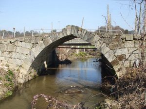
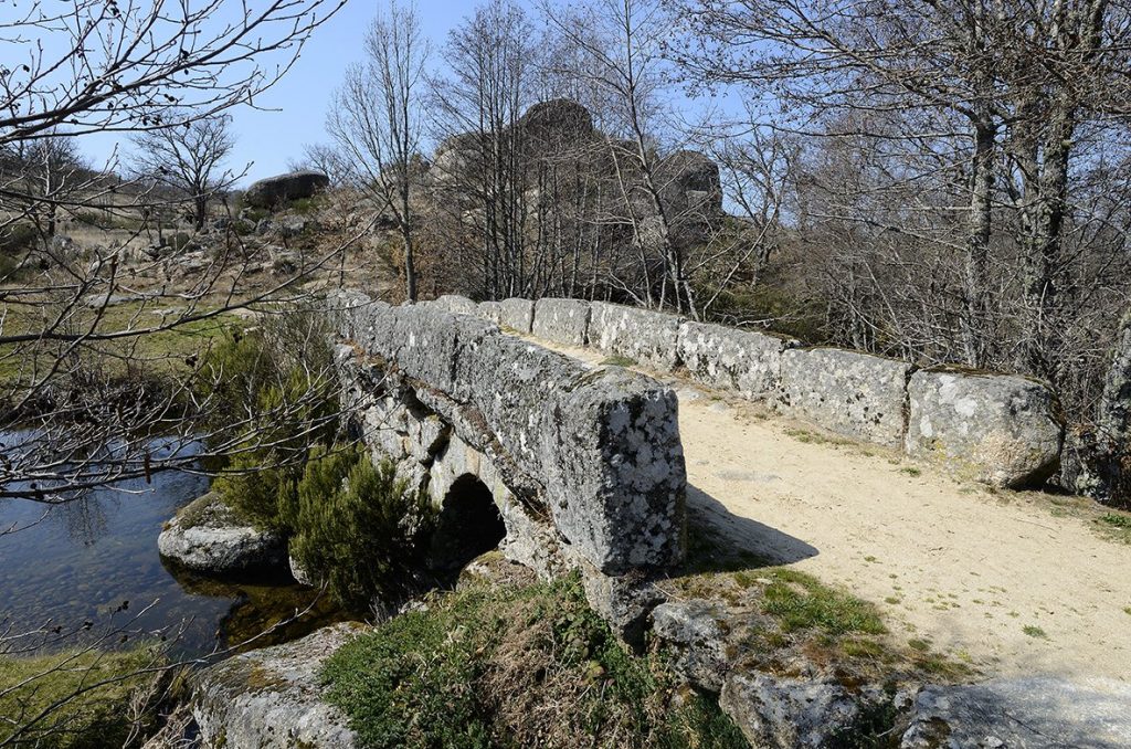
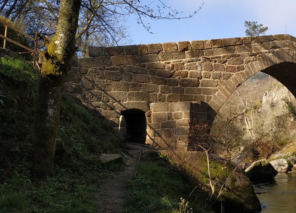
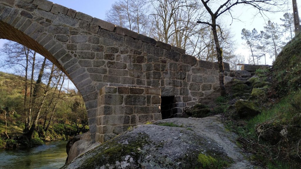
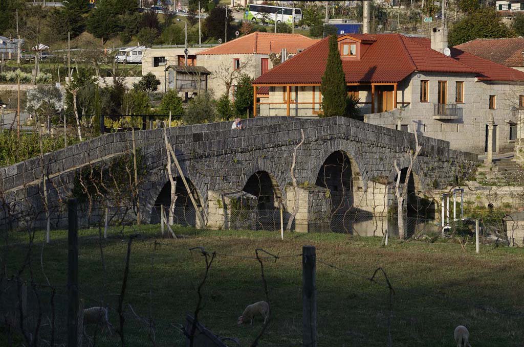
Bridge of Espindo

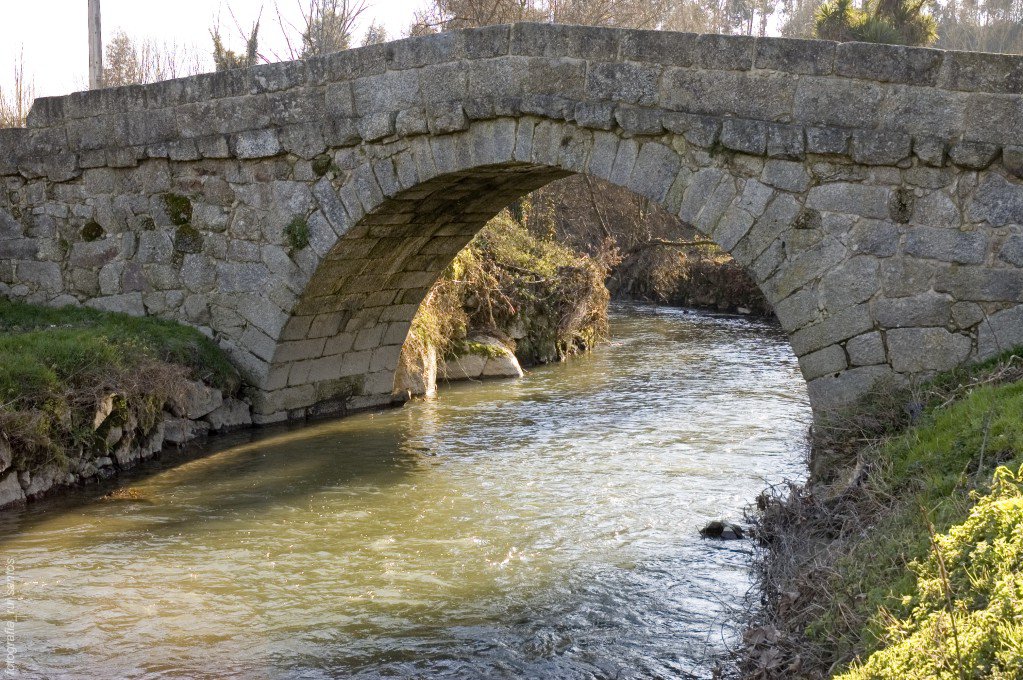
The Espindo Bridge is supported by a single circular arch supported by strong pillars that emerge straight from the banks.
Because of the breadth of the span, the arch was elevated and the tray was placed on a trestle, resulting in a double-ramp.
The Bridge is made of granite, with unevenly bonded batters that contrast with the arch’s regular stone bonding and well-cut voussoirs.
Though technically and structurally, this Bridge resembles a medieval bridge, it is impossible to place a date on it.
Bridges erected in the Middle Ages placed a higher value on their foundations than Roman bridges, and their designers sought out more stable locations for their construction.
These facts contributed to medieval bridges’ durability in the face of weather and flooding.
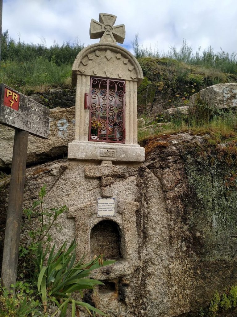
The “Alminhas” [Shrines] at one end of the Bridge of Espindo are wayside shrines linked with old Portuguese routes and the symbolic protection of travellers.
How to get there: GPS 41.24348, -8.273541
Rua da Ponte de Espindo, Meinedo, Lousada, Porto
Bridge of Panchorra
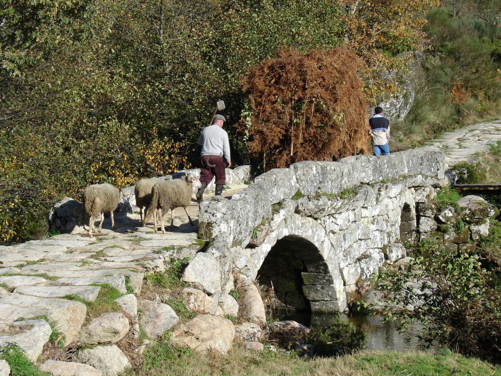
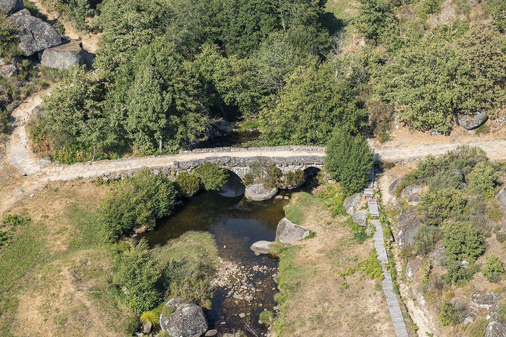

The Bridge of Panchorra is a stunning example of vernacular [traditional] architecture, located around 1000 meters above sea level and connecting the banks of the river Cabrum.
It is a two-arched bridge with a regular structure in the voussoirs [arch-forming stones] and irregular masonry [stones] in the remaining structure, which may suggest a work by local or regional masters to fulfil the community’s access needs to their fields and forests.
As a result, it stands in stark contrast to its downstream equivalents, which include the Ovadas, Lagariça, and Nova bridges, all of which are located near the river Cabrum’s mouth. It remains, however, an excellent example of communal infrastructure.
The bridge utilizes outcrops on the riverbanks to support its pillars, which support the horizontal deck with guards, which provides the required sturdiness for agricultural vehicles and cattle to cross.
Although Panchorra is referenced in the 1258 Inquirições [administrative inquiries], it was not split from Ovadas, the location of the medieval parish’s old ecclesiastical centre, until the 16th century.
As a result, it was elevated to the status of “curato” [parish], with the Chapel of Saint Lawrence acting as the new religious centre.
- 1258 – First reference to Panchorra;
- 1288 – Reference to the existence of three farmhouses in Panchorra;
- 1513 – The charter of Terra de Aregos already refers all taxes paid to the crown;
- 1527 – Panchorra had between 71 and 77 inhabitants;
- Before the 17th century – Construction of the Bridge of Panchorra;
- 1758 – Of all the clerics from the parishes of the Cabrum valley, only the one of Gralheira makes any reference to the (masonry) bridge of Gralheira;
- 2010 – Integration of the Bridge of Panchorra in the Route of the Romanesque;
- 2013 – The Bridge of Panchorra is classified as Public Interest Monument.
How to get there: GPS 41.013979, -7.975075
Rua da Ponte da Panchorra, Panchorra, Resende, Viseu
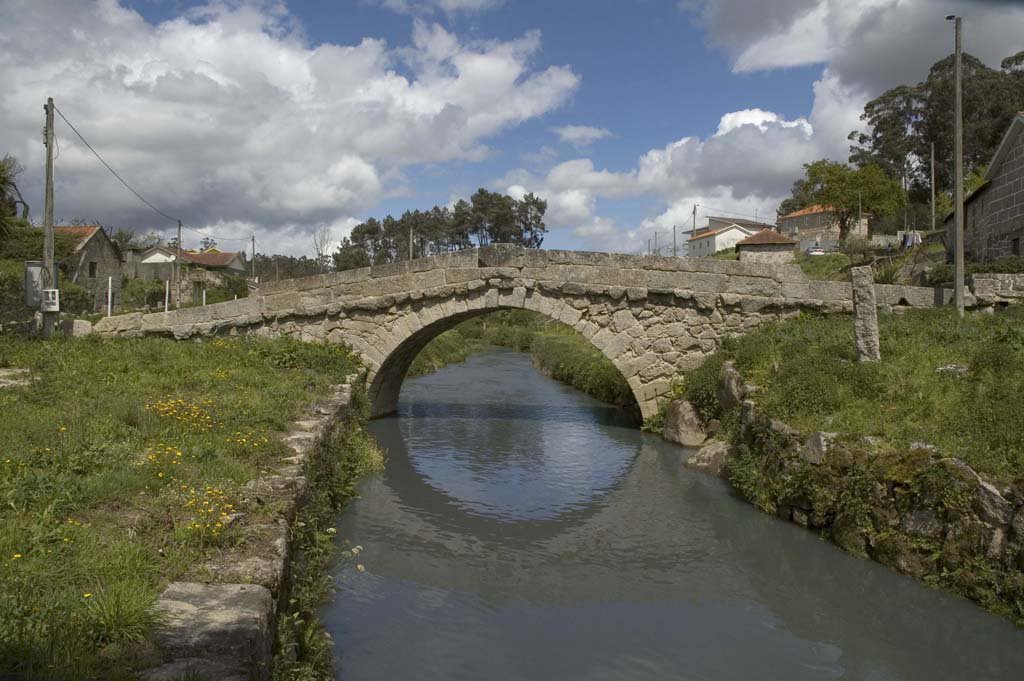
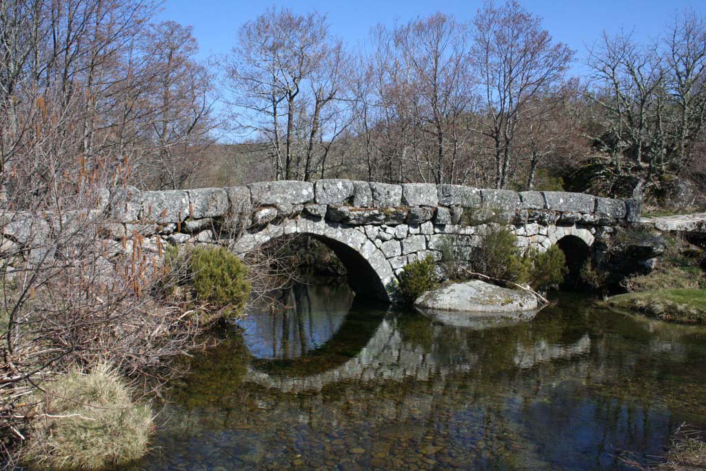
Bridge of Esmoriz

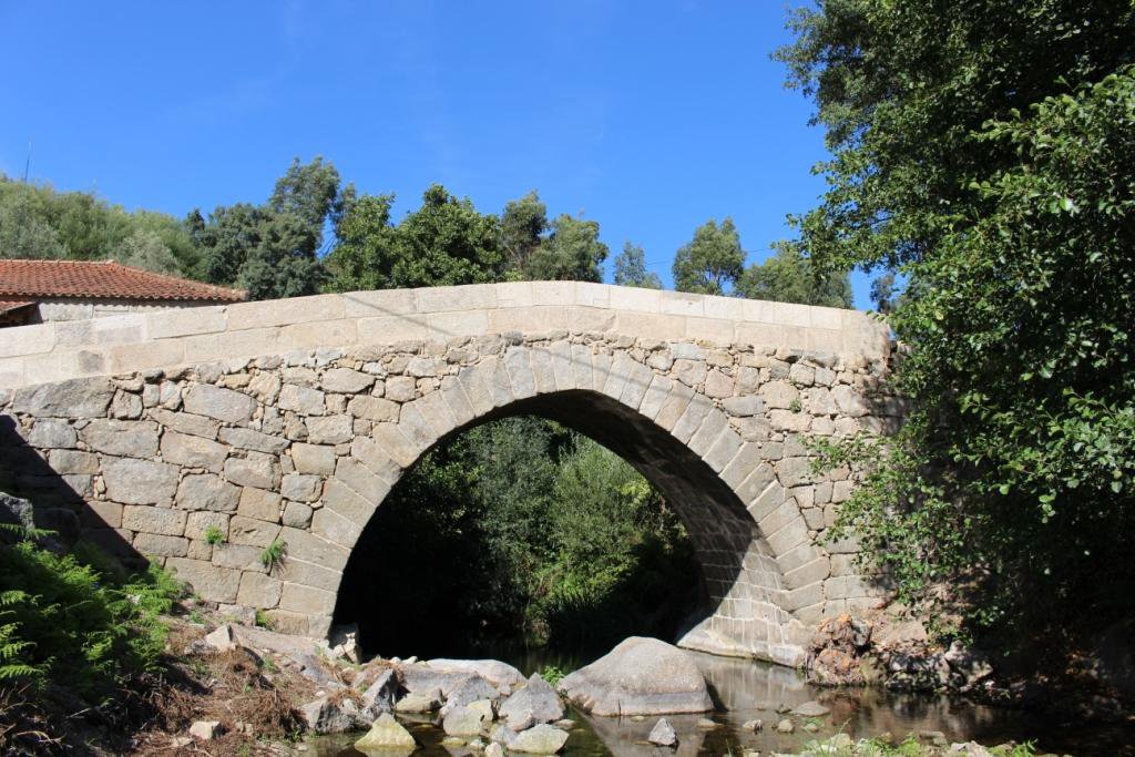

The Bridge of Esmoriz joins the sides of the river Ovil in the historic “Couto de Ancede” [privileged location] with a single circular arch, slightly raised deck with guards but without cut-seas or buttresses.
It has a regular structure, is shapely carved with voussoirs [stones that form the arch], and is thin and long.
It is listed in the 1758 Memórias Paroquiais [Parish Memorandum] among five other bridges on the parish circuit.
However, the earliest known reference goes all the way back to 1666, when various clashes about the estate of the House of Esmoriz were mentioned. Indeed, this small bridge was at the crossroads of ecclesiastical and manorial interests: the slope of the left bank of the river Ovil, the House of Penalva, the House of Esmoriz, and, not far from there, the majestic Monastery of Ancede.
Even after its incorporation into the Dominican order in the 16th century (it had previously been a part of the Canons Regular of Saint Augustine), which centralized its administration in Lisbon, the latter continued to polarize a number of interests, including business and export trade, which the monks excelled at optimizing.
Given their involvement in the design and construction of walkways, they may be attributed to the construction of the Bridge of Esmoriz, an important example of vernacular engineering [traditional].
- 1258 – Reference to Lourenço Ermiges of Esmoriz who is a witness in the “Inquirições” [administrative enquiries] involving the “couto” [place with privileges] of Ancede;
- Around 1400 – At the “Tombo” of the Monastery of Ancede there is no reference to the Bridge of Esmoriz;
- 1666 – There is a reference to the stone Bridge over the river Ovil on the way of Minhoso and the Monastery;
- 1758 – Three stone bridges are located in Ancede, among them the one in Esmoriz;
- 2010 – Integration of the Bridge of Esmoriz in the Route of the Romanesque;
- 2014-2015 – Intervention for the conservation and protection of the Bridge of Esmoriz, under the scope of the Route of the Romanesque.
How to get there: GPS 41.112754, -8.063309
Caminho da Ponte de Esmoriz, Ancede, Baião, Porto
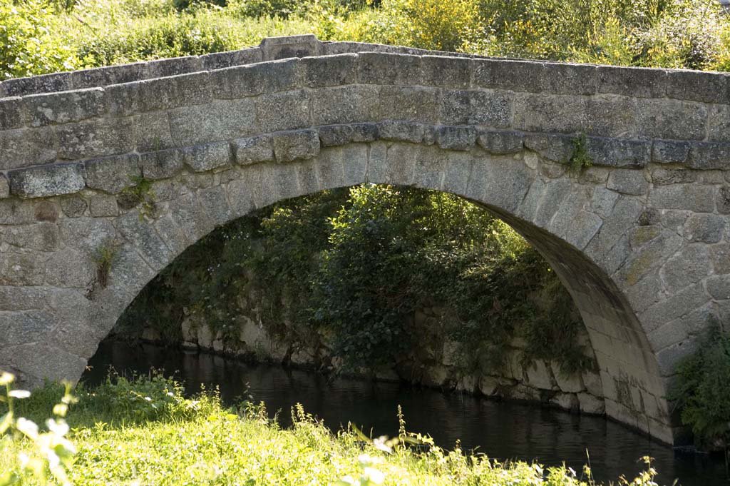
Bridge of Arco
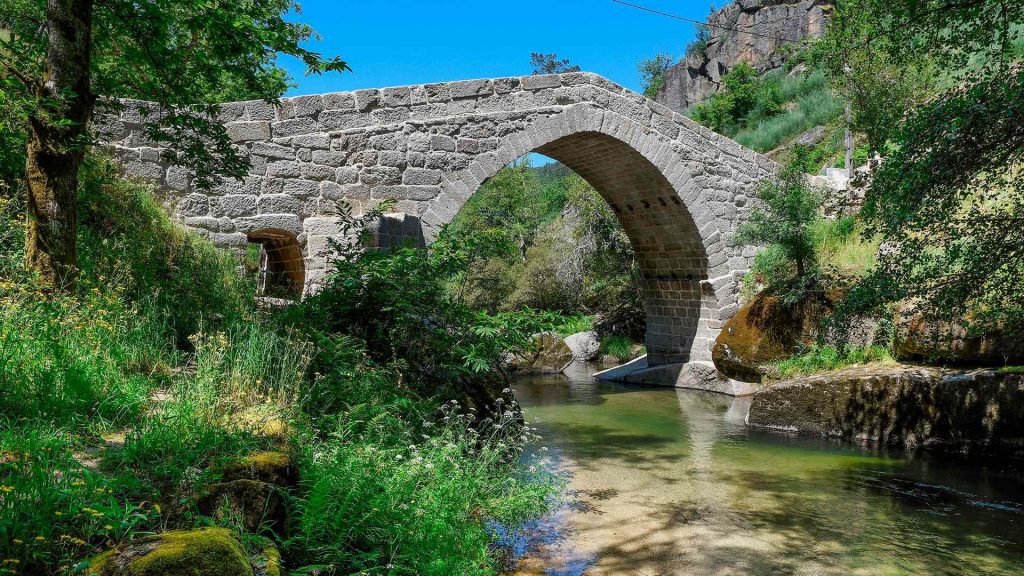
The Bridge of Arco [Arch], which connects the sides of the River Ovelha, stands true to its name.
It is an amazing work of architecture, consisting of a single slightly pointed arch. Its deck is shaped like a trestle, evoking Gothic bridge design.
The skilled masons who constructed and conceptualized it elevated the edifice’s foundations in two outcrops of the banks, therefore articulating a more robust and stable construction.
Perhaps unintentionally, they ended up creating a model of power and balance.
This harmony is upset only while looking at the intradorsum of the Bridge on the left bank, and you can see the lag between the starting ashlars [stones] on the right bank, whose position was disrupted for the installation of a wooden rib (the wooden structure that serves as the frame for the arch).
The Bridge of Arco was a good illustration of the type of local bridges distributed throughout the Modern Age. It was part of a municipal and parish network of roadways in the former county of Gouveia.
- 1758 – The abbot of Folhada mentions and describes the Bridge of Arco;
- 1982 – By Decree no. 28 from February 26th, the Bridge of Arco was considered as a Building of Public Interest;
- 1986 – Because it was a car passageway, the bridge suffers a few setbacks, related to its parapet and paving;
- 2010 – Integration of the Bridge of Arco in the Route of the Romanesque;
- 2015 – Intervention for the conservation and protection of the Bridge of Arco, under the scope of the Route of the Romanesque;
- 2018-2020 – Conservation, safeguarding and enhancement of the Bridge of Arco, within the scope of the Route of the Romanesque.
How to get there: GPS 41.222143, -8.088117
Rua do Arco, Folhada, Marco de Canaveses, Porto.
Bridge of Fundo de Rua
Amarante

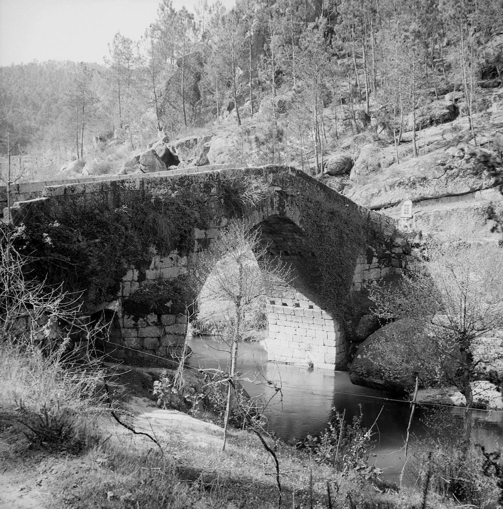
A stone bridge across the river Ovelha, supported by four unequal-sized circular arches on which a deck is slightly raised above the upper arch.
The pillars are protected upstream by steep cut-waters and downstream by buttresses. A transept at the Bridge’s entry, on the left side, may record the year (1630) of the Bridge’s construction or reconstruction, succeeding the medieval span that provided transportation between Amarante and Vila Real.
This was the entrance to the historic area of Ovelha do Maro, which was formerly one of the few in Portugal and where the people elected their feudal ruler.
Near the Bridge, the pillory symbolizes this autonomy, first of the “beetria” and then of the “honra” and municipality, which became the property of Portugal’s monarchs in the 16th century.
The French forces under General Soult marched through here on their way to capture Amarante on May 3rd 1809.
As one of two points of passage between Amarante and Trás-os-Montes, the Bridge of Fundo de Rua (or Aboadela) was also mentioned in the writings of Camilo Castelo Branco, who visited the location numerous times.
- 258 – The patronage of the Church of Saint Mary of Aboadela was the property of the Monastery of Pombeiro;
- 14th century – Ovelha do Marão (a term which included the parishes of Aboadela and Canadelo) was a medieval benefactor;
- 1550 – On the death of D. Jorge de Lencastre, the medieval benefactor becomes the property of the Crown, by order of King D. João III;
- 1630 – Construction date of the cruise at the east entrance of the Bridge;
- 17th century – Construction period of the Bridge of Fundo de Rua;
- 18th century – The term of Ovelha do Marão is transferred to the jurisdiction of the master grantees and barons of Mateus;
- 2000 – Restoration works in its pavement, with the replacement of the slabs and of some stones from the ledges, cleaning and removal of the vegetation which had accumulated over time;
- 2010 – Integration of the Bridge of Fundo de Rua in the Route of the Romanesque.
How to get there: GPS 41.277322, -7.995505
Rua de Ovelha e Honra do Marão, Aboadela, Amarante, Porto