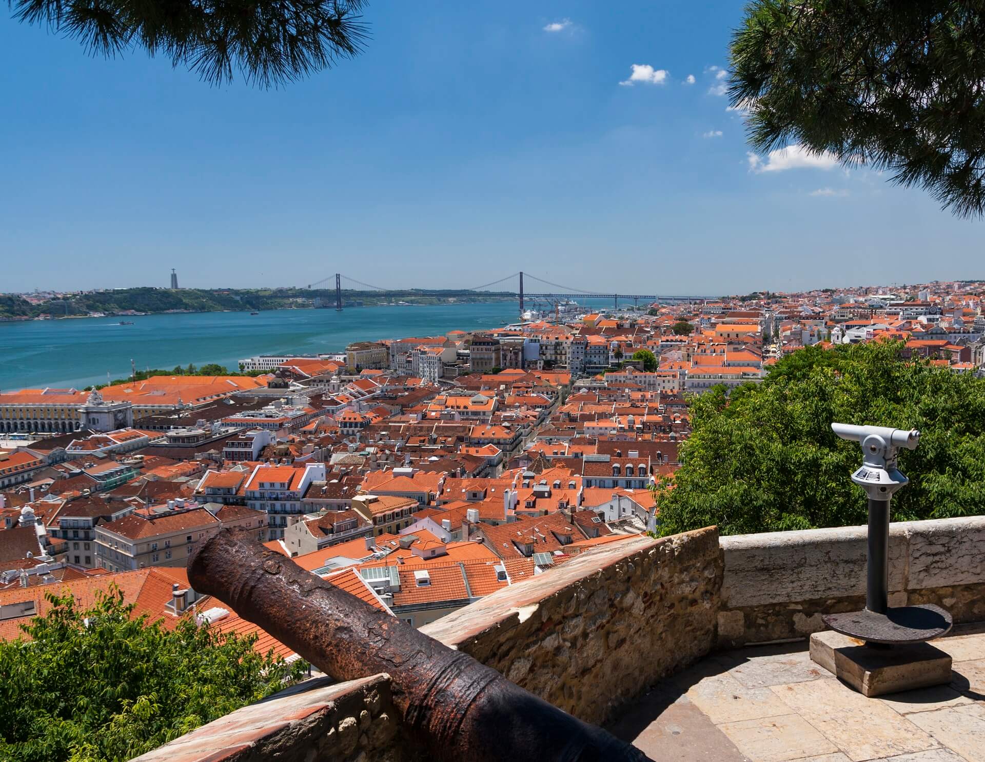
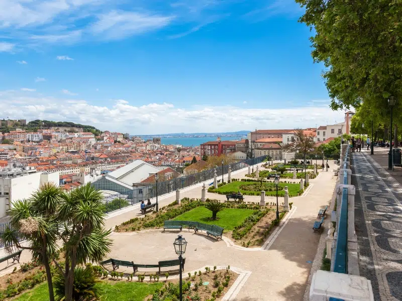
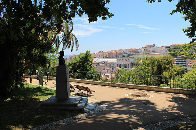
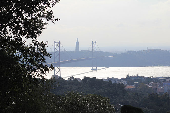
Lisbon is one of the most picturesque capitals in the world, owing to its numerous hills that provide breathtaking views from the summit. Many hilltops have been designed to be “miradouros” (viewpoints), and miradouro-hopping is a must-do activity in the city.
You’ll come upon a few by chance as you wander about, but some are worth making an effort to see. Many of these overlooks offer refreshment shops, making them popular gathering places for locals and visitors alike, as well as the ideal place to take a breather while sightseeing. The following is a collection of green space perspectives from which to enjoy the city.
MIRADOURO DE SÃO PEDRO DE ALCÂNTARA
This beautifully landscaped terrace, on a hill directly across from the castle, offers a view over Avenida da Liberdade, downtown and the river. It’s also one of the most romantic spots in the city. This sizable, landscaped terrace with a fountain offers panoramic views of the city
Lisbon: View of the Tagus River from the Alfama Neighborhood.
MIRADOURO DE SANTA CATARINA
The scenic overlook of Miradouro da Santa Catarina, showing a view of the Tagus River and local neighbourhoods.
The port of Lisbon and 25 de Abril Bridge are seen from this terrace, where you may also sit and watch the cruise ships navigating by, or stay for the sunset. A kiosk serves drinks to the many locals who join the tourists at the end of the day.
MIRADOURO DE SANTA LUZIA
This popular observation deck with a pergola offers dramatic views of Lisbon & the Tagus River. You can look out to the terracotta rooftops of Alfama and the river from this incredibly charming terrace, always filled with tourists snapping photos.
MIRADOURO DO PARQUE EDUARDO VII
A scenic spot with an expansive city park with exotic plants, a monument & panoramic views, plus a lake & kids’ play area. All of downtown Lisbon can be seen from the top of this sloping park. With a view of the castle and the river, this is a picture-perfect spot.
MIRADOURO DO TOREL
you can take the Lavra Lift – the oldest in the city – in order to get there. Besides having this historical experience, it is at the Torel viewpoint where we can indulge in a fantastic view of the western part of Lisbon. Relax quietly in a space filled with small ponds, while you delight in seeing, from high above, the Avenida da Liberdade, the heart of downtown and the São Roque hill, which highlights the São Pedro de Alcântara garden.
TOREL VIEWPOINT
The Torel viewpoint is a public garden on top of a hill that originated from an early 18th-century farm, and its name comes from Judge Cunha Thorel, the wealthiest landowner in the area. The lookout is surrounded by a large green area, as well as several 18th and 19th-century palaces.
MIRADOURO DO JARDIM DA CERCA DA GRAÇA
A hillside park with views of the city, picnic spaces, a playground, and a kiosk café. From this vantage point, you can see the castle, the Mouraria neighbourhood, and the 25 de Abril Bridge.
AJUDA BOTANICAL GARDEN
This botanical garden, which is tucked away within a short walk from Ajuda Palace, is exquisitely landscaped with plants and sculptures. It’s also a viewing point, as it’s divided into two levels, with a great view of the 25 de Abril Bridge from the steps that connect them.
MIRADOURO ANFITEATRO KEIL DO AMARAL
The amphitheatre overlooking the 25 de Abril Bridge is Europe’s largest urban woodland. The picnic area is popular, and the remainder of the park features sports facilities and children’s playgrounds.
MIRADOURO DO LARGO DAS NECESSIDADES
The majority of people are unaware of this patio. It is directly across from Necessidades Palace and boasts a stunning view of the 25 de Abril Bridge. The entrance to Tapada das Necessidades Park, one of Lisbon’s “hidden gardens,” lies behind it (to the left of the palace).
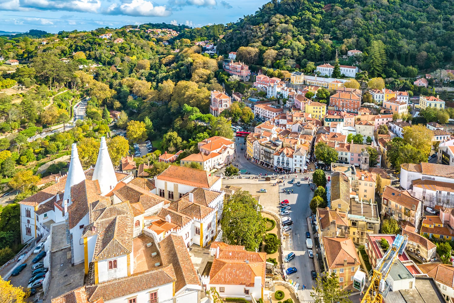
Sintra is a Portuguese hamlet that is part of the district and metropolitan region of Lisbon ( Greater Lisbon ).
It is the seat of the municipality of Sintra with an area of 319.23 km²
Vila de Sintra is notable for the presence of its romantic architecture, resulting in its classification as a Cultural Landscape of Sintra, a UNESCO World Heritage Site and has refused to be elevated to the category of city, despite being the seat of the second-most populous municipality in Portugal.
The Sintra area has been inhabited since the Paleolithic epoch. D. Afonso Henriques conquered the Moors’ fortress in 1147, marking a watershed moment. Sintra has repeatedly played a political role in the Portuguese monarchy and was regarded as the court’s summer residence from the beginning.
Downtown, with its maze of streets and history Pena Palace, hidden in the forest and brimming with enchantment and tales Quinta de Regaleira is located in the heart of the city, just a few steps away. The remnants of a Moorish castle, perched magnificently on a hill, are identifiable with their two towering chimneys. Seteais Palace, which is now a renowned hotel known as Monserrate Palace, is set inside a park brimming with diverse plant varieties.
Sintra is known as Portugal’s romantic hamlet, owing to its stunning architecture, lovely streets, foggy climate, and the way man-made structures are intertwined into nature.
Sintra has been designated a UNESCO World Heritage Site in the category “Cultural Landscape” since 1995.
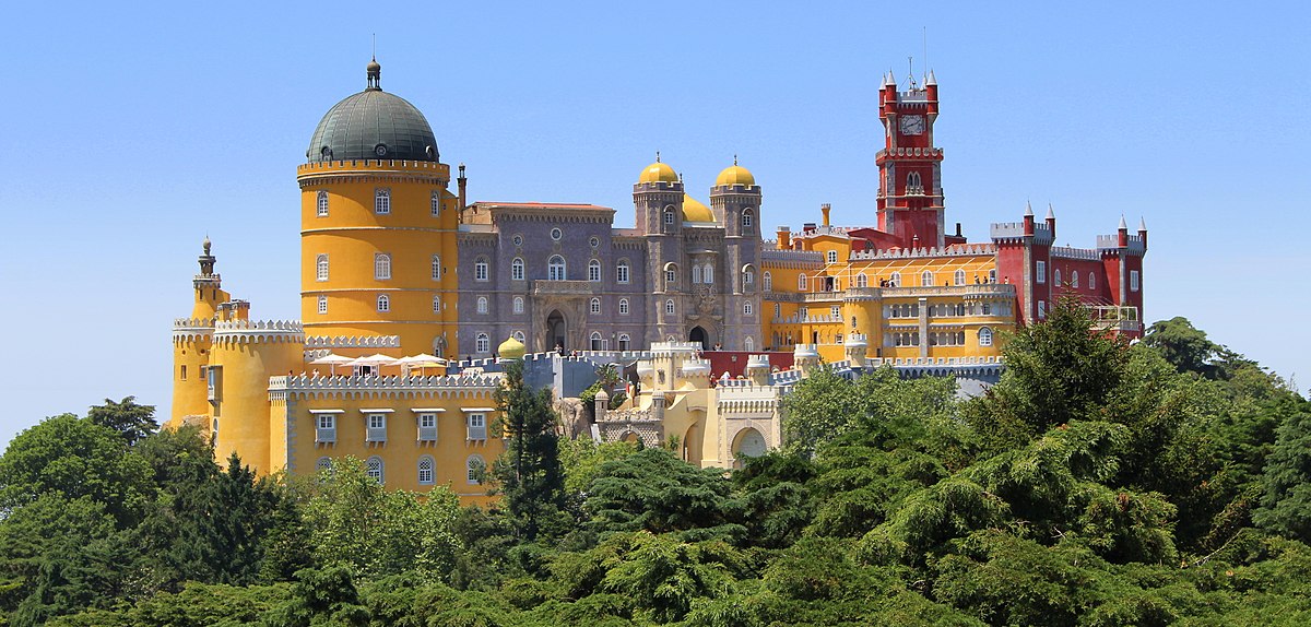
National Palace of Pena
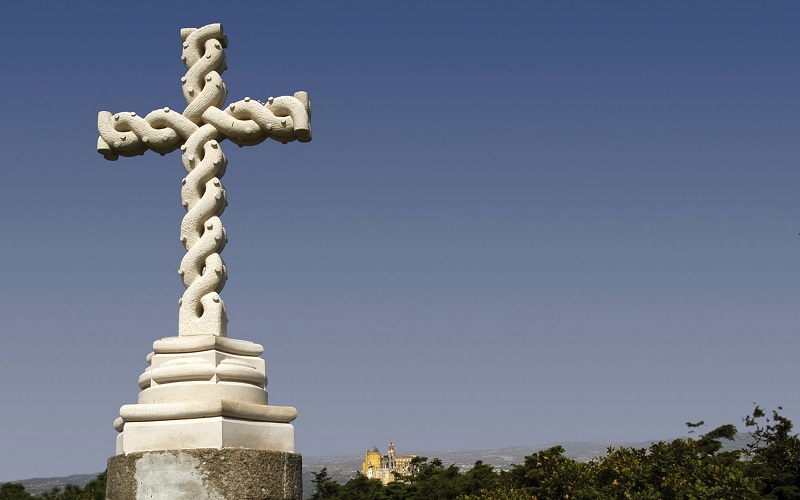
The National Palace of Pena is one of the finest examples of nineteenth-century Romanticism in the world, perched on a rocky outcrop on the Sintra Mountains’ second highest peak (exceeded only by Cruz Alta [High Cross] at 528 m above sea level).
The Palace is located on the eastern side of Pena Park and may be approached by the steep access ramp erected by the Baron of Eschwege.
It was named one of Portugal’s seven wonders on 7 July 2007 The Palace and Park were designed and constructed in unison. From the Palace, visitors may enjoy views of the woodland that covers over 200 hectares of Pena Park. This park features lovely pathways and hikes, as well as several garden structures. There are bridges and caverns, as well as garden seats, pergolas, and fountains.
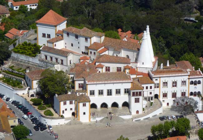
The Sintra National Palace, commonly known as the Town Palace, was one of the residences used by the Portuguese Royal Family up until the monarchy’s demise in 1910.
Its construction began in the fifteenth century under the direction of an unknown architect. Its characteristics are reminiscent of those seen in Medieval, Gothic, Manueline, Renaissance, and Romantic architecture. The palace is regarded as an example of organic architecture, a collection of widely varying forms that connect together as a whole via courtyards, stairwells, hallways, and galleries. It holds Portugal’s biggest collection of Mudéjar tiles, and its kitchen is topped by two massive conjoined chimneys, a Sintra landmark.
The Regaleira Palace is the largest structure and the most often used name for Quinta da Regaleira. Additionally referred to as “Palace of the Monteiro Millionaire,” a reference to the former owner’s surname, António Augusto Carvalho Monteiro.
The home is perched on a hillside not far from Sintra’s Historic Centre.
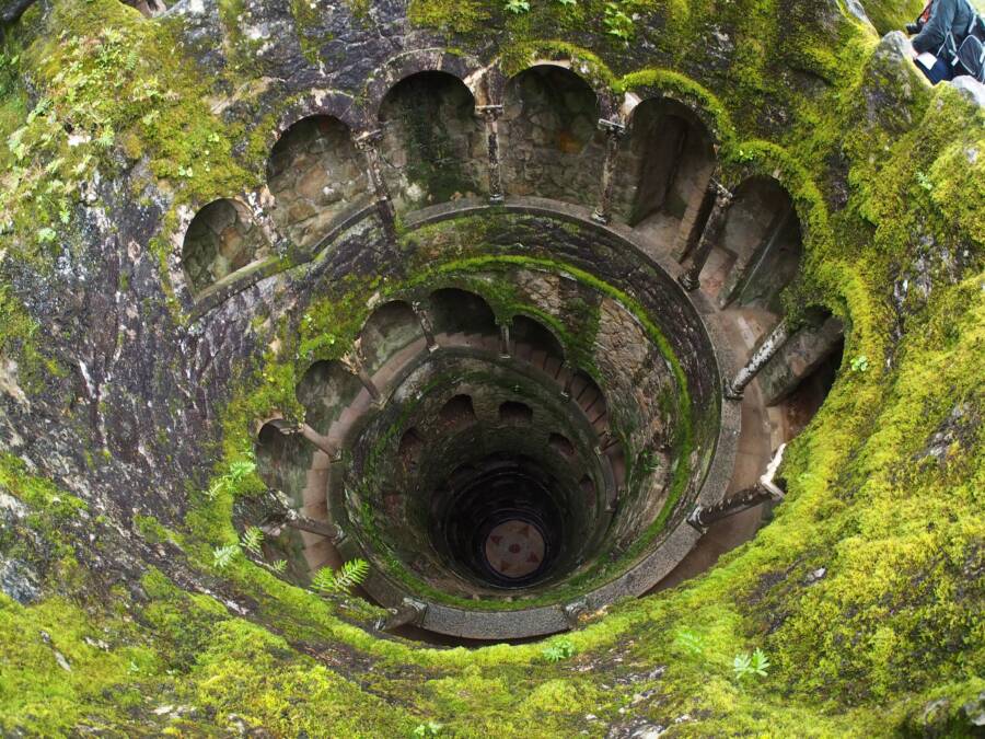
Carvalho Monteiro converted the 4-hectare estate with the assistance of Italian architect Luigi Manini into a palace surrounded by beautiful gardens, lakes, caverns, and mysterious structures that conceal alchemical meanings such as those inspired by Freemasonry, the Templars, and the Rose-cross. He uses a variety of lines to form the area, suggesting Romanesque, Gothic, Renaissance, and Manueline architecture.
GPS: N38º47’46.33, W9º23’45.23
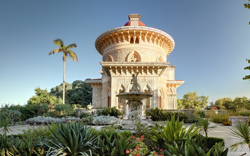
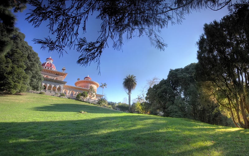
Monserrate Palace
The palace was erected in 1858 at the request of Sir Francis Cook, Viscount of Monserrate. It was designed by architects Thomas James Knowles (father and son). The gardens were built to take advantage of the Mountain’s microclimate, resulting in a beautiful park with over 3000 exotic plants still visible today.
The palace served as the Cook family’s vacation house and was erected over the remains of a neo-Gothic mansion built by English trader Gerard de Visme, who was also responsible for the original Montserrat palace. In 1793, William Beckford rented the property, began repairing the palace and began establishing a manicured garden.
Along with other palaces in the neighbourhood, such as Pena Palace, it is a remarkable example of Portuguese Romanticism. Since 1978, it has been designated a Monument of Public Interest.
GPS: 38º 47’ 30.70” N 9º 25’ 9.09” W
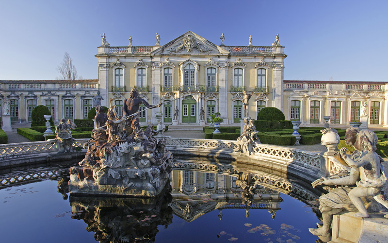
National Palace of Queluz
The Royal Palace of Queluz, also known as the National Palace of Queluz, was built in the 18th century. The palace was created as a summer getaway for Don Pedro de Bragança, future King Pedro III, and was one of Europe’s last great Rococo style structures.
It was utilized as a covert location to confine Queen Maria I throughout her dementia, and notably after the death of King Pedro in 1786. After a fire destroyed the Palace of Ajuda in 1794, the Palace of Queluz became the official house of the Portuguese Prince Regent, the future King João VI, and his family. And thus it stayed until the Royal Family fled to Brazil in 1807 as a result of the French Invasions.
Mateus Vicente de Oliveira, the architect, began work on the Palace in 1747. Despite its tiny size, it is sometimes referred to as the “Portuguese Versailles.” From 1826 onwards, the palace gradually fell out of favour with Portuguese kings. Following a major fire in 1934 that devastated the inside of the palace, the monument was significantly renovated and is now available to the public.
The Queen Maria Pavilion, one of the wings of the Palace of Queluz constructed between 1785 and 1792 by architect Manuel Caetano de Sousa, is now an exclusive guest suite for foreign heads of state visiting Portugal.
It has been designated as a National Monument since 1910.
The Moorish Castle provides a unique vantage point from which to appreciate the panorama stretching from Sintra to the seaside. The castle, which winds between two peaks in the Sintra Mountains, dates all the way back to the early years of Moorish control in the Iberian peninsula, in the eighth century.
Following the capture of Santarém, King Afonso Henriques imposed a three-month siege on Lisbon.
Although Sintra’s Castle was voluntarily surrendered following the fall of Lisbon, legend has it that the sovereign entrusted Don Gil, a Knight Templar, with gathering twenty trusted men to secretly observe the enemy’s movements in Sintra, fearful of a surprise attack on his forces by the Sintra Moors, and preventing the Lisbon Moors from heading up the River Tagus into Sintra via Cas.
Quinta da Regaleira is a must-see. It is insufficient to learn about its history, geography, and secrets. You must familiarize yourself with the estate, observe the landscape among the gardens and structures, appreciate the Palace, a genuine philosophical house inspired by alchemy, and wander through the unique park to experience its essence.
GPS: N38º47’46.33, W9º23’45.23
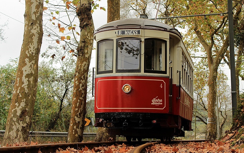
Sintra Tram
The railway line connects the mountains to the sea through the town to Maçãs Beach, a stretch of almost 11 kilometres, between Vila Alda in Estefânia and Maçãs Beach. During the 45 minutes trip, passengers can enjoy unique sightseeing between the Sintra Mountains and the Atlantic Ocean.
GPS: 38°48’14.3″N 9°22’54.8″W
Correnteza Viewpoint
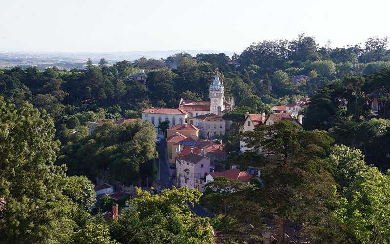
This is one of the most popular leisure areas in Sintra, owing to the massive ensemble and the lush scenery visible from the walls: Vale da Raposa, Vila Velha with its homes, and the Sintra National Palace, with the ocean in the distance. At the summit, there lies a Moorish castle.
Take a seat and take in the breathtaking view from this viewpoint in Sintra’s Historic City Centre, which is easily accessible from the Sintra railway station.
GPS – 38°48’03.3″N 9°23’02.8″W
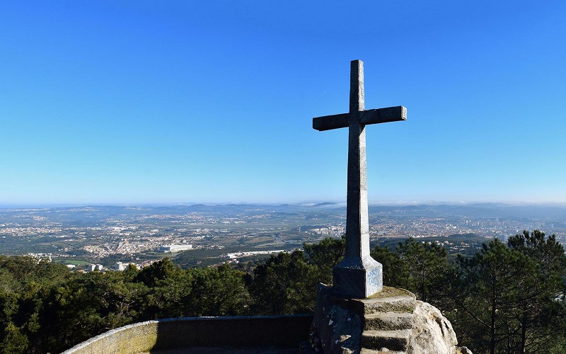
Cruz Alta Viewpoint
Cruz Alta Viewpoint
This viewpoint, at 529 meters above sea level, is the Sintra Mountains’ highest point. Visitors may enjoy the Sintra Mountains in all their grandeur from this location in the middle of Pena Park, 4 kilometres from the old city. With a panoramic panorama and the sea on the horizon, the entire municipality of Sintra is visible to the north, while the vast expanse of Lisbon and the River Tagus is visible to the south.
GPS – 38°46’55.4″N 9°23’29.0″W
Ferraria Viewpoint
The Ferraria Viewpoint is nestled among alleys and staircases in the town’s historic centre. It is a fantastic location from which to take in the magnificent panoramic view of the Historic Centre and the countryside north of Sintra, all framed by the ocean in the backdrop.
GPS – 38°47’46.55″N 9°23’23.5″W
Santa Eufémia Viewpoint
Located in Santa Eufémia da Serra at an elevation of approximately 470 meters above sea level, this viewpoint provides one of the most breathtaking views of Sintra, stretching from Queluz to the Ocean.
According to 1147 crusade records, the water from the Santa Eufémia Fountain had curative properties, which is why the 13th century Santa Eufémia hermitage was ordered and built. Additionally, this site contains a recreational area with a park and picnic area, which provides shade on hot days.
GPS – 38°47’12.3″N 9°23’06.75”W
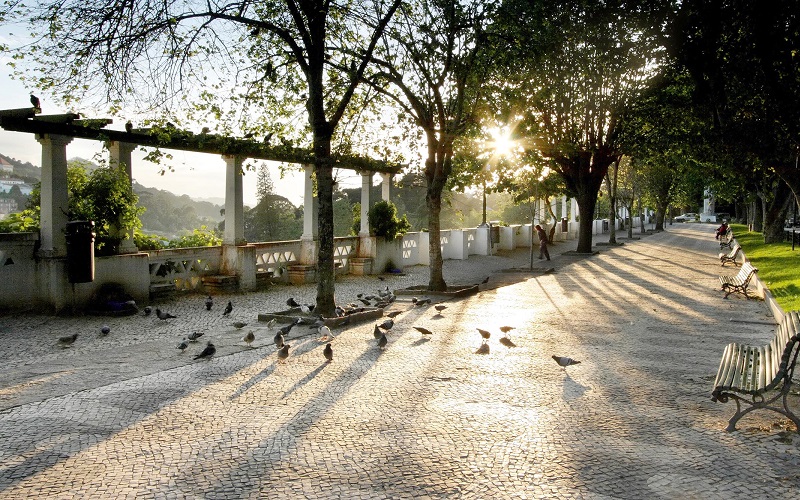
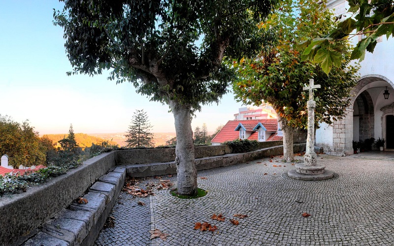
São Martinho Churchyard Viewpoint
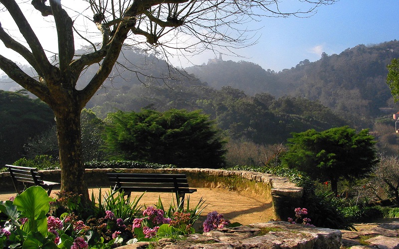
This perspective, located in the Town’s Historic Centre, is easily accessible and is regarded as a real Romantic setting.
Vines envelop the columns and the porch, suffocating those who sit beneath them and creating the ideal setting for viewing an alchemical landscape. It is possible to see a portion of the Sintra National Palace and the white homes topped by the Moorish Castle and the Pena Palace from this vantage point. In the distance, the agricultural scenery stretches all the way to the ocean. The benches beckon us to pause and unwind. This location is particularly lovely at sunset, as the sun sets behind the mountain.
GPS – 38°47’47.2″N 9°23’30.3″W
Seteais Viewpoint
The expansive green lawn of Seteais Palace, an 18th-century structure that has been transformed into a hotel, draws people in. The Triumphal Arch is visible in the backdrop. Once there, visitors are awestruck by the breathtaking view beyond the arch onto Pena Palace, or by the west-facing viewpoint located on the Saloia moorland, which is interlaced with agricultural fields and studded with white hamlet homes and framed by the ocean in the distance.
GPS: 38°47’48.3″N 9°23’58.1”W
Vigia Viewpoint
The Vigia Viewpoint is located in São Pedro de Sintra, approximately two kilometres from the historic centre, and gives a spectacular view similar to that of a picture on the most exquisite postcards.
Three hills may be seen from this vantage point, each with a magnificent structure: the National Palace of Pena, the Moorish Castle, and the revivalist Castle of São Gregório.
GPS – 38°47’40.8″N 9°22’50.1″W
Capuchos Convent
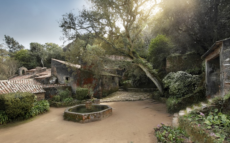
The Capuchos Convent was notable for its minimalist architecture and is one of several instances of 16th century Pietistic piety in Portugal. During a visit to the convent in 1787, William Beckford noted that “we took a tiny shortcut across a wild and desolate hill for several kilometres, to the Capuchos Convent, which at first sight reminds us of Robinson Crusoe’s dwelling.” (Beckford, William, and Portugal.) A Journey of Love, Exhibition Catalogue, National Palace of Queluz, 1987, p. 159).
The Convent symbolizes the Franciscan friars’ goal of global fraternity and brotherhood. Those who lived there were members of the Arrábida Province of the Order of Friars Minor Capuchin.
The convent’s entrance, a basic portico with a wooden roof and beams coated with cork, exemplifies the minimalist attitude of this building devoid of ornamental features.
The announcement of the acquisition of Valenças Park by the Sintra Tourism Board dates back to 1936 and is intended to provide Sintra with a Public Park.
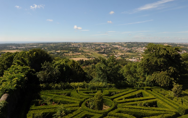
The exuberant romantic garden and palace built by Francis Cook, an English millionaire, provide unique testimony of the eclectic spirit of the eighteen hundreds.
The Pena Park and Palace combine the search for exoticism with a fascination for nature. Discover these unmissable monuments among exotic trees and indigenous species, where the incomparable Pena Palace stands out on its own.
Solar de Ribafria was built in 1541, on the Lourel estate, by Gaspar Gonçalves, to whom King Manuel I attributed a charter and a coat of arms, and is a magnificent example of Manueline civil architecture.
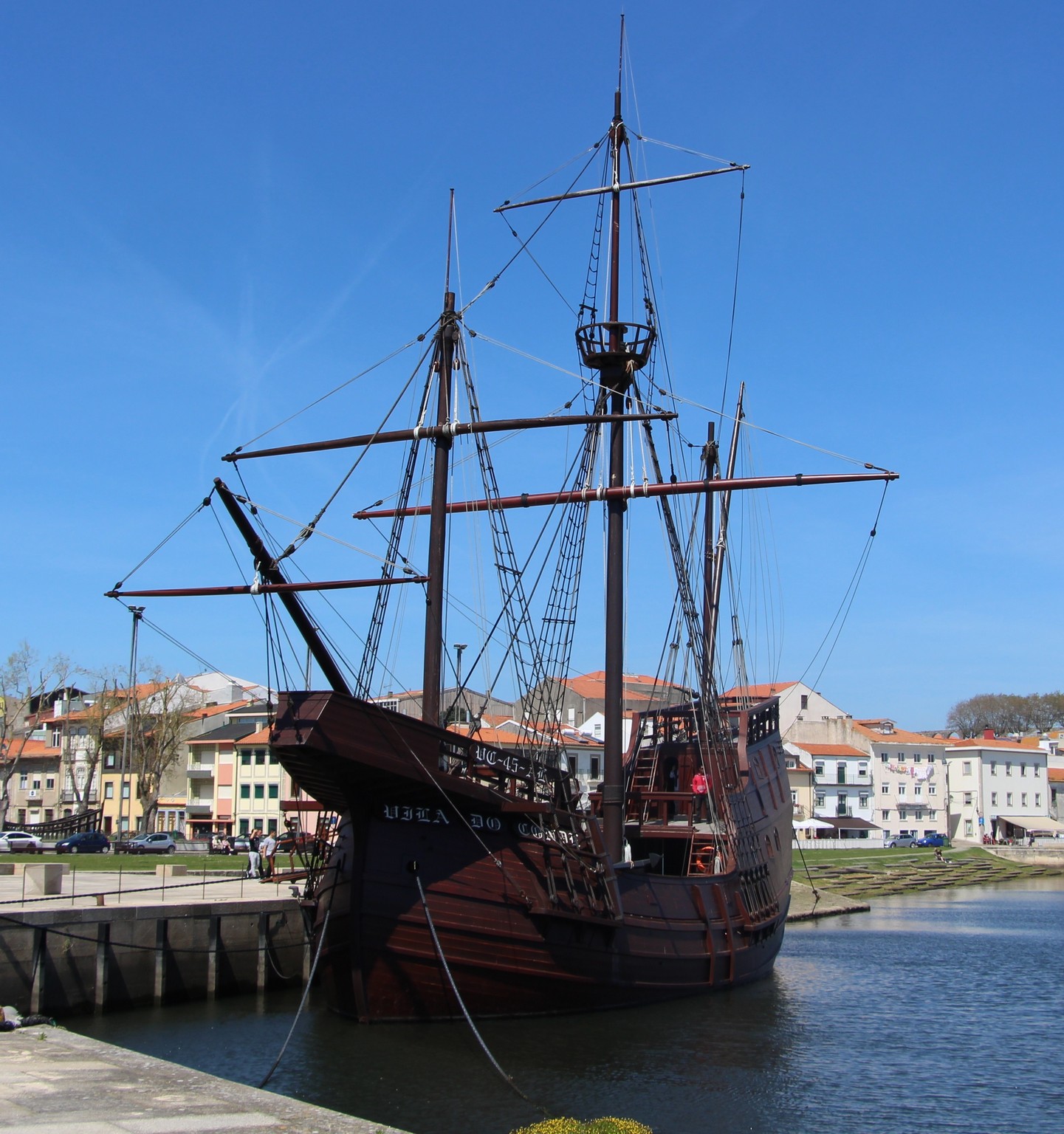
The Nau Quinhentista, a replica of a Portuguese vessel from the early 16th century, was designed by Rear Admiral Rogério d’Oliveira and built at the Samuel & Filhos shipyards.
With a length of 27.50 meters, a width of 7.70 meters, a height of 4.75 meters, and a weight of about 300 tons and carried 180 tons of cargo.
Inside the ship, you can see different recreations of life on board at the period, reflecting the complexity encountered by navigators on their deep-sea trips, such as crew quarters, places and forms of storage of products, disposal of cartographic material and navigation aids, artillery pieces, ballast, and so on.
Address : Largo da Alfândega – Vila do Conde Telephone : +351 252 248 468 ( bookings ) E-mail : museums@cm-viladoconde.pt Opening times: Tuesday to Sunday – 10:00 am to 6:00 pm
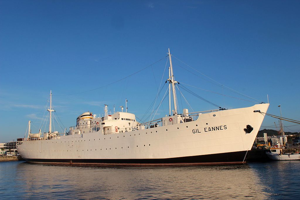
Viana do Castelo Naval Shipyards Tonnage 3467 gt Length 322.99 feet (98.45 m) Beam 45.00 feet (13.72 m) Draught 7.87 feet (2.40 m) Propulsion 2 engines of 1,400 bhp (1,000 kW) each Speed 12.5 knots (23.2 km/h; 14.4 mph)
Here’s a detailed look at the Gil Eannes — its story, its role and why it’s interesting to visit.
1. Origins & Construction
The ship we’re talking about was launched in 1955 at the shipyard in Viana do Castelo, Portugal.
It was built to replace an earlier vessel (also named Gil Eannes) that had been supporting the Portuguese fishing fleet.
Its design: about 98.45 m long, 13.72 m wide, 5.49 m draft. Motorised by two Fairbanks-Morse diesel engines (~2 × 1400 hp) giving a speed around 12.5 knots.
It was built as a multi-role ship: hospital ship, supply vessel, icebreaker, tug, mail ship, flagship for the fishing fleet.
2. Its Role & Service
Between 1955 and 1973 the Gil Eannes operated with the Portuguese “White Fleet” (fishing for cod around Newfoundland and Greenland).
While its primary function was as a hospital ship (treatment rooms, radiology, operating theatre) it also: delivered supplies (food, fuel, bait), acted as ice-breaker, tug, mail ship, maritime authority for the fleet.
In 1963 it began to do some passenger and refrigerated-cargo work during off-season.
The last voyage supporting the cod-fishing fleet to Newfoundland was in 1973. After that it lost its original role.
3. Decline, Rescue & Museum Conversion
After 1973 it was decommissioned, anchored in Lisbon, and looked set for scrap.
In 1997/98 a campaign succeeded in saving the ship. In 1998 the vessel was restored in Viana do Castelo.
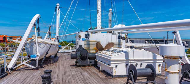
Today it is permanently moored in the fishing harbour of Viana do Castelo and functions as a museum ship and a youth hostel (in the former wards) under the management of Fundação Gil Eannes.
4. Why It’s Interesting to Visit
It’s a rare example of a ship that combined hospital/medical services with support for a large-scale fishing operation in harsh North Atlantic conditions.
Visiting gives you a feel for the scale and complexity of Portuguese maritime fishing in the 20th century: the ship’s engine room, treatment rooms, bridge, supply decks.
It also offers insight into social history: the lives of fishermen, the support infrastructure they had, the maritime heritage of Portugal.
From a travel-perspective: located in Viana do Castelo, at the waterfront, so it’s also a nice stop when exploring that region of Portugal.
5. Practical Info
Note: there are steep ladders and stairs inside the ship, so mobility may be an issue for some visitors.
Location: Doca Comercial, Viana do Castelo, Portugal.
The museum part of the ship has a modest entry fee; there is also a free “Centro do Mar” section.
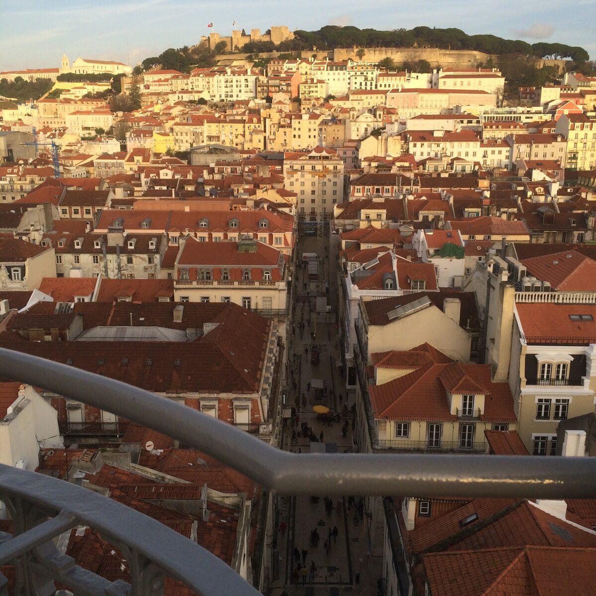
Rising above Lisbon’s historic Baixa district, the Santa Justa Lift is a breathtaking Neo-Gothic elevator that has been connecting city neighborhoods—and delighting visitors—with spectacular views since 1902. Discover its remarkable engineering, rich history, and panoramic vantage point over Portugal’s City of Seven Hills.
The corpse bride is installed in a lavish tomb in the beautiful Monastery of Alcobaça, where she remains to this day, interred next to her love.
THE PASSIONATE BUT FAILED LOVE STORY BETWEEN Pedro, Portugal’s crown prince, and his wife’s lady-in-waiting is the stuff of bodice rippers and slasher flicks.
Inês de Castro, a young woman, met Pedro in 1340 while accompanying his wife to court. Inês and Pedro fell madly in love, and neither the king’s displeasure nor the wife’s intrigues could keep them apart.
In a final act of desperation, King Afonso IV, Pedro’s father, had Inês assassinated in front of her children. Pedro, hurt and angry, rose up against his father in open rebellion but eventually failed in his quest for vengeance and justice.
Afonso died two years after Inês’ death, and Pedro became king; and here’s where things get a little strange:
According to legend, Pedro ordered Inês’ body to be exhumed, clothed in finery and propped up in the throne room. Pedro then commanded his vassals to swear allegiance and duty to this corpse he dubbed his wife and queen and further required that they kiss her lifeless hand.
Without regard for formalities, Pedro had his deceased bride placed in a sumptuous tomb at the magnificent Monastery of Alcobaça, where she remains to this day, interred beside her love.
Afonso Henriques, the first Portuguese monarch, constructed the monastery in 1153. It survived the 1755 Great Lisbon Earthquake but was heavily ravaged by Napoleon’s invading French, who seized the magnificent library, robbed graves, and ruined décor. It was a monastery until the mid-nineteenth century and is now a UNESCO World Heritage Site.
The transept of the cathedral contains the burials of King Pedro I and his mistress, Inês de Castro. Nobody knows who carved the exquisitely beautiful and detailed graves, but they are among the finest in Portugal, depicting images of the last judgment and the couple’s sculpted likenesses being carried aloft by angels. The lovers stand facing one other, their tombstones engraved with the words “Até ao fim do mundo…” or “Until the end of the world…”
The Alcobaça Monastery is a Catholic monastic complex located in the town of Alcobaça, in central Portugal, some 120 km north of Lisbon.
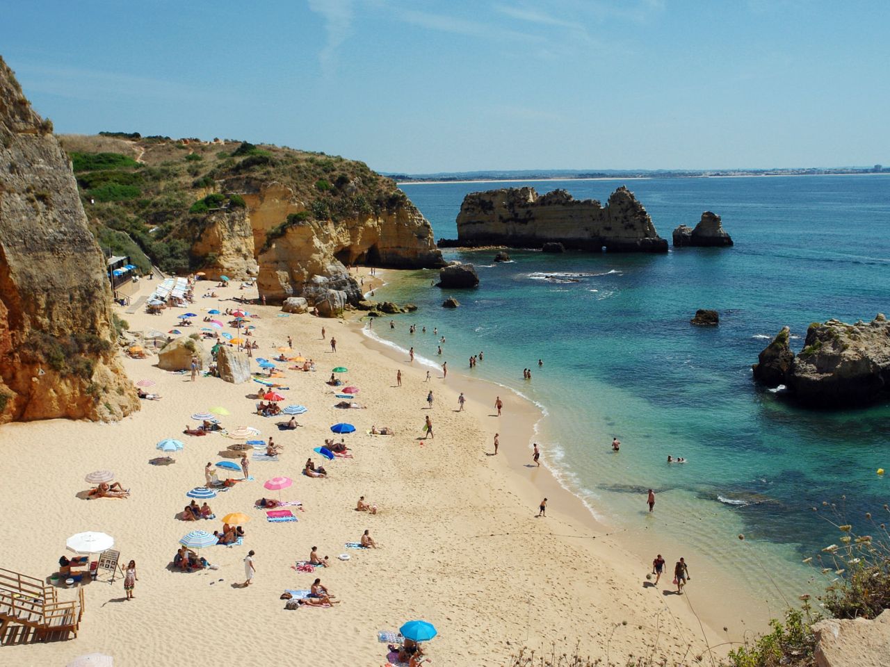
Portugal is a beach lover’s heaven with around 600 miles of coast, the majority of which is sandy. Add to that Portugal’s exceptional climate, and it’s easy to see why Portugal is one of Europe’s most popular vacation locations.
There are plenty of sandy beaches, rugged cliffs, and beautiful views to select from between the mainland, the Azores, and Madeira.
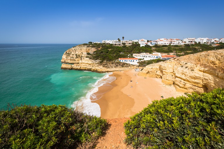
Praia de Benagil, Algarve
The Algar (Grotto) de Benagil is one of the most photographed caves in the Algarve. Located in a fishing community near Carvoeiro, the Algar (Grotto) de Benagil is the star attraction of the local beach and is only accessible by water. The Praia de Benagil is much more than this unique feature; it is one of the more tranquil and private locations due to the lack of surrounding parking. Additionally, it is bordered by steep cliffs, which are a frequent feature across the Algarve.
Praia da Marinha, Algarve
Another attractive beach in Lagoa is the Praia da Marinha, which is covered with smooth sand and framed by colourful cliffs. It is also one of the quietest areas in the area, maybe due to the fact that it is only truly accessible by car, followed by a steep descent down the cliffside. Bring snorkelling equipment along with your sunblock, as the Praia do Marinha has calmer seas that are ideal for swimming all day.
Praia da Rocha, Algarve
Praia da Rocha in Portimo, a lovely long beach close to hotels, cafes, restaurants, and bars, is closer to the tourist centres. It is one of the nicest resort beaches in the Algarve.
Praia de Odeceixe Mar, Algarve
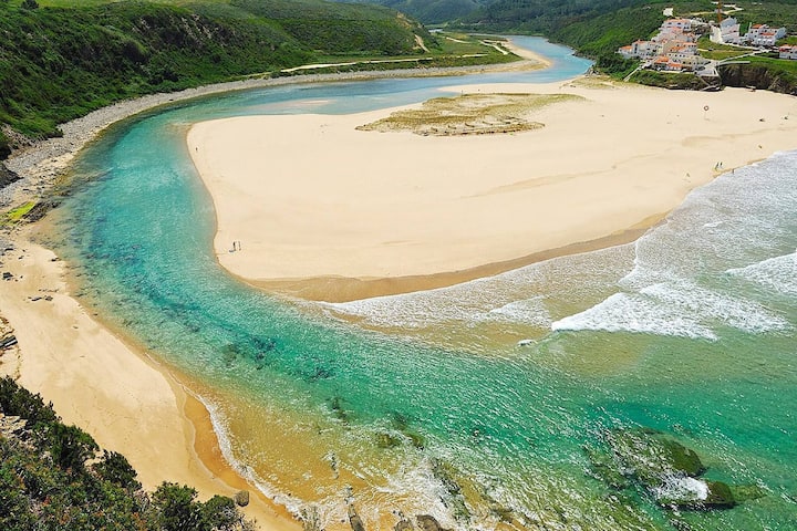
Praia de Odeceixe Mar is a beach on Portugal’s Atlantic coast that borders the Algarve and Alentejo provinces. It is located near the mouth of the River Seixe (Rio de Seixe), which forms the border and leads to the beach via a lovely green valley.
Odeceixe is a large sand beach that attracts surfers. The break near the river mouth is really good. At the northern end, there are cliffs that are abrupt and precipitous. A little cove (Praia de Adegas) at the far southern end is a certified nudist beach.
Odeceixe beach is around 4 kilometres (3 miles) from Odeceixe settlement, and during the summer, a ‘road train connects the two. However, it is not significantly faster than walking, and the trek down to the ocean is rather pleasant.
As a Blue Flag beach, there are numerous facilities, including a smattering of beachfront shops and cafes. Additionally, the beach is located within the Vicentine Coast Natural Park.
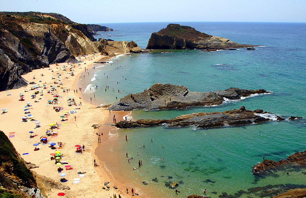
Praia Zambujeira do Mar, Alentejo
Many people know Alentejo with expansive fields and delectable wine, the region also boasts some stunning beaches. In the Natural Park of the Costa Vicentina e Sudoeste Alentejano is a tranquil surf beach surrounded by untamed countryside and endowed with almost magical beauty. This fishing community comes to life only in August, when the area hosts one of the major music festivals in the country. Otherwise, it’s an excellent spot to escape the crowds and enjoy some peace and quiet, whether on the beach or in the neighbouring natural park.
Portinho da Arrábida, Setúbal
Serra da Arrabida, located less than an hour south of Lisbon, is a popular hiking destination that conceals lovely beaches along the mountainside. Portinho do Arrábida, with its glittering sea and beautiful sands, is a popular choice. Numerous charming fishing villages are nearby, where you may sample traditional Portuguese cuisine and culture.
Praia da Nazaré, Nazaré
Nazaré, in central Portugal, is a well-known surf destination. Indeed, the world’s highest wave was surfed here, so it should be experienced only by those with strong wave riding skills. The best time to visit is in the spring or fall when the weather is still pleasant but there are fewer people. Apart from the ocean, Nazaré is an excellent location for fresh seafood and immersion in Portugal’s thriving fishing culture.
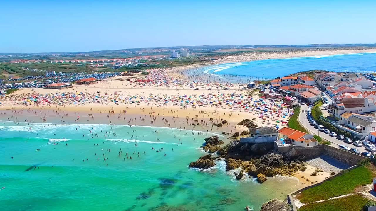
Praia do Baleal, Peniche
Baleal beach is located at the opposite end of the broad bay, approximately 4 kilometres (3 miles) from the town of Peniche. Around 100 metres away, the sandy beach connects the island of Baleal to the mainland.
Baleal is a wonderful, clean beach that is popular with families and, more importantly, surfers. Due to the diversity of the shoreline, there are waves ideal for all skill levels and weather situations.
Praia Azul, Torres Vedras
Just 35 minutes north of Lisbon on a toll-free piece of highway, the stunning and wild Praia Azul, whose name translates as ‘blue beach,’ was one of the first beaches to be connected with Peniche’s legendary waves. This relatively unspoiled blue flag beach is a long, sandy surfer’s paradise located at the mouth of the Sizandro River. There is pretty steady surf throughout the year, with easterly off-shore winds. With adequate banks, this exposed beach break can be large and hollow, with hefty barrels, making it more suitable for surfers than swimmers.
Torres Vedras, a historic city, is only 15 kilometres away.
Praia de Porto das Barcas, Lourinhã
Porto das Barcas is a huge sandy beach located near Lourinhã, approximately 15 kilometres south of Peniche. A little over an hour from Lisbon, this beach was formerly quite popular. However, things have mellowed out through the years, and the beach retains a wild feel for the majority of the year.
For the majority of its length, the beach is surrounded by towering cliffs. These rocks are of importance to palaeontologists due to the discovery of multiple dinosaur remains.
Around halfway along the beach’s length, the cliffs descend and a car park and road lead down. This road goes beside the northern section of the beach, shielded from view by boulders put in front of it. At the end of the road is the old fishing port, which consists of a slipway and a few dilapidated whitewashed hotel structures.
Matosinhos beach,Porto
Porto’s principal beach is Matosinhos. It’s a pleasant enough stretch of fine sand, surrounded by apartment buildings, an esplanade, and a variety of tiny cafes. There is always something going on on the beach during the summer, and the lifeguard service ensures that bathing is safe.
Although the water quality has significantly improved over the years, it still falls short of Blue Flag criteria. This is unsurprising, given the presence of a sizable port and oil terminal near the beach’s northern end.
Matosinhos is also the most reliable surfing location in Porto. Unlike the beaches towards Foz, this beach is devoid of rocks, and the harbour wall at the northern end provides wind protection. The gently sloping sand here absorbs part of the surf’s energy, making it a good site for surfers of all abilities.
One significant advantage of visiting Matosinhos beach is that the area is well-known for its excellent eateries, particularly those serving seafood.
Praia Castelo do Queijo,Porto
The name of the beach is Praia Castelo do Queijo, which translates as “Cheese castle beach”! The name is derived from the Fort of San Francisco Xavier, which is located just across from the beach. The fort is claimed to have been erected on a rock that resembled a massive chunk of cheese.
The beach is a tiny expanse of sand and pebbles that runs parallel to a promenade. Although not as popular as nearby Matasinhos, the beach is nonetheless quite busy throughout the summer months.
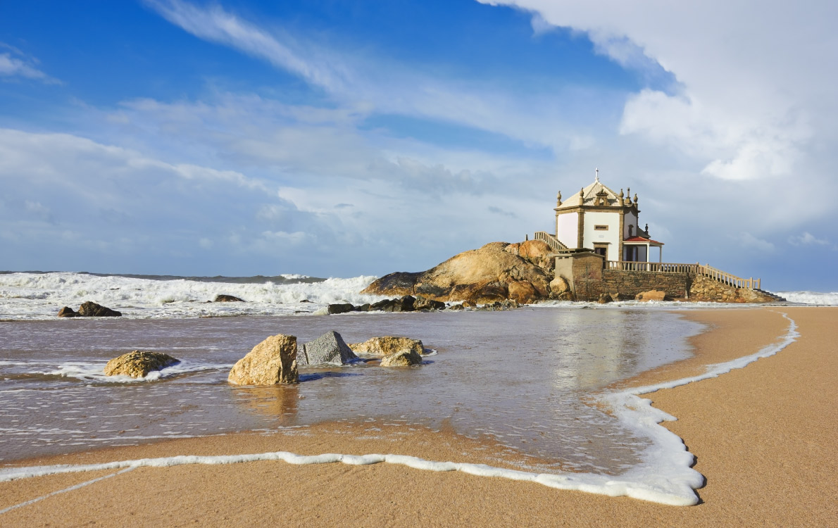
Praia da Miramar,Northern Portugal
The Capela do Senhor da Pedra is a lovely lonely chapel perched on a rocky outcrop in northern Portugal’s Praia da Miramar. The beach surrounding the chapel is expansive, frequently uncrowded, and offers spectacular sunsets (especially when the chapel is included in the backdrop).
Apúlia– Northern Portugal
The long sandy beach of Aplia is located a few kilometres south of Esposende, on the far bank of the river Cavado. Aplia has numerous conveniences, as you would expect from a Blue Flag beach, and is backed by a modest promenade and tiny town. The beach is guarded by lifeguards throughout the summer season, making it a suitable option for families.
The most recognizable feature of Aplia is a cluster of ancient windmills situated in the dunes at the northern end of the beach. These no longer have sails and have been converted into lodging.
Praia Formosa,Azores
Praia Formosa, in Santa Maria, is one of the most beautiful beaches in the Azores. The beach’s most distinguishing characteristic is its yellow-white sands that stretch between the beautiful blue Atlantic and undulating green hills. Even better, you may tent nearby and spend a few days relaxing and admiring this Atlantic gem.
Seven Wonders of Portugal is a list of cultural wonders in Portugal.
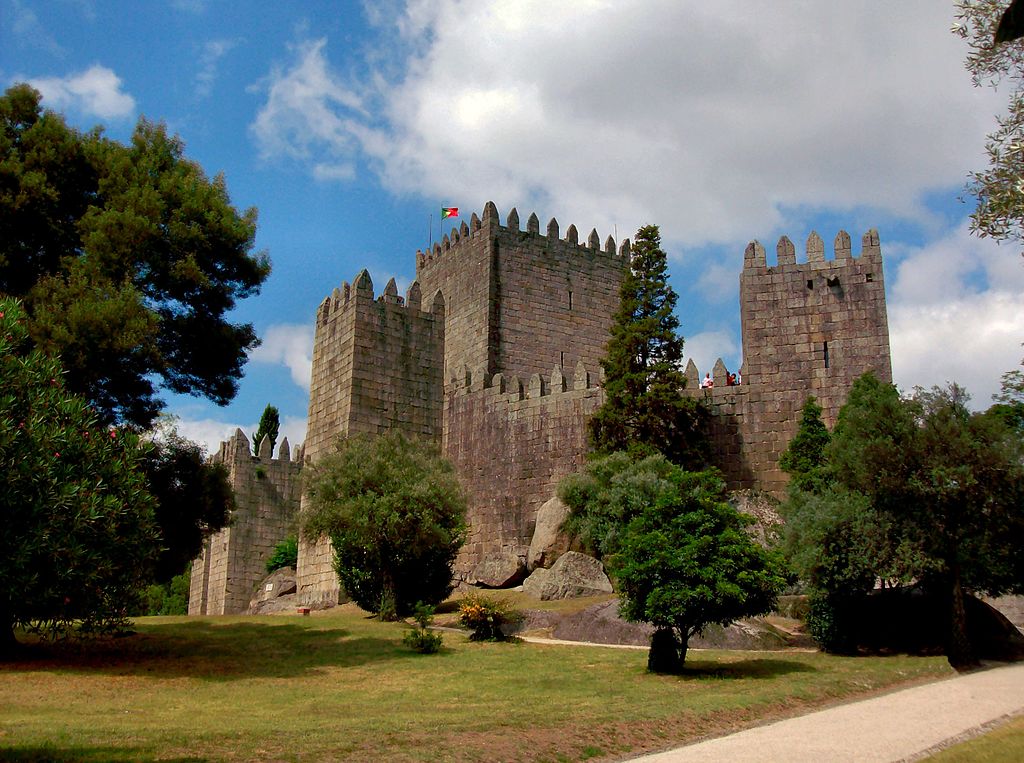
Castle of Guimarães 10th century
Guimarães Castle (Portuguese: Castelo de Guimarães) is the main medieval castle in the municipality of Guimarães, in the northern region of Portugal. It was built in the tenth century on the orders of Mumadona Dias to protect the monastery from raids by Moors and Norsemen.
The castle is a military structure that originated in the late Romanesque period and was developed during the early Gothic period in Portugal. It is surrounded by walls in the shape of a pentagram, with eight rectangular towers, a military square, and a central keep. Built on the foundations of a Roman structure described in the works of Alfredo Guimares, it was later developed on the French model, in the form of a shield with a reduced central courtyard and limited access. Due to its reconstruction at the end of the 13th century, which created the keep and the houses, it retains some Gothic elements (possibly on top of pre-existing structures).
Guimarães is emblematic of the medieval Portuguese castle and is associated with the origins of the Portuguese nation.
The castle is located within the northern limits of Guimarães, isolated on a small granite hill, surrounded by a small wooded park with several pedestrian paths. Next to the southern tower is a bronze medallion by D. Afonso Henriques, on top of a large rock. Nearby, on the hillside, are the Romanesque church of São Miguel do Castelo and the palace of the Dukes of Braganza, as well as some sections of the wall that surrounded the city, which was originally integrated into the castle.
Guimarães, Braga GPS 41.4479°N 8.2906°W
Castle of Óbidos 1195
Óbidos Castle is a well-preserved medieval castle in the parish of Santa Maria, São Pedro e Sobral da Lagoa, in the parish of Óbidos, in the Portuguese district of Leiria.
Óbidos was founded on the existence of a fortified settlement, most likely on the hill overlooking the Luso-Roman castle and Roman oppidum (then civitas), known as the mysterious Eburobrittium, which Pliny the Elder once mentioned as being located between Collipo (modern Golpilheira, near Leiria) and Olisipo (Lisbon). Archaeological research has revealed the presence of a forum, baths, and other Roman structures in the vicinity of the village. The area was later inhabited by the Lusitanians (from the 4th century B.C.) and the Romans in the 1st century, but was later invaded by the Visigoths in the 5th and 6th centuries and by the Moors in the 8th century, who were responsible for fortifying the town.
The trapezoidal castle faces south-east and rises 79 metres above sea level, in the extreme north-west corner of the walled enclosure. It is reinforced in the north by three semicircular and rectangular corbels; in the east and west by rectangular corbels known as the D. Dinis and D. Fernando towers; in the south by two semicircular corbels, one with machicolations; and in the north and west by a barbican. A graceful rectangular arch, known as the Albarrã Tower, runs along the wall dividing the two courtyards. The castle’s architecture, influenced by Romanesque, Gothic, Baroque, and Manueline styles, is divided into two sections: the Castelejo (now known as the Inn or Pousada de Obidos) and the interior.
The courtyard has an irregular triangle shape and is surrounded by square merlons with sills and crenellations. The perimeter of the walls, reinforced by square and cylindrical crenellated towers, is 1,565 metres long and is completely enclosed by a battlement guarded by a crenellated parapet. To the west, a line of walls, reinforced by huge rectangular towers, runs along the rocky cliffs. The Cerca Gate, the Talhada Gate and the Jogo da Bola watchtower interrupt this line of walls, which ends in the southwest with the Facho tower. From here, the walls are irregularly shaped to follow the relief of the land to the north-east, bending towards the north and east and supported by semicircular corbels and the minarets of the castle. The walls reach a height of 13 metres (43 feet) in places.
A 3 km aqueduct was built by Queen Catherine of Austria, wife of King John III (1521-1557), to bring water from the Usseira highlands to bidos to fill the city’s fountains.
Óbidos, Leiria GPS 39°21.819′N 9°09.428′W
Batalha Monastery, 1385
Batalha Monastery (Portuguese: Mosteiro da Batalha) is a Dominican convent located in the town of Batalha, district of Leiria, Portugal’s Centro Region. Originally and officially known as the Monastery of Saint Mary of the Victory (Portuguese: Mosteiro de Santa Maria da Vitória), it was built in remembrance of the 1385 Battle of Aljubarrota and was intended to serve as the burial church for the Portuguese royalty of the 15th-century Aviz dynasty. It is one of the best and most unique instances of Late Flamboyant Gothic architecture in Portugal, incorporating Manueline elements.
The monastery was built to thank the Virgin Mary for the Portuguese victory over the Castilians in the battle of Aljubarrota in 1385, fulfilling a promise of King John I of Portugal.
The convent is a separate entity from the town.
The western façade, which faces the wide square with its equestrian statue of general Nuno Álvares Pereira, is divided into three sections by buttresses and massive pilasters: the Founder’s Chapel (Capelo do Fundador), an aisle’s sidewall, and the projecting gateway. The Unfinished Chapels (Capelas Imperfeitas) are a freestanding octagonal structure erected to the complex on the right side of this façade.
The Chapterhouse is located on the east side, adjacent to the church choir (Sala do Capitulo). King João I Cloister abuts the church and this chapterhouse. The construction continues into King Afonso V’s cloister (Claustro de D. Afonso V). The Tomb of the Unknown Soldier from the First World War is located on the complex’s northern flank.
The archivolt contains a profusion of 78 statues of Old Testament kings, angels, prophets, and saints, each with its own baldachin. On both sides, splays depict (poor copies of) apostles, one of them is standing on a chained devil. Christ is enthroned in the tympanum, seated beneath a baldachin and flanked by the four Evangelists, each with his particular attribute.
Batalha, Portugal GPS 39°39′33″N 8°49′34″W
Alcobaça Monastery, 1153
The Alcobaça Monastery (Portuguese: Mosteiro de Alcobaça, Mosteiro de Santa Maria de Alcobaça) is a Catholic monastic complex located in the town of Alcobaça, in central Portugal, some 120 km north of Lisbon. The monastery was established in 1153 by the first Portuguese king, Afonso Henriques, and would develop a close association with the Portuguese monarchy throughout its seven-century-long history.
The church and monastery were the first Gothic buildings in Portugal, and, together with the roughly older Augustinian Monastery of Santa Cruz in Coimbra, it was one of the most important mediaeval monasteries in Portugal. Due to its artistic, cultural and historical relevance, it was included in UNESCO’s World Heritage Site list in 1989.
The Alcobaça Monastery was one of the first structures in Portugal affiliated with the Cistercian Order. It was founded in 1153 as a gift to Bernard of Clairvaux by the first Portuguese king, Afonso I or Afonso Henriques (1112–1185), following the king’s capture of the Moorish city of Santarém in March 1147. The monastery was founded as part of King Afonso I to strengthen his rule and promote colonization of previously won regions from the Moors during the “Reconquista Cristã” or Reconquista.
The Alcobaça Monastery was erected in an early Gothic style, marking the entrance of this style in Portugal. The church and other major structures were built between 1178 and the end of the 13th century. In 1252, the church was dedicated. The original monastic buildings were erected along lean architectural lines, with no adornment other than some capital sculpture and a figure of the Virgin Mary, in accordance with the rules of the Cistercian Order.
Alcobaça, Portugal GPS 39°32′54″N 8°58′48″W
Jerónimos Monastery, 1502
The Jerónimos Monastery, also known as the Hieronymites Monastery (Portuguese: Mosteiro dos Jerónimos), is a former monastery of the Order of Saint Jerome in the parish of Belém, Lisbon Municipality, Portugal.
In Lisbon, the monastery is one of the most visible specimens of the Portuguese Late Gothic Manueline style of construction. It was designated a UNESCO World Heritage Site in 1983, together with the adjacent Tower of Belém.
The Jerónimos Monastery replaced a church dedicated to Santa Maria de Belém in the same location, where monks of the military-religious Order of Christ assisted mariners in route. The port of Praia do Restelo was a desirable location for mariners, offering secure mooring and protection from the winds, which were desired by ships entering the Tagus mouth. The current edifice was built in 1495 at the Montemor o Velho courts on the instructions of Manuel I (1469–1521) as a final resting place for members of the House of Aviz, in accordance with his idea that an Iberian dynastic monarchy would govern after his death. In 1496, King Manuel requested permission from the Holy See to build a monastery on the site. The Hermitage of Restelo (Ermida do Restelo), as the church was known, was already in disrepair when Vasco da Gama and his crew prayed there the night before embarking on their trip to the Orient in 1497.
Santa Maria de Belém, Lisbon GPS 38.6975°N 9.206667°W
Pena Palace, 1854
The Pena Palace (Portuguese: Palácio da Pena) is a Romanticist castle in São Pedro de Penaferrim, in the municipality of Sintra, on the Portuguese Riviera. The castle stands on the top of a hill in the Sintra Mountains above the town of Sintra, and on a clear day, it can be easily seen from Lisbon and much of its metropolitan area. It is a national monument and constitutes one of the major expressions of 19th-century Romanticism in the world. The palace is a UNESCO World Heritage Site and one of the Seven Wonders of Portugal. It is also used for state occasions by the President of the Portuguese Republic and other government officials.
The Pena Palace has a profusion of styles much in accordance with the exotic taste of Romanticism. The intentional mixture of eclectic styles includes the Neo-Gothic, Neo-Manueline, Neo-Islamic and Neo-Renaissance. Much of this has been evident since major renovations in the 1840s. References to other prominent Portuguese buildings, such as the Belém Tower, are also present.
Almost the entire palace stands on a rock in the Sintra Mountains. Structurally, it can be divided into four sections:
the foundations and its enveloping walls, with two gateways (one of which is protected by a drawbridge)
the restored structure of the old convent, and the clock tower
the Arches Yard in front of the chapel, with its wall of Moorish arches
the palatial zone and its cylindric bastion, with interiors decorated in the cathédrale style.
Sintra, Lisbon GPS 38.787778°N 9.390556°W
Belém Tower, 1521
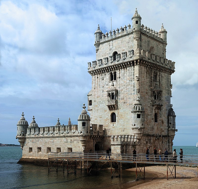
Belém Tower (Portuguese: Torre de Belém, officially the Tower of Saint Vincent (Portuguese: Torre de S. Vicente)) is a 16th-century fortress in Lisbon that functioned as a point of embarkation and disembarkation for Portuguese explorers as well as a ceremonial gateway to the city. It was constructed during the Portuguese Renaissance’s height and is a noteworthy example of the Portuguese Manueline style, while it also combines elements of other architectural styles. The structure is made of lioz limestone and consists of a bastion and a four-story, 30-metre (98.4 ft) tower.
Since 1983, the tower, along with the Jerónimos Monastery, has been a UNESCO World Heritage Site. Due to its iconic importance, it is frequently shown as a symbol of Europe’s Age of Discovery and as a metonym for Portugal or Lisbon. It has been mistakenly asserted that the tower was built in the middle of the Tagus and later relocated to the coast during the 1755 Lisbon earthquake. Indeed, the tower was constructed on a small island in the Tagus river near the Portuguese capital’s shore.
The Belém Tower is located on the northern bank of the Tagus River in the municipality of Lisbon, in the civil parish of Santa Maria de Belém. It is accessible through a tiny bridge at the western end of the Avenida de Braslia. To the east is the Jeronimos Monastery, to the west is the Forte do Bom Sucesso, and to the north is the tower Governor’s residence, the original Governor’s residence for the Forte do Bom Sucesso, and the Chapel of São Jerónimo.
The tower lies isolated along the riverbank, between Bom Sucesso and Pedrouços, on a basaltic outcrop of rocks from the Lisboa-Mafra geomorphological volcanic complex. Although several guides state that the tower was built in the middle of the Tagus and relocated to the shore following the 1755 earthquake, this is not the case. According to the Portuguese Ministry of Culture and the Institute of Architectural Heritage, the tower was built on a tiny island along the Tagus’s bank, opposite Restelo’s beach. As expansion stretched the shoreline, more and more of the northern bank sank into the Tagus, gradually integrating the tower into the riverbank.
The Belém Tower was constructed using a beige-white limestone found in the Lisbon area and environs known as Lioz. The structure is broken into two sections: the bastion and the four-story tower on the bastion’s north side.
The sixteenth-century tower is regarded as a masterpiece of the Portuguese Late Gothic Manueline architecture. This is particularly evident in its ornate rib vaulting, Order of Christ crosses, armillary spheres, and twisted rope, all of which are characteristic of the nautically inspired organic Manueline style.
Santa Maria de Belém, Lisbon GPS 38.691389°N 9.215833°W
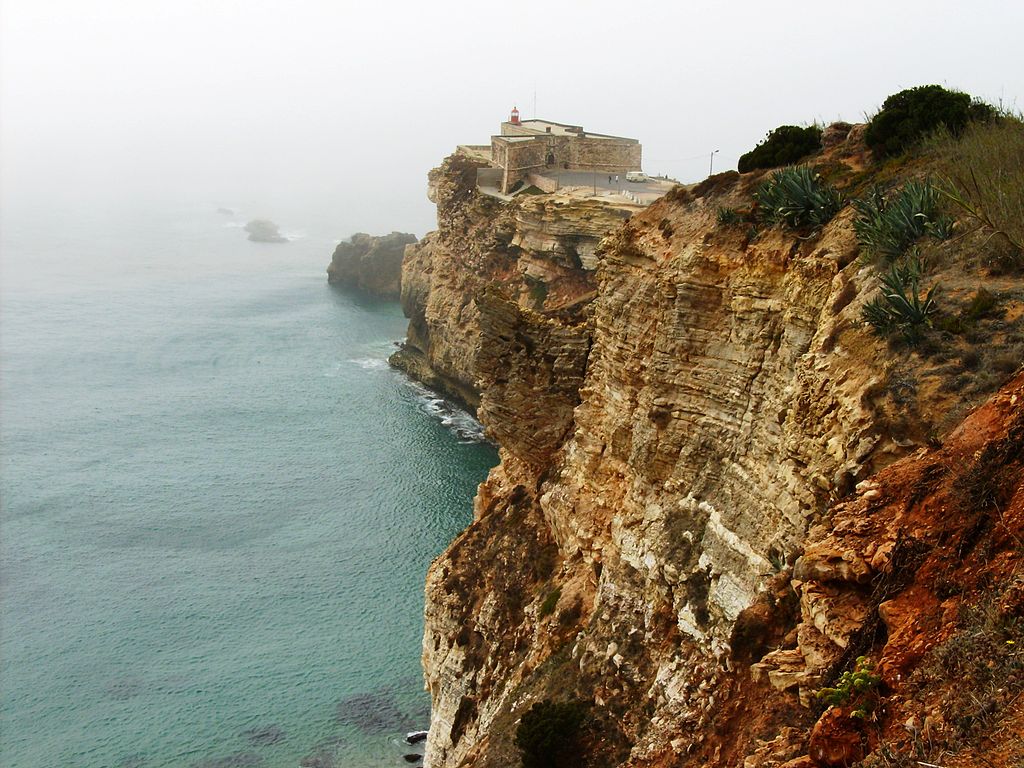
The Fort of SãoMiguel Arcanjo (St. Michael the Archangel) is located in the Portuguese town of Nazaré, in the Leiria District. It was built in 1577 but has been remodelled and expanded numerous times since then. The fort is a major tourist attraction, owing in part to its closeness to a surfing region renowned for its huge waves. It currently serves as both a lighthouse and a museum, with an emphasis on surfing.
The Fort of São Miguel Arcanjo is perched on cliffs, surrounded on three sides by the sea. In 1577, King Sebastian I of Portugal ordered the construction of a basic fort with the purpose of safeguarding Nazaré’s fishing, shipbuilding, and wood trade businesses against raids by Algerian, Moroccan, Dutch, and Norman pirates. It was armed with four pieces of cannon by 1595. Between 1639 and 1641, more construction was completed, increasing the number of cannon pieces to six. The fort was upgraded once again in 1644, under the orders of King John IV, when it gained its current shape and name. It has an uneven design, which was essential to accommodate the promontory’s contours. King John commissioned the placement of a limestone picture of St. Michael the Archangel over the entry, with the phrase “EL REY DOM JUAN-1644”.
It was held by a group of 50 troops during the French invasion of Portugal in 1807 or 1808 after its artillery pieces were transferred to the Citadel of Cascais to offer defence for Lisbon. The French were imprisoned by the indigenous people when a group of students convinced the invaders to surrender by falsely claiming the Portuguese had sent reinforcements. Simultaneously, residents of Nazaré travelled south by boat to Cascais in quest of weaponry that would enable them to fight French troops going north from Peniche to assist the French garrison. The fort became a symbol of popular resistance, but the French invaders eventually returned, murdering residents and setting fire to their homes and boats in retaliation.
In 1831, the fort held a military unit backed up by two 12-gauge pieces, which were later relocated to Peniche.
The fort was the scene of clashes during the Liberal Wars, or Portuguese Civil War, which pitted followers of King Pedro IV and King Miguel I against one another.
Following D. Miguel I’s exile in July 1834, the fort’s stone figure of St. Michael the Archangel was assaulted by Pedro supporters, who threw down the fort’s walls to the shore. While it was later returned to its original place, it remains damaged. Following this, the fort remained privately held until 1902, when it was expropriated by the state.
Lighthouse
In 1903, a lighthouse and keeper’s quarters were built, largely to aid local fishermen. On December 1, 1903, the lighthouse was inaugurated. It is currently a red lantern with an 8-metre height, a white light, and a range of 14 nautical miles located 50 metres above sea level. Additionally, a foghorn is located on the premises. The walls were restored in 1907, and additional work began on the walls in 1941. In 1977, work was completed on restoring the main gate and waterproofing the terrace. In 2005-06, drainage improvements were made. Although the building is now well preserved, it is in danger of collapsing due to the south side’s extensive erosion.
Museum
Since 2014, visitors have been able to visit the fort’s museum section. It has an exhibition on the German submarine U-963, which was scuttled off the coast of Nazaré on May 20, 1945. Additionally, there is an Interpretation Center that describes the impact of the Nazaré Canyon, which is located just off the coast of Nazaré and is believed to be Europe’s largest canyon, with a maximum depth of at least 5,000 metres. The canyon is believed to be the source of the high waves that make Nazaré a popular surfing destination.
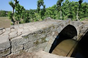
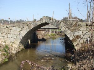
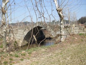
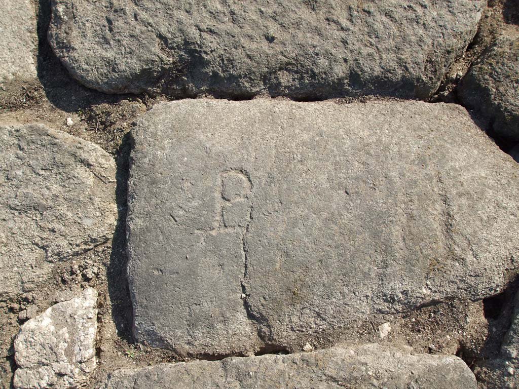
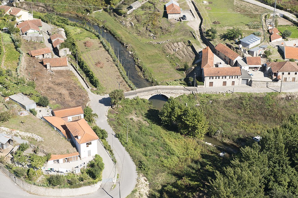
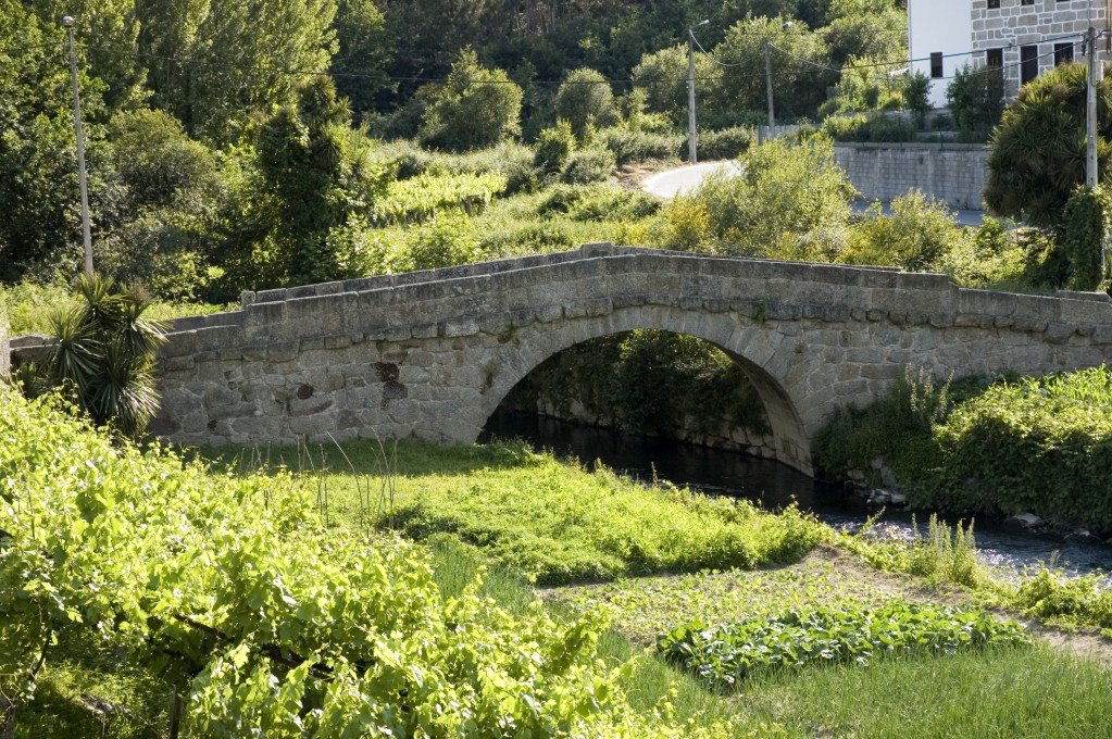
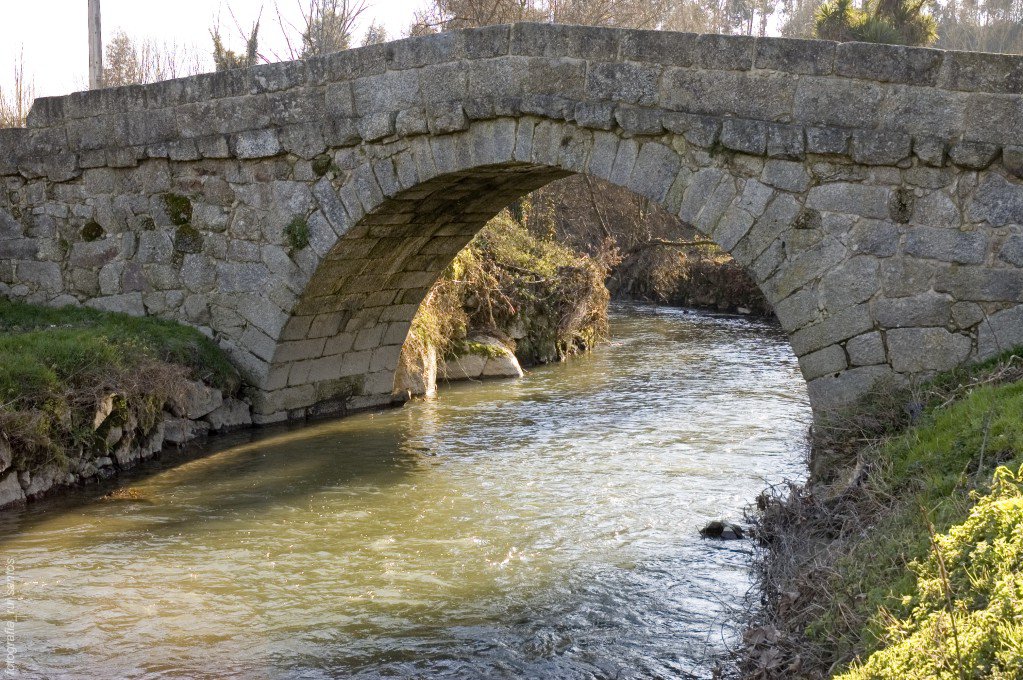
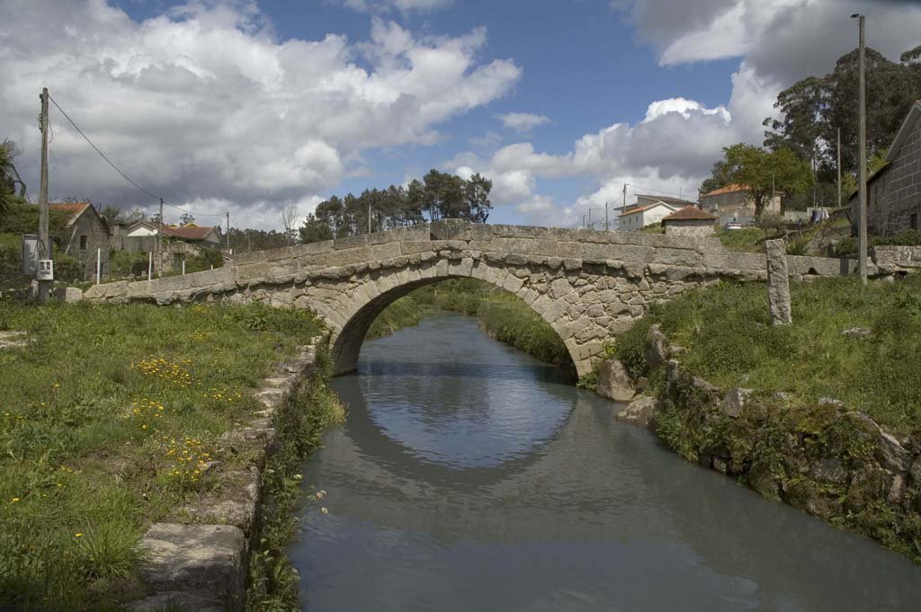
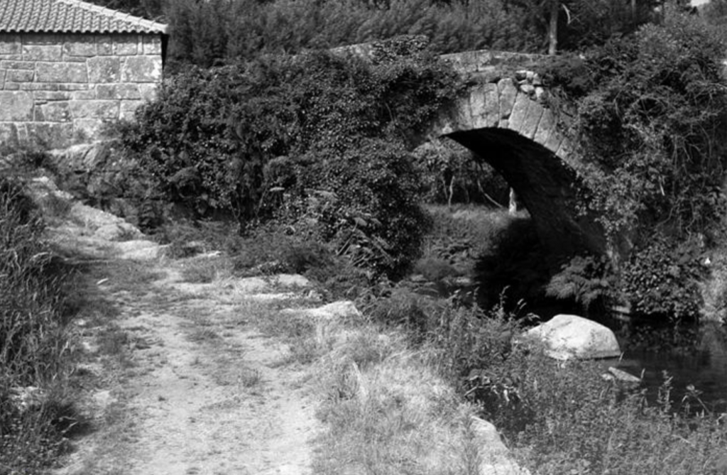
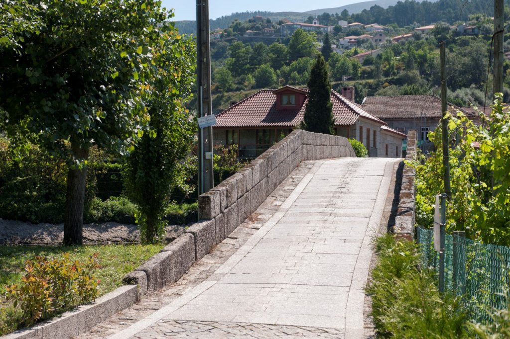
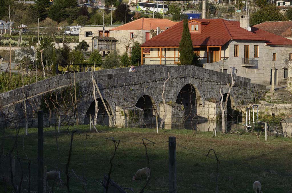
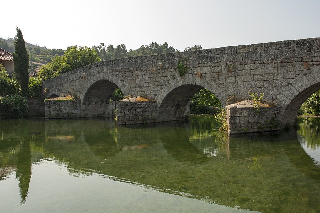
The Ponte da Veiga, located in the village of Torno in the municipality of Lousada, Portugal, is a remarkable example of Gothic architecture from the early 15th century. This single-arch stone bridge spans the River Sousa and is characterised by its slightly broken arch with narrow and elongated voussoirs (wedge-shaped stones that form the arch), which bear distinctive masonry marks.
Historically, the bridge was under the protection of the Pombeiro Monastery in Felgueiras. Its construction probably facilitated local and regional transit across the River Sousa, serving its secular and religious interests. The surrounding area is known as the “Veiga”. It is a fertile plain that was intensively cultivated during the Middle Ages.
In the 20th century, the bridge began to decay due to traffic and was finally replaced by a concrete structure. In recognition of its historical importance, in 2010, the Ponte da Veiga was included in the Rota do Românico (Romanesque Route), a series of cultural itineraries that explore the rich Romanesque heritage of the Sousa Valley region.
The bridge is open to the public and partially accessible to persons with reduced mobility. For a more immersive experience and a deeper understanding of the region’s Romanesque architecture, the nearby Centro de Interpretação do Românico in Lousada offers a comprehensive insight.
The Ponte da Veiga is a testament to the region’s medieval engineering and remains a point of interest for those exploring Portugal’s historic landscapes.
1427 – Fleeing the plague, Friar Amaro – the commander of Pombeiro – takes refuge in São Fins de Torno, which was the abbey’s church;
15th century (1st half) – Construction of the Bridge of Veiga;
17th-18th centuries – Conduction of conservation and strengthening works;
1726 – Francisco Craesbeeck mentions the existence of parapets on the Bridge;
1758 – The Vicar of Torno, Félix Borges, points out that within the limits of his parish there was only one masonry Bridge, which had a single arch;
20th century – Subject to motor-vehicle traffic, the Bridge of Veiga degrades and is replaced by a concrete pontoon;
2010 – Integration of the Bridge of Veiga in the Route of the Romanesque.
How to get there:GPS 41.299365, -8.217653
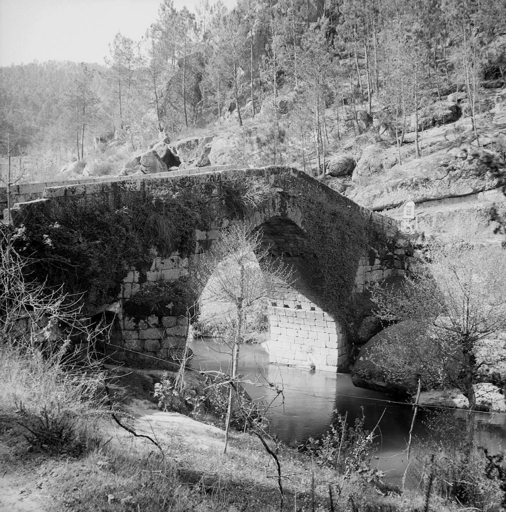
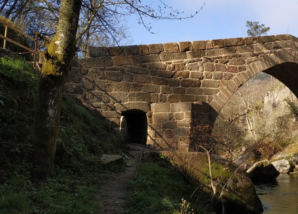
Bridge of Espindo
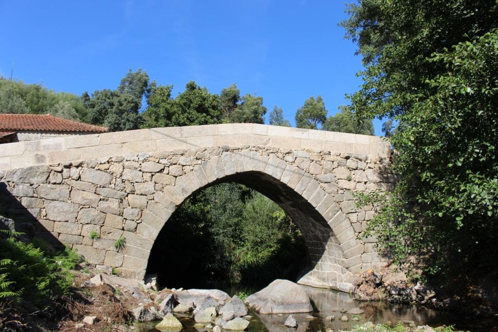
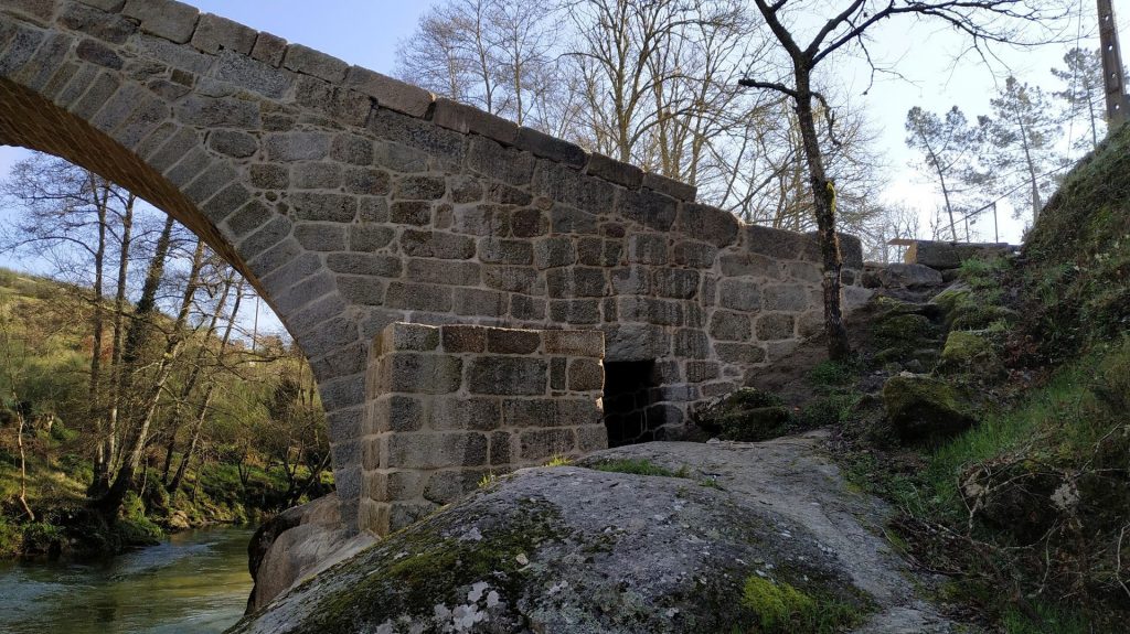
The Espindo Bridge is supported by a single circular arch supported by strong pillars that emerge straight from the banks.
Because of the breadth of the span, the arch was elevated and the tray was placed on a trestle, resulting in a double-ramp.
The Bridge is made of granite, with unevenly bonded batters that contrast with the arch’s regular stone bonding and well-cut voussoirs.
Though technically and structurally, this Bridge resembles a medieval bridge, it is impossible to place a date on it.
Bridges erected in the Middle Ages placed a higher value on their foundations than Roman bridges, and their designers sought out more stable locations for their construction.
These facts contributed to medieval bridges’ durability in the face of weather and flooding.
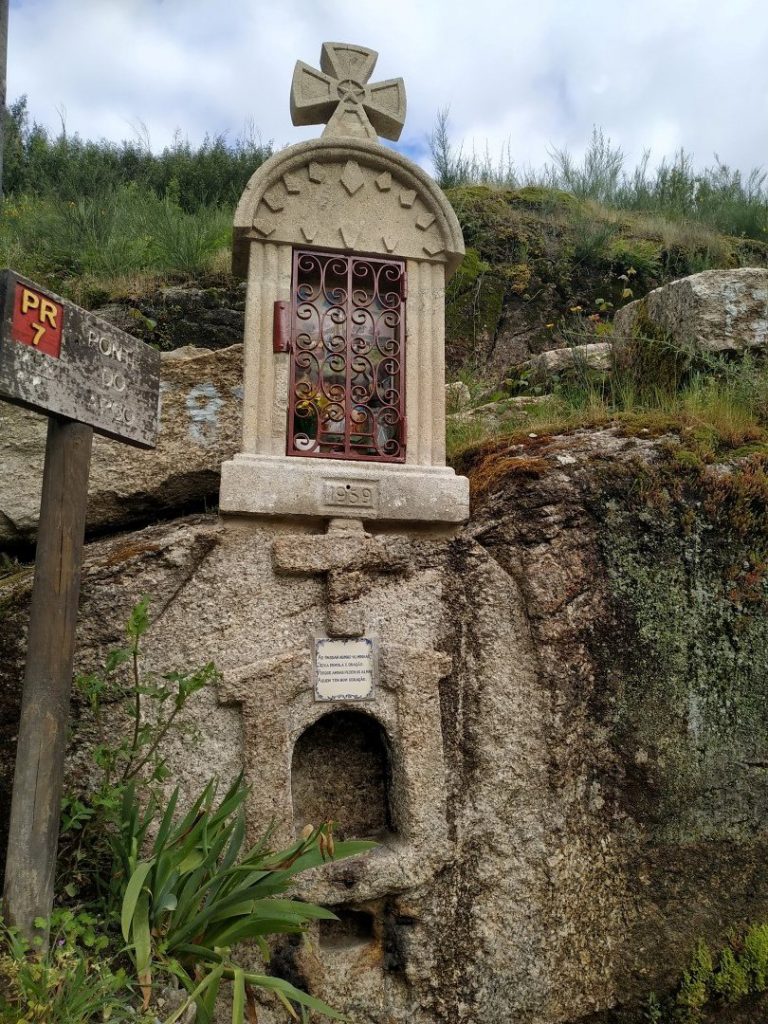
The “Alminhas” [Shrines] at one end of the Bridge of Espindo are wayside shrines linked with old Portuguese routes and the symbolic protection of travellers.
How to get there: GPS 41.24348, -8.273541
Rua da Ponte de Espindo, Meinedo, Lousada, Porto
Bridge of Panchorra
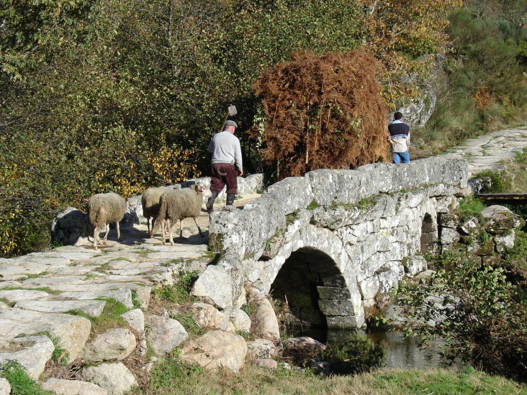
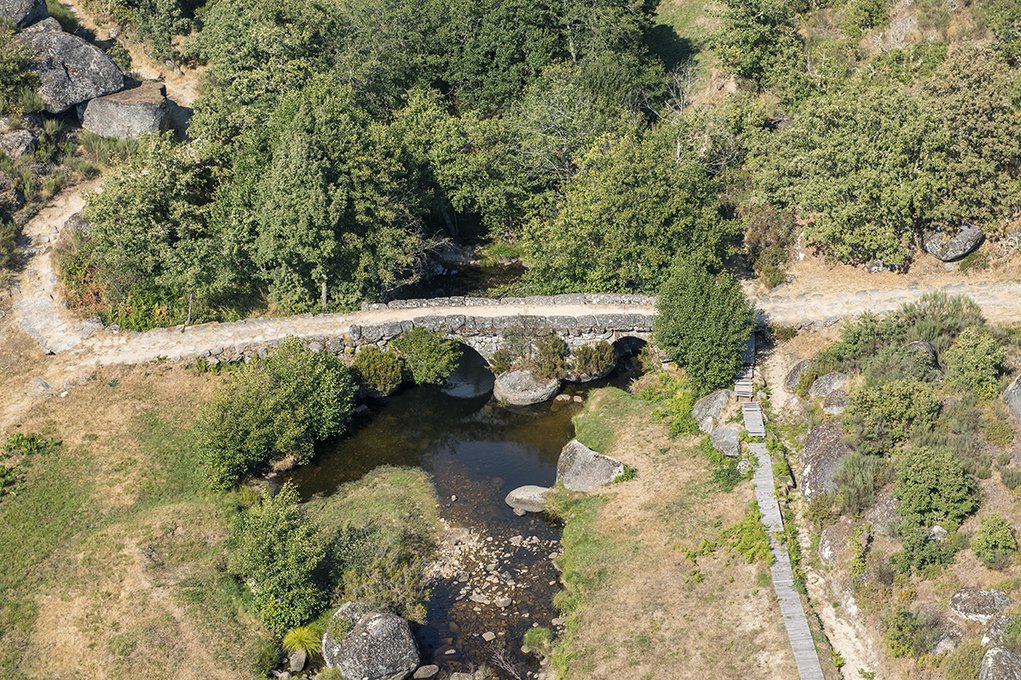
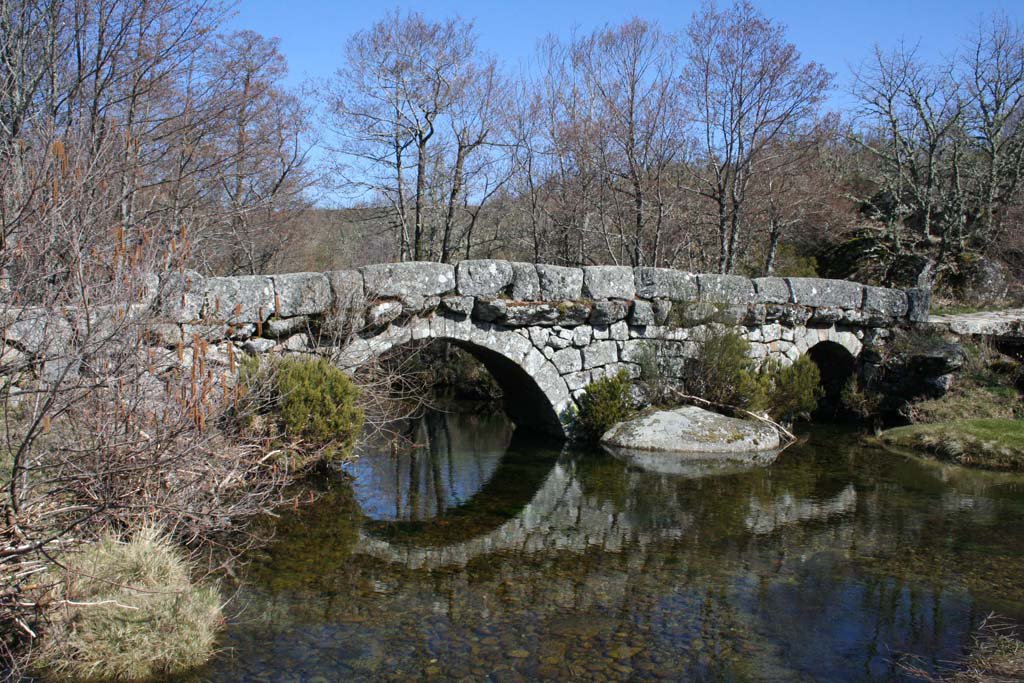
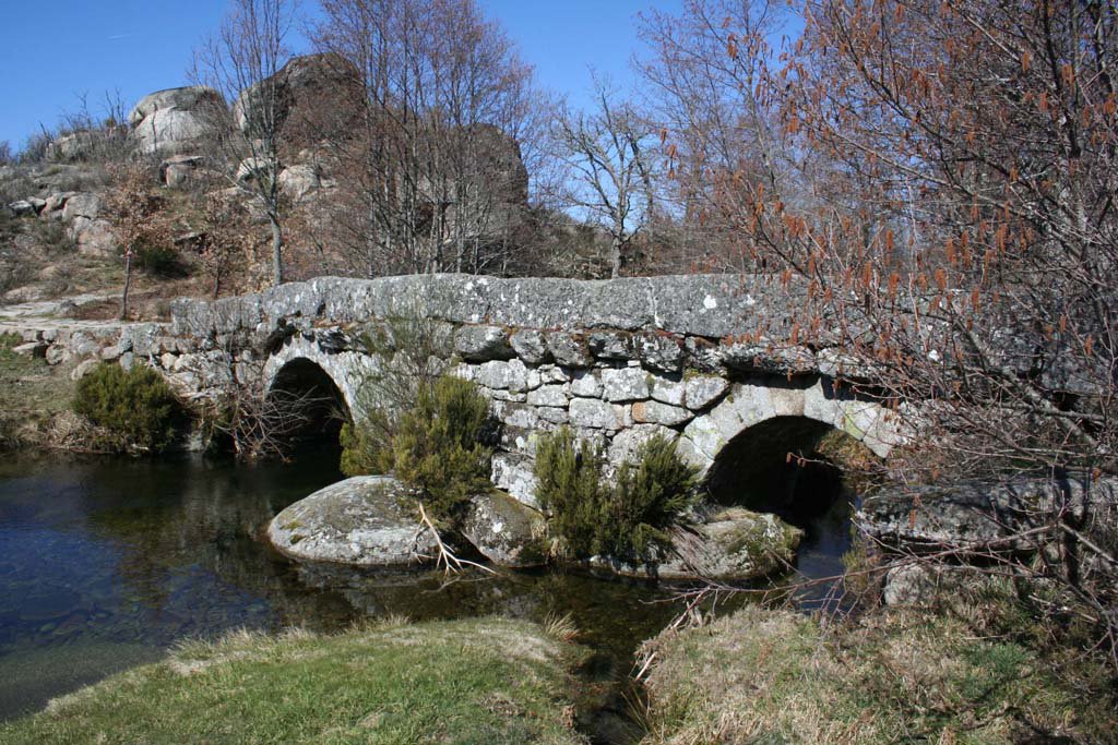
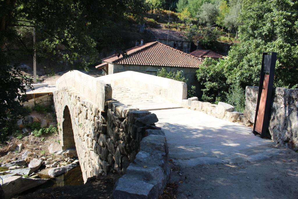
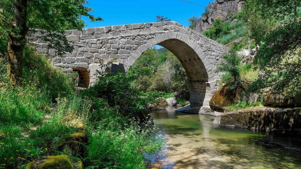
The Bridge of Panchorra is a stunning example of vernacular [traditional] architecture, located around 1000 meters above sea level and connecting the banks of the river Cabrum.
It is a two-arched bridge with a regular structure in the voussoirs [arch-forming stones] and irregular masonry [stones] in the remaining structure, which may suggest a work by local or regional masters to fulfil the community’s access needs to their fields and forests.
As a result, it stands in stark contrast to its downstream equivalents, which include the Ovadas, Lagariça, and Nova bridges, all of which are located near the river Cabrum’s mouth. It remains, however, an excellent example of communal infrastructure.
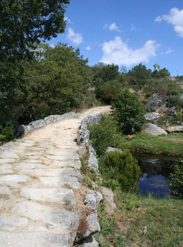
The bridge utilizes outcrops on the riverbanks to support its pillars, which support the horizontal deck with guards, which provides the required sturdiness for agricultural vehicles and cattle to cross.
Although Panchorra is referenced in the 1258 Inquirições [administrative inquiries], it was not split from Ovadas, the location of the medieval parish’s old ecclesiastical centre, until the 16th century.
As a result, it was elevated to the status of “curato” [parish], with the Chapel of Saint Lawrence acting as the new religious centre.
1258 – First reference to Panchorra;
1288 – Reference to the existence of three farmhouses in Panchorra;
1513 – The charter of Terra de Aregos already refers all taxes paid to the crown;
1527 – Panchorra had between 71 and 77 inhabitants;
Before the 17th century – Construction of the Bridge of Panchorra;
1758 – Of all the clerics from the parishes of the Cabrum valley, only the one of Gralheira makes any reference to the (masonry) bridge of Gralheira;
2010 – Integration of the Bridge of Panchorra in the Route of the Romanesque;
2013 – The Bridge of Panchorra is classified as Public Interest Monument.
How to get there: GPS 41.013979, -7.975075
Rua da Ponte da Panchorra, Panchorra, Resende, Viseu
Bridge of Esmoriz
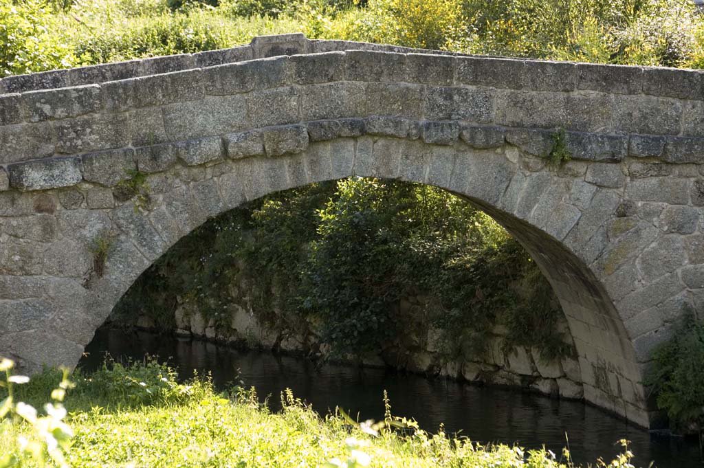
The Bridge of Esmoriz joins the sides of the river Ovil in the historic “Couto de Ancede” [privileged location] with a single circular arch, slightly raised deck with guards but without cut-seas or buttresses.
It has a regular structure, is shapely carved with voussoirs [stones that form the arch], and is thin and long.
It is listed in the 1758 Memórias Paroquiais [Parish Memorandum] among five other bridges on the parish circuit.
However, the earliest known reference goes all the way back to 1666, when various clashes about the estate of the House of Esmoriz were mentioned. Indeed, this small bridge was at the crossroads of ecclesiastical and manorial interests: the slope of the left bank of the river Ovil, the House of Penalva, the House of Esmoriz, and, not far from there, the majestic Monastery of Ancede.
Even after its incorporation into the Dominican order in the 16th century (it had previously been a part of the Canons Regular of Saint Augustine), which centralized its administration in Lisbon, the latter continued to polarize a number of interests, including business and export trade, which the monks excelled at optimizing.
Given their involvement in the design and construction of walkways, they may be attributed to the construction of the Bridge of Esmoriz, an important example of vernacular engineering [traditional].
1258 – Reference to Lourenço Ermiges of Esmoriz who is a witness in the “Inquirições” [administrative enquiries] involving the “couto” [place with privileges] of Ancede;
Around 1400 – At the “Tombo” of the Monastery of Ancede there is no reference to the Bridge of Esmoriz;
1666 – There is a reference to the stone Bridge over the river Ovil on the way of Minhoso and the Monastery;
1758 – Three stone bridges are located in Ancede, among them the one in Esmoriz;
2010 – Integration of the Bridge of Esmoriz in the Route of the Romanesque;
2014-2015 – Intervention for the conservation and protection of the Bridge of Esmoriz, under the scope of the Route of the Romanesque.
How to get there: GPS 41.112754, -8.063309
Caminho da Ponte de Esmoriz, Ancede, Baião, Porto
Bridge of Arco
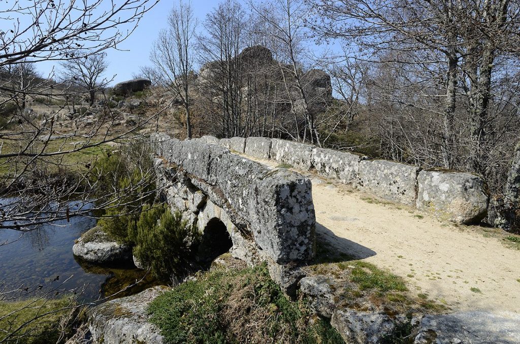
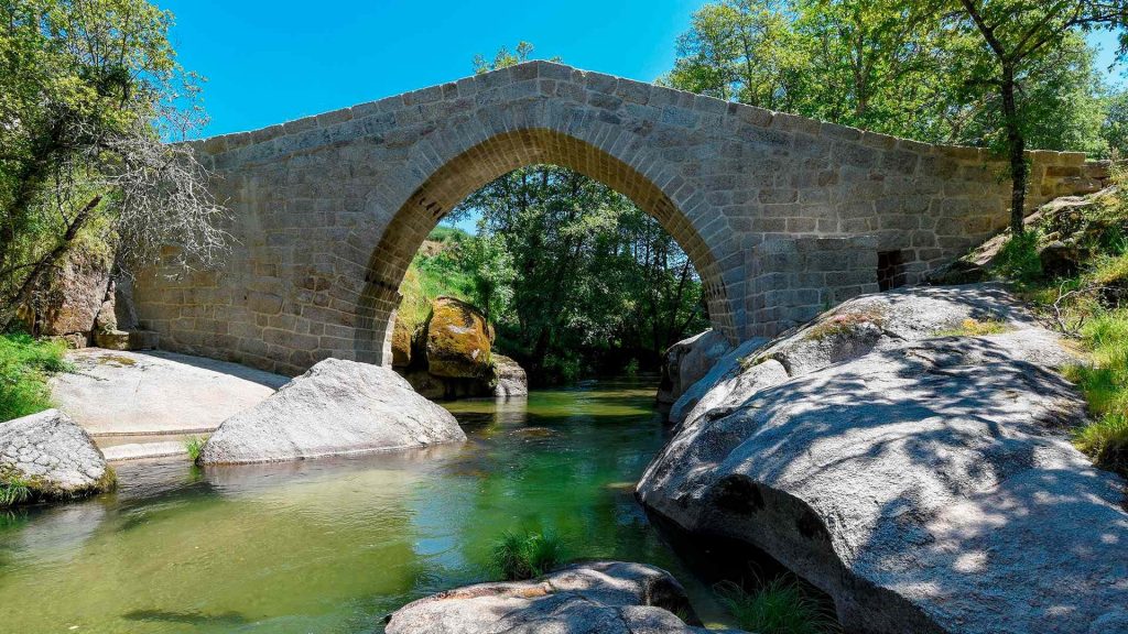
TheBridge of Arco [Arch], which connects the sides of the River Ovelha, stands true to its name.
It is an amazing work of architecture, consisting of a single slightly pointed arch. Its deck is shaped like a trestle, evoking Gothic bridge design.
The skilled masons who constructed and conceptualized it elevated the edifice’s foundations in two outcrops of the banks, therefore articulating a more robust and stable construction.
Perhaps unintentionally, they ended up creating a model of power and balance.
This harmony is upset only while looking at the intradorsum of the Bridge on the left bank, and you can see the lag between the starting ashlars [stones] on the right bank, whose position was disrupted for the installation of a wooden rib (the wooden structure that serves as the frame for the arch).
The Bridge of Arco was a good illustration of the type of local bridges distributed throughout the Modern Age. It was part of a municipal and parish network of roadways in the former county of Gouveia.
1758 – The abbot of Folhada mentions and describes the Bridge of Arco;
1982 – By Decree no. 28 from February 26th, the Bridge of Arco was considered as a Building of Public Interest;
1986 – Because it was a car passageway, the bridge suffers a few setbacks, related to its parapet and paving;
2010 – Integration of the Bridge of Arco in the Route of the Romanesque;
2015 – Intervention for the conservation and protection of the Bridge of Arco, under the scope of the Route of the Romanesque;
2018-2020 – Conservation, safeguarding and enhancement of the Bridge of Arco, within the scope of the Route of the Romanesque.
How to get there: GPS 41.222143, -8.088117
Rua do Arco, Folhada, Marco de Canaveses, Porto.
Bridge of Fundo de Rua
Amarante
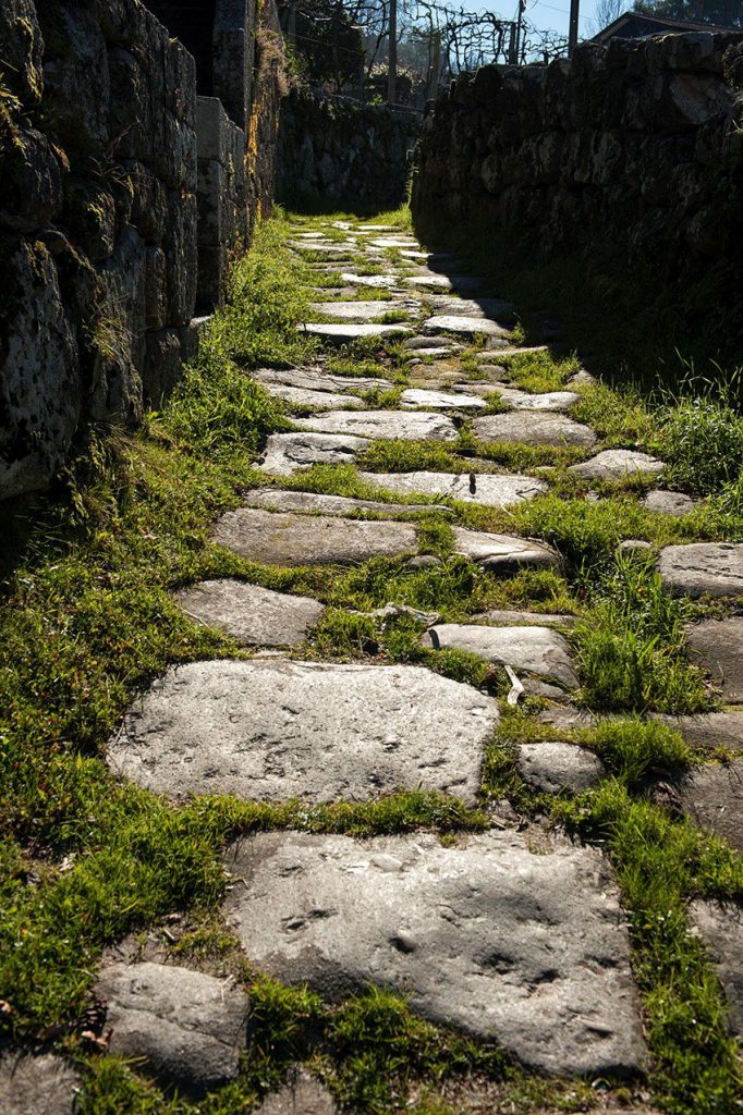
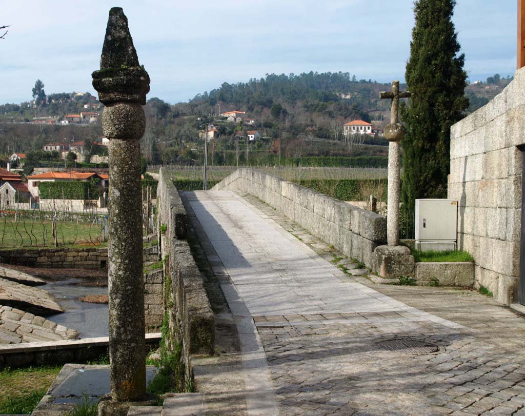
A stone bridge across the river Ovelha, supported by four unequal-sized circular arches on which a deck is slightly raised above the upper arch.
The pillars are protected upstream by steep cut-waters and downstream by buttresses. A transept at the Bridge’s entry, on the left side, may record the year (1630) of the Bridge’s construction or reconstruction, succeeding the medieval span that provided transportation between Amarante and Vila Real.
This was the entrance to the historic area of Ovelha do Maro, which was formerly one of the few in Portugal and where the people elected their feudal ruler.
Near the Bridge, the pillory symbolizes this autonomy, first of the “beetria” and then of the “honra” and municipality, which became the property of Portugal’s monarchs in the 16th century.
The French forces under General Soult marched through here on their way to capture Amarante on May 3rd 1809.
As one of two points of passage between Amarante and Trás-os-Montes, the Bridge of Fundo de Rua (or Aboadela) was also mentioned in the writings of Camilo Castelo Branco, who visited the location numerous times.
258 – The patronage of the Church of Saint Mary of Aboadela was the property of the Monastery of Pombeiro;
14th century – Ovelha do Marão (a term which included the parishes of Aboadela and Canadelo) was a medieval benefactor;
1550 – On the death of D. Jorge de Lencastre, the medieval benefactor becomes the property of the Crown, by order of King D. João III;
1630 – Construction date of the cruise at the east entrance of the Bridge;
17th century – Construction period of the Bridge of Fundo de Rua;
18th century – The term of Ovelha do Marão is transferred to the jurisdiction of the master grantees and barons of Mateus;
2000 – Restoration works in its pavement, with the replacement of the slabs and of some stones from the ledges, cleaning and removal of the vegetation which had accumulated over time;
2010 – Integration of the Bridge of Fundo de Rua in the Route of the Romanesque.
How to get there: GPS 41.277322, -7.995505
Rua de Ovelha e Honra do Marão, Aboadela, Amarante, Porto
We use cookies on our website to give you the most relevant experience by remembering your preferences and repeat visits. By clicking “Accept All”, you consent to the use of ALL the cookies. However, you may visit "Cookie Settings" to provide a controlled consent.
This website uses cookies to improve your experience while you navigate through the website. Out of these, the cookies that are categorized as necessary are stored on your browser as they are essential for the working of basic functionalities of the website. We also use third-party cookies that help us analyze and understand how you use this website. These cookies will be stored in your browser only with your consent. You also have the option to opt-out of these cookies. But opting out of some of these cookies may affect your browsing experience.
Necessary cookies are absolutely essential for the website to function properly. These cookies ensure basic functionalities and security features of the website, anonymously.
Cookie
Duration
Description
cookielawinfo-checkbox-analytics
11 months
This cookie is set by GDPR Cookie Consent plugin. The cookie is used to store the user consent for the cookies in the category "Analytics".
cookielawinfo-checkbox-functional
11 months
The cookie is set by GDPR cookie consent to record the user consent for the cookies in the category "Functional".
cookielawinfo-checkbox-necessary
11 months
This cookie is set by GDPR Cookie Consent plugin. The cookies is used to store the user consent for the cookies in the category "Necessary".
cookielawinfo-checkbox-others
11 months
This cookie is set by GDPR Cookie Consent plugin. The cookie is used to store the user consent for the cookies in the category "Other.
cookielawinfo-checkbox-performance
11 months
This cookie is set by GDPR Cookie Consent plugin. The cookie is used to store the user consent for the cookies in the category "Performance".
viewed_cookie_policy
11 months
The cookie is set by the GDPR Cookie Consent plugin and is used to store whether or not user has consented to the use of cookies. It does not store any personal data.
Functional cookies help to perform certain functionalities like sharing the content of the website on social media platforms, collect feedbacks, and other third-party features.
Performance cookies are used to understand and analyze the key performance indexes of the website which helps in delivering a better user experience for the visitors.
Analytical cookies are used to understand how visitors interact with the website. These cookies help provide information on metrics the number of visitors, bounce rate, traffic source, etc.
Advertisement cookies are used to provide visitors with relevant ads and marketing campaigns. These cookies track visitors across websites and collect information to provide customized ads.