Martinho da Arcada brought life and the smell of coffee to Praca do Comércio 238 years ago.
It was an original for the time in a city dominated by bars and had numerous titles before settling on the appellation “Martinho da Arcada” in 1845. It is a restaurant and café that has been a refuge for rulers, politicians, soldiers, artists, and writers for more than two hundred years. The most famous regular client, though, was Fernando Pessoa, who composed some poetry here.
Downtown address: Praça do Comércio 3
@flickr.com/photos/iseecat
National Confectionery (1829)
Confeitaria Nacional has been in operation since 1829 and is still owned by the same family who created it. If it was founded in the style of Parisian patisseries at first, it quickly began to produce highly traditional delicacies—the bolo-rei is without a doubt one of the house’s ex-libris, and it is stated that it was in this business that such a cake began to be marketed in Portugal, in 1870.
Address: 18B Praça da Figueira (downtown)
@lojascomhistoria.pt
Benard Pâtisserie (1868)
Élie Benard started a pastry business on Rua do Loureto in 1868, and this was the beginning of the iconic Pastelaria Benard, which eventually relocated on Rua Garrett in Chiado in 1902. It should be remembered that the phrase “pastry shop” was first used in 1926, when the Chamber of Commerce began taxing signage in foreign languages. The Pastelaria was reopened in the 1940s, and it held noteworthy occasions such as a supper for Queen Elizabeth II during her visit to Portugal in 1957. The croissants remain the house’s main attraction.
Rua Garrett 104 is the address (Chiado)
@flickr.com/photos/art-ko
The Brazilian (1905)
Following the establishment of the first Brasileira in Porto in 1903, the capital gained a comparable facility in 1905. Although there was another in Rossio, it is the one in Chiado that remains today, with Pessoa greeting us on the terrace since 1988. It is without a doubt one of the most iconic locations in Chiado, serving as a venue for intellectual and artistic events during the turn of the twentieth century in Lisbon.
Rua Garrett 122 is the address (Chiado)
Photo: @lojascomhistoria.pt
Versailles Pastry (1922)
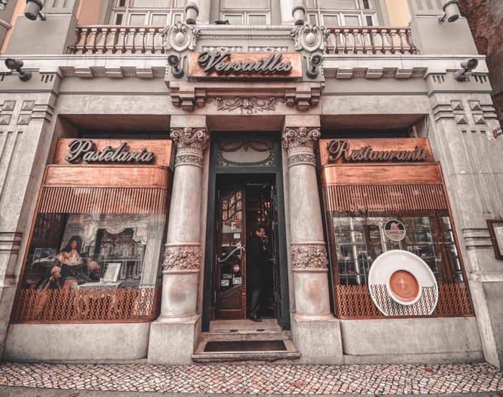
Versailles, which opened in 1922, functioned as the cultural and social core of Avenidas Novas; it was the neighborhood’s first significant café. Fortunately, it has remained loyal to itself, and tourists are still few in this area. The croquettes are our favourite among the pastries.
Address: 15A Avenida da Repblica (Avenidas Novas)
@lojascomhistoria.pt
Café Nicola (1929)
In 1929, what began as Botequim do Nicola (named after the Italian who created it in the 18th century) became Café Nicola. The area was ultimately supplemented with the features that are now its characteristic in 1935, with a focus on Bocage’s paintings and the deco style. It was one of the poet’s favourite spots, and his presence may still be felt in a statue in the dining room. It will be remembered as a gathering place for intellectuals and social activists.
Address: 24/25 Praça Dom Pedro IV (Rossio)
And while we’re on the subject of coffee, it’s always worth noting Cafés Negrita, which was created in 1924 and is presently the oldest roasting factory in Lisbon.
The Lágrimas Estate is a beautiful property with 20 hectares of fertile land on the left side of the Mondego River. The natural geology of the slope is primarily limestone, making this location a rare and abundant supply of fresh water that rises at the hill’s lower level and runs through three separate channels.
The hill provides shelter from the wind, and the area’s rich soil and plentiful water make it an ideal environment for a wide variety of plant life, including subtropical species like ficus macrophylla, podocarpus, and cinamomun camphora, as well as more temperate species like sequoia sempervirens, cedrus libani, cedrus atlantica, cupressus lusitanica, araucaria bidwilli, camelli An extensive laurel grove has developed, and the bottom layers of plants have spread out unchecked to form a thick maquis typical of the Mediterranean.
A higher ground was used in construction of the home so that it would be safe from flooding. According to the ancient maps, water was considered a “frequent companion” in this community, and the fertile deposits left by the river were appreciated on the islands located on the higher ground near the structures.
Wheat, grapes, and olives, the three classic crops of the Mediterranean, were gathered here; subsequently, orange groves provided plenty of fruit.
The water that emerges from the ground and the rocks at the base of the hill or floods the land every year has always been the most significant aspect of this environment. The area was encircled by the Mondego River, and the resulting lake was peaceful and reflective. At that time, it seemed like a waterscape, with the house situated on an island and the trees reflected in the lake. Because of these inherent characteristics, this location stands out from the others.
When did the Gardens of Lágrimas Estate first come into being, and what events led up to its current state?
Over the ages, the Gardens of Lágrimas Estate have served as the site of countless celebrations and social gatherings. In 1326, Queen Saint Isabel had a new canal built to provide water from springs on the land to her adjacent convent, Saint Claire.
The other spring on the property, which was given the name “Fountain of Tears” (Fonte das Lágrimas) by the poet Camões, is said to have been formed by Inês’s tears while she was being killed. After 650 years, Inês’ blood is still visible in the canal’s stones. … “Camões writes in “The Lusíadas,” “Tears are the water, and the name is love.” “
Paths and fences were marked out in the woods and a wall was constructed around the land around the year 1650. Water from the Fonte das Lágrimas fountain is collected in a big pool. Water was channelled from the pool to the olive mill’s grinding wheel, resulting in plentiful, high-quality olive oil.
The current proprietors of Lágrimas Estate may trace their lineage back to António Maria Osório Cabral de Castro, the Duke of Wellington’s aide-de-camp and the owner of the Quinta where the duke stayed in 1813. The ceremony was marked by the planting of two Wellingtonian trees (Sequoia gigantea) and a stone bearing an inscription of the well-known lyric from “The Lusíadas” about Pedro and Inês’s love tale. Around 1850, António’s son Miguel had a picturesque garden designed and developed, complete with winding lakes and exotic and uncommon plants that, even now, survive in the Quinta’s environment. D. Duarte de Alarcão Velasquez Sarmento Osório, his nephew and the present owners’ great-grandfather, added an archway and a neo-gothic window to the mine that Queen Saint Isabel had constructed. Both the entrance and window provide access to the hidden forest realm beyond. Several monarchs, including the Brazilian Emperor and the Portuguese King Miguel, paid visits to their respective countries throughout the nineteenth century.
In 1995, the Hotel Quinta das Lágrimas opened its doors to guests. In 2004, the hotel commissioned architect and Académie des Beaux-Arts in Paris Prize Winner Gonçalo Byrne to create a new wing that would house guest rooms, conference spaces, and a spa. Donated to the Inês de Castro Foundation in 2006, the gardens’ makeover was spearheaded by landscape architect Cristina Castel-Branco. The Medieval garden’s layout was revamped, and its wooden walls and canals of Love and Tears were repaired. The Colina de Cames amphitheatre was erected, and a flora curtain, sequoia forest, and Japanese garden were planted inside the hotel grounds (it won the Portuguese Landscape Architecture Award in 2008). There has been no tampering or alteration to any of these landmarks; the Fonte dos Amores and the Colina de Cames are both located in their original positions.
Chronology
1326 fountains and canals 1601 large pool to store water and canals to feed the mill for olive oil production 1858 creation of the Romantic Garden 1995 transformation of the palace into a hotel 2004 restoration of the garden
Type of Historical Garden: Romantic 19th century garden including a medieval fountain
Address:Hotel Quinta das Lágrimas
Rua António Augusto Gonçalves
Santa Clara – Apartado 5053
3041 – 901 Coimbra, Portugal
The cultural landscape of Sintra lies in central Portugal, at the westernmost tip of the Iberian Peninsula, a few kilometers from the Atlantic Ocean. This cultural landscape is an amazing mix of natural and cultural sites in an unmistakable setting. From a distance, it essentially gives the impression of a natural landscape, contrasting with its surroundings. It’s a small chain of forested granite mountains towering over rolling countryside. Seen up close, the Serra reveals a surprisingly rich cultural history that spans centuries of Portuguese history.
This cultural landscape is an exceptional and unique complex of parks, gardens, palaces, country houses, monasteries and palaces that create architecture in harmony with exotic and lush vegetation, creating an exotic and lush beauty. creating a microscopic landscape. This fusion of exotic styles transforms the landscape into a lush world, taking visitors from one discovery to the next, offering surprises at every turn. Its uniqueness and vegetation abundance as well as its charming surroundings make it unique in the landscape.
This syncretism between nature and ancient monuments, villas, monasteries and chalets has influenced the development of landscape architecture throughout Europe. Monserrate Palace was designed by noted British architect James Knowles Jr. for Sir Francis Cook. Again, an example of mid-19th-century eclecticism adapted to the remains of an earlier building destroyed by the 1755 earthquake. It combines key elements of Gothic Revival and Indian architecture. Monserrate is known for its gardens, mostly the work of Thomas Gargill. A careful analysis of the country’s microclimate allowed us to plant more than 3000 of his exotic species, collected from all over the world. Monserrate Park covers his 50 hectares on the northern slopes of the Serra. William Beckford’s late 18th-century remodelling of the existing palace included the creation of landscaped gardens.
The historical background of the gardens Four kilometres from the historic centre of Sintra and a testament to the eclectic taste of the 19th century, Monserrate’s peerless palace and park is home to an array of exotic plants in the interiors of its buildings. The motif spreads harmoniously in the outdoor garden.
The Monserrate estate was rented to Gerard de Visme (1789), a wealthy English merchant, who built a neo-Gothic house on it. William Beckford then unleashed the Monserrate from 1793 to 1794, but when Lord Byron visited the estate in 1809, the house was already in ruins. The stately appearance of the mansion was a source of inspiration for the poet. The poet sang about the beauty of Monserrate in his poem “Childe Harold’s Pilgrimage”, after which foreign travellers were obliged to visit the mansion.
One of his most famous visitors was Francis Cook. He was one of the very wealthy English industrialists, later made Viscount Montserrate by King Louis, who was granted the estate in 1856.
Over the years, the surrounding gardens have attracted plant species from all over the world. Arranged by geographic area (perhaps most notably Mexico), the gardens showcase the diverse origins of plants that compose different landscape effects along paths through ruins, hidden nooks and crannies, and past lakes and waterfalls. It reflects. Monserrate Park grew to be what it is today thanks to the intervention of painter William His Stockdale and master gardener Francis Bart, but above all, thanks to the romantic spirit of Francis Cook. As you stroll the winding paths of the various gardens and interact with the native species of the region (strawberry trees, holly bushes, majestic cork oaks, etc.), Arocaria, palm trees, and tree ferns suddenly emerge. You can find amazingly contrasting landscapes that look ancient. From agave and yucca that reproduce in parts of Australia, New Zealand, and Mexico. As you stroll through the botanical gardens of five continents, you’ll also see camellias, azaleas, rhododendrons, and bamboo, which will bring back memories of Japanese gardens. In 1949, the estate and palace were purchased by the Portuguese government.
The park and palace of Monserrate were classified as properties of public interest in 1993, included in the Cultural Landscape of Sintra, and declared a World Heritage Site by UNESCO in 1995.
Sintra embarked on an extensive restoration and restoration programme, which made it possible to open the palace to the public while restoring the park’s historic gardens to their former glory. In 2013, Monserrate Park won the European Garden Award in the category “Best Development of a Historic Park or Garden.”
Portugal
UNESCO World Heritage Designation : Yes, 1995 / 723
Type of Historical Garden: Botanic Garden | Romantic Park | English Landscape Garden
Address:Parque de Monserrate, 2710-405 Sintra, Portugal
Region: Lisbon Metropolitan Area
Municipality : Sintra
Town : Sintra
Place : Park of Monserrate / Parque de Monserrate
Google Maps Coordinates:8°47’30.9″N 9°25’09.1″W
38.794134 -9.420613
Access from the provincial capital :By car
If driving to Sintra, take the IC19 (from Lisbon), IC30 (from Mafra) or EN9 (turning off the A5 motorway to Cascais).
When you arrive in the town’s historic centre, you’ll see a vertical sign showing the way to Monserrate (3.5 km).
Public transportation
Lisbon > Sintra
By train (CP) – Take the Sintra Line
Departure stations:
– Estação do Oriente
– Estação do Rossio
– Estação de Entrecampos
Sintra (historic centre) > Park and Palace of Monserrate
– By bus (Scotturb)
– From Sintra Train Station
From Sintra, take Scotturb bus No. 435, which runs from the railway station to the Palace and Park of Monserrate.
Access from the nearest place to the site :Sintra (historic Sintra) – Take N375 (by car or public transportation)
Discover this amazing route in Condeixa-a-Nova. The Buracas do Casmilo are located in the Serra do Sicó, close to Condeixa-a-Nova, and offer a beautiful pathway worth exploring. It has a unique and varied natural history that gives people who like to climb, mountaineer, or go hiking a rush of excitement and adrenaline. The area is also important from a geological point of view, which brings in a lot of students and people who are interested in nature. Learn more about this one-of-a-kind and utterly delightful location.
Located in the town of Condeixa a Nova in the middle of the Chico Mountains, the Bracas de Casmilo Valley is an Instagram-worthy place. Well, we know that this is the largest concentration of halls in Portugal. These pits are small, laterally grown caves with entrances up to 10 metres high. As far as is known, these limestone layers were formed when the climate was colder than it is today. Goats and sheep were kept in these areas.
How to get there To get to Vale das Buracas do Casmilo, keep in mind the following directions: Taking the village of Condeixa-a-Nova (in the district of Coimbra) as a reference point, take the IC2 heading south. Then, head towards the village of Arrifana (on the way out of Condeixa), and, finally, go up the hill towards the village of Casmilo.
The Minho region of northern Portugal is one of the oldest provinces in the country, with a rich historical heritage. Comprised of both the Baixo and Alto Minho provinces, the region was the source of many Portuguese settlers who colonised Brazil in the 18th century.
Minho is not as popular as some of the other tourist destinations in Portugal, but it offers a unique chance to discover authentic local customs and undiscovered gems. Waterfalls, mountain villages, and breathtaking vistas of the countryside can all be explored for an unforgettable experience.
If you’re looking for a truly off-the-beaten-track adventure, consider visiting the Minho region. Here are some recommendations for the hidden gems in this Portuguese province.
Protected Landscape of Corno do Bico
Much more than a classified area, this is a magical place in Minho that takes us to an enchanted forest scenario. The Protected Landscape of Corno do Bicowas created in 1999.
It has about 2,200 hectares, which are spread over five parishes: Bico, Castanheira, Cristelo, Parada, and Vascões, in the municipality of Paredes de Coura, part of the Iberian Massif.
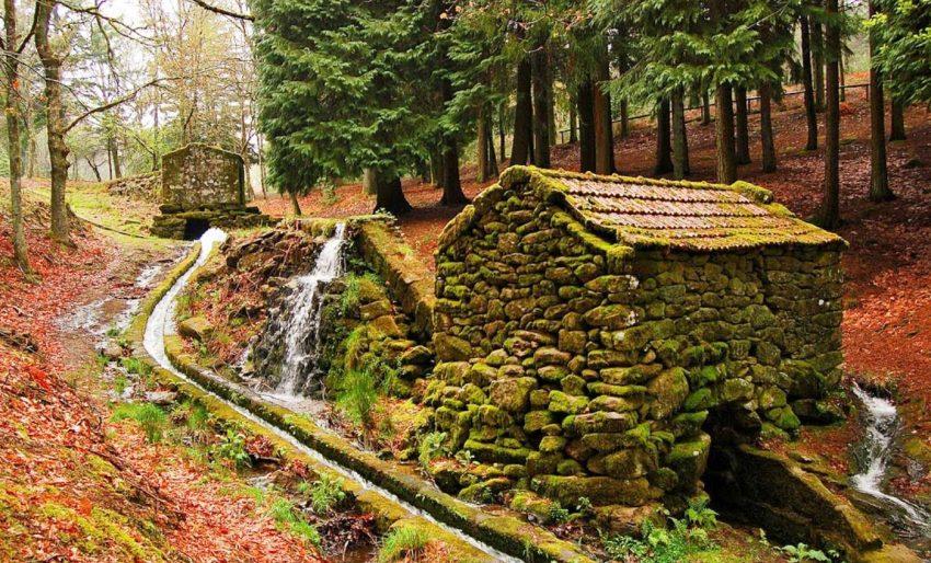
The Corno do Bico forest is made up of an extensive forest of chestnut trees, oaks, beech trees, and cypress trees, all planted in the 1940s but magically forgotten for 80 years.
Here, various elements intersect that seem to have come out of a fairy tale, such as lichens, different species of mushrooms (more than 200 species), leafy trees, and games of light and shadow.
Therefore, it is not surprising that the forest is home to several animals, such as the Iberian wolf, the Lusitanian salamander, the water mole, and the Seoane viper. In total, more than 188 species of vertebrates and 439 species of plants have been identified.
If you’re curious, start planning your visit to this enchanting place with a magical aura and an authentic charm for the senses thanks to the exuberant colors, the intensity of the smells of nature, and the depth of silence that one feels around here. You will see that it is one of those places that will stay in your memory for a long time.
Lagoas of Bertiandos
The protected zone includes an area of 346 hectares (3.46 km2) situated in the municipality of Ponte de Lima, accessible directly by the Estrada Nacional E.N.202 and the Auto-Estrada A27. Bertiandos and São Pedro de Arcos are important spaces for the conservation of nature and biodiversity, resulting in the presence of a diverse biotope associated with a humid continental zone that includes habitats and priority species conservation.
Its wetlands are divided between the Bertiandos, São Pedro de Arcos, Estorãos, Moreira do Lima, Sá, and Fontão parishes of Ponte de Lima, northern Portugal.
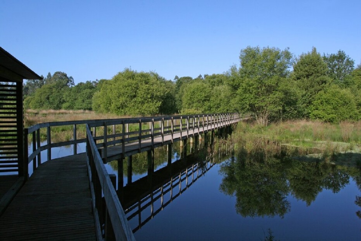
A “small route” for pedestrians is the Lagoa Trail. The corresponding markings and signs adhere to universal standards. You can enjoy the distinctive scenery of the lagoon of S. Pedro d’Arcos and understand its natural values thanks to the route’s location in the Bertiandos and S. Pedro d’Arcos Lagoon Protected Area.
These lagoons are a protected landscape as they contain diverse habitats, ranging from wetlands, non-wetlands, pastures, forests, and agricultural areas. The Bertiandos lagoons are served by natural canals and crossed by the river Estorãos.
King’s Mills
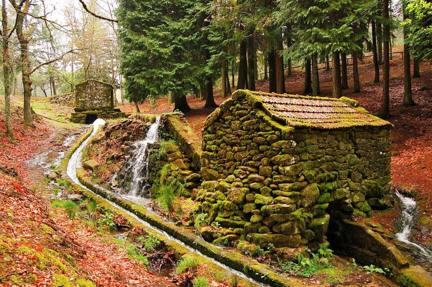
They are known as Moinhos de Rei because they were erected by D. Dinis, one of the Portuguese kings who promoted agriculture and related activities the most. They are at Cabeceiras de Basto, in the Serra da Cabreira, and are now part of a beautiful park where you can spend valuable time with your family.
The municipality erected two interpretive centres here to enhance the area: one dedicated to the bread cycle and another to the municipality’s diverse wildlife life. This is a must-see, especially if you have children.
Pontes
Pontes is a tiny cluster of seasonal houses known as an “inverneira,” or “winter place,” that used to be occupied during the colder months, from Christmas to Easter. It is situated in the valley at an elevation of 700 to 750 metres above sea level. It is one of a collection of inverneiras that, along with the brandas and permanent houses in the region, comprise Castro Laboreiro’s settlement structure. It consists of 12 inverneiras on the right side of the Laboreiro River. In the parish of Castro Laboreiro, there are 19 inverneiras, 18 brandas, and 9 permanent communities.
Families in Pontes would uproot themselves, along with their animals and goods, and relocate to the brandas (summer settlements) of Campelo and Formarigo, where they would meet up with neighbours from neighbouring inverneiras. They intended to go back to Pontes before Christmas.
Estorãos
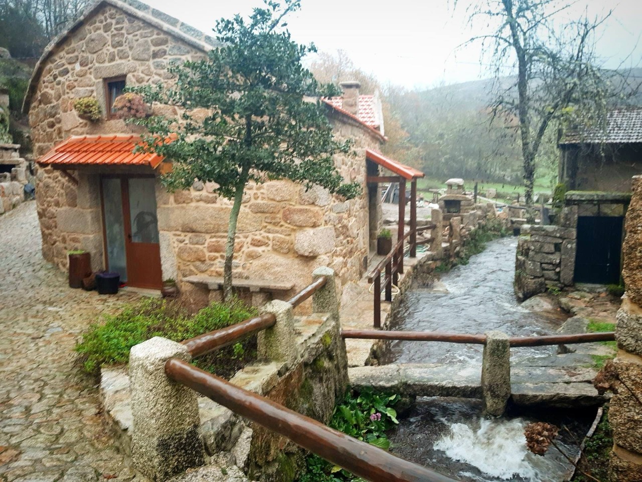
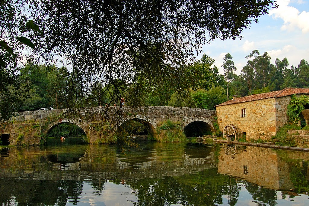
The parish of Estorãos is one of the most beautiful, not only in the municipality of Ponte de Lima but also in the entire Minho region, given the magnificent landscapes that can be enjoyed in its lands and its enchanting water courses, where the river Estorãos assumes, in this particular case, the main role. The river also provides an excellent river beach. Indeed, because this beautiful parish extends from the foothills of Serra de Arga to its highest points, it enjoys this privilege of nature. Despite these important aspects, there are other attractions for which man assumes responsibility for their unquestionable quality. We refer to its architectural heritage as follows: the Roman Bridge, the Parish Church, crosses, the Roman Bridge of Arquinho, the Chapel of S. João, Ruins of Bouça do Monte de Crasto and Crasto in ruins on Monte Castelo, Gramela mills, and the watermill. Its Romanesque bridge has its own characteristics that indicate that it dates from the 13th century.
Approximately six kilometres from Ponte de Lima, where the river that gives the village its name runs, is Estorãos, a tiny Minho village. The waters that flow from the Arga mountain’s summit meander through pine forests, vineyards, and fields, forming little lakes and dams where trout and lampreys hide from tourists and anglers. The scenery is breathtaking. The mountains’ bluish and sombre shape contrasts with the green of the fields and the autumnal hues of the vines and cornfields, producing a genuine garden that begs for many strolls and rural explorations.
Branda da Aveleira
Located on the entrance to the Peneda Gerês National Park, Portugal, Branda do Aveleira is a testament to human resilience. This humble cluster of cottages, which was used for generations as a temporary settlement, was in danger of being lost in the last century. Fortunately, it has been restored and is now open for visitors.
Branda da Aveleira today has a selection of homes for rural tourism. The restoration was done carefully to retain the original architecture and character of the village. Everything has been renovated to keep the essence of the village alive and provide the necessary comforts and amenities.
.
Poças do Malho
Poças do Malho are four deep pools with four beautiful waterfalls on the Castro Laboreiro River, located between Mistura das Guas (the junction of the Peneda and Laboreiro rivers) and Ribeiro de Baixo, and they form the boundary between Portugal and Spain. The best way to get to the Poças do Malho is to take a route that starts on the Spanish side, at the point where the road connecting Olelas and Mistura das Águas ends. The route follows the right side of the Laboreiro River and goes through Peneda Gerês National Park in Portugal.
Before making any vacation plans, please check the constantly changing local limitations and safety rules. It should be noted that not all sites and services are operating as usual, so check their respective websites for the most recent details.
Palácio do Grilo, classified as a monument of public interest (MIP) since 2011, and also known as Palácio dos Duque de Lafões , is located at the corner of Rua do Grilo and Calçada dos Duques de Lafões, rising in the parish of Beato (Lisbon) in the heart of Lisbon.
The structure is a Neoclassical-style architectural complex from the 18th century, with Baroque inspirations and motifs. The building’s construction is inextricably linked to some historical contingencies that witnessed the Palace’s extensive construction process.
Palácio do Grilo was built on top of an old palace building in Quinta do Grilo that originally belonged to D. António de Mascarenhas. The exact date of the pre-existing palace structure is uncertain. This farm was a vast property that ascended the steep slope known as Calçada dos Duques de Lafes.
Following the massive earthquake that shook Lisbon on November 1, 1755, D. Pedro Henrique de Bragança is credited with refusing to light up his residence on the occasion of Infante D. Pedro III of Portugal’s wedding to the king’s eldest daughter, Maria I of Portugal, Princess of Brazil. This episode, in turn, stemmed from the fact that D. Pedro Henrique de Bragança was one of only two candidates for the princess’s hand and thus a contender for the Portuguese throne as consort king. It should be noted that this event occurred a few years after D. Pedro Henrique de Bragança was embroiled in a feud with his uncle, King D. Joo V of Portugal, over land.
It should be noted that this event occurred a few years after D. Pedro Henrique de Bragança had a falling out with his uncle, King D. Joo V of Portugal, over a love affair between D. Pedro Henrique de Bragança and Luísa Clara de Portugal.
Following the massive earthquake in Lisbon on November 1, 1755, the 1st Duke of Lafões directed the construction of the Palácio do Grilo. This opportunity was originally given to Pedro Henrique de Bragança, but due to his untimely death in 1761, it was delegated to the Duke’s younger brother, D. João Carlos de Bragança, 2nd Duke of Lafões.
From 1759 to 2018, it was owned by the Dukes of Lafões.
Labrousse’s team wanted the setting to stay true to its roots, so only a few new pieces of furniture and decorations were added. The rest was left alone. Inside the palace, sets of mural paintings by Cirilo Wolkmar Machado or tiles from the 18th and 19th centuries can be found in thematic rooms such as the Academy Room, the Venus Room, and the Chinese Room. A gilded, carved panel from the second half of the 18th century is housed in the rectangular-shaped chapel.
Palácio do Grilo is a palace-museum-restaurant-bar-theatre-whatever the visitor desires. The Palace’s atmosphere transports you to another dimension—to dreams, to a live movie, to fantasy—with over 200 rooms to explore.
This location in Lisbon has a three-century history. It was conceived in the 18th century by the 1st Duke of Lafões, Pedro Henrique de Bragança. And, under the direction of Julien Labrousse, it reopened in June 2022. A notebook written by the Duke, an illegitimate descendant of Pedro II, the king who was born in Brazil when the crown fled, was discovered by this French businessman. He had imagined “a place that is also not a place and that can allow the soul to take the flight that best suits it.”
Three centuries later, Julien (who had relocated from Paris to Lisbon) purchased the palace and adapted it in accordance with the Duke’s wishes, preparing it to receive visitors who might simply attend performances, stroll around the rooms, or enjoy the restaurant menu or drinks in the bar.
The goal is for “people to wander, discover, and live a little in the realm of fantasy and the extravagant, while actors and dancers perform” in the various rooms. As a result, some people jump, scream, lie down, and wander around the rooms. Everyone appears to be in a different dimension and at a different time.
The palace is open every day from 11 a.m. to midnight. Free entrance.
Palacio do Grilo
1 Calçada do Duque de Lafões
1950-207 Lisboa
(+351) 910 440 942 – contact@palaciogrilo.com
Portuguese dishes include meats (pork, beef, poultry mainly also game (hunting) and others), seafood (fish, crustaceans such as lobster, crab, shrimps, prawns, octopus, and molluscs such as scallops, clams and barnacles), vegetables and legumes (a variety of soups) and desserts (cakes being the most numerous). Portuguese often consume bread with their meals and there are numerous varieties of traditional fresh bread like broa which may also have regional and national variations within the countries under Lusophone or Galician influence. In a wider sense, Portuguese and Galician cuisine share many traditions and features.
Francesinha
Francesinha is a Portuguese sandwich originally from Porto, made with bread, wet-cured ham, linguiça, fresh sausage like chipolata, steak, or roast meat, and covered with melted cheese and a hot and thick spiced tomato and beer sauce. It is typically served with French fries.
Caldo Verde
Caldo Verde is a simple soup that contains shredded kale, onions, potatoes, garlic, and chouriço. It originates from the North of Portugal, but it’s served all over the country. It’s also listed as one of the 7 wonders of Portuguese gastronomy.
Arroz de Marisco
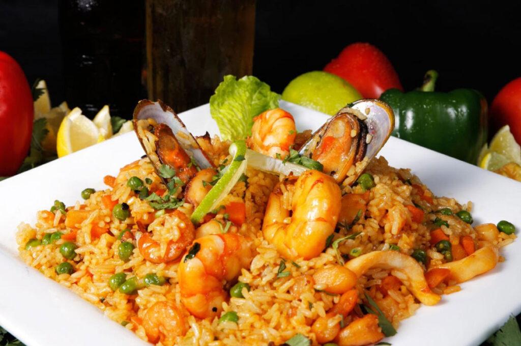
Arroz de Marisco is a rich seafood stew that’s made up of fish and rice. It’s a Portuguese favourite, and it’s also another of the 7 wonders of Portuguese gastronomy.
Bacalhau
Bacalhau is dried and salted cod. Rumour has it that there are more than 365 different ways to cook bacalhau, and some people say that’s even an under-estimation.
Most Portuguese menus will contain at least one bacalhau dish. Favorites to look out for include bacalhau com natas (bacalhau with cream and potatoes), bacalhau à lagareiro (bacalhau with lots of olive oil), and bacalhau com broa (bacalhau with a type of cornbread).
Most cafés will also have pastéis de bacalhau (or bolinhos de bacalhau, depending on what part of the country that you’re in), which is also a fantastic way to enjoy bacalhau.
Pastéis de Nata
It’s probably Portugal’s most famous food, and there’s a good reason for that. Pastéis de Nata (or Portuguese custard tarts as they’re known outside of Portugal) are just delicious. They originate from Lisbon, but you’ll find them in just about every café in Portugal.
The Bragança Castle, or Castelo de Bragança in Portuguese, is a well-preserved mediaeval castle located in the heart of Bragança, Portugal. It is in the Bragança neighbourhood.
The castle is in excellent condition. Its stormy history stretches from possession during the Moorish period through destruction and reconstruction during the Christian reconquest of the Iberian Peninsula. It serves as a memorial to Portugal’s past.
The castle of Bragança was classified as a national monument by decree on June 23, 1910. The General Directorate of National Buildings and Monuments began extensive restoration and reconstruction of the walls. Since 1936, a historic military museum has been housed on the premises of the keep.
Castle of Bragança, Book of Fortresses 1509-1510 Early history
Archaeological evidence suggests that early human settlers in the area built a fort of some sort. Later, during their occupation of the Iberian Peninsula, the Romans expanded and improved the stronghold. The fortification, however, was destroyed when the Muslims arrived. They reconstructed the castle.
A viewpoint of the ancient castle of Bragança
Paleolithic-era human settlement in this area can be determined by archaeological evidence. Neolithic settlements grew and became more productive as people focused on farming and taming animals. At the same time, a primitive religion began to form. These prehistoric societies left behind a wide variety of artifacts, including ceramics, forged-from-rock jewelry, weights, arrowheads, and farming tools. Many of these objects were found in grave mounds, like the tumulus of Donai (mostly destroyed). There are various indications of megalithic structures all across the area. Terra Fria is thought to have had bigger prehistoric villages, most likely in the second half of the Bronze Age (1000–700 BC). During this time period, the Castro culture of fortified urban constructions resulted in the construction of walled communities in elevated areas with panoramic views for defence. Subsistence farming was the main source of income for many communities.
Roman colonisation, which happened late in the Roman era, resulted in the development of private property and a migration away from the woodlands, as well as organisational changes brought about by administrative, material, and cultural evolution. In the Castros of Sacóias and Avelãs, remnants of the Luso-Roman castro societies are discernible. Modern archaeologists have unearthed funerary remains, money, and artefacts at these sites. The Castro of Avelãs (about three kilometres from Bragança) was an important centre on the military road to Astorga, despite the presence of several Roman remains (in Alfaião, Aveleda, Carrazedo, the Castro de Avels, Donai, França, Gostei, Meixedo, Pinela, Quintela Lampaças, etc.). The region was dominated by two distinct ethnic groups: the Zoelae, whose capital was Castro de Avelãs, and a Lusitanian civitas governed by the Baniense in the southern portion of the territory. A Latin map, Atlas de Gotha by Justus Perthes, noted three settlements in this region: Aquae Flaviae (Chaves), Veniatia (Vinhais), and Zoelae (its capital in Zoelas, today Castro de Avelãs), but made no mention of a place with a name similar to Bragança. During Roman colonisation, it was part of Gallaecia and administratively dependent on Astorga, which controlled the gold, iron, and silver trade and was located on the Atlantic axis of a Roman roadway from the Meseta. In the Vergancia-related acts of Council Lugo (569 AD), a village with a name similar to Bragança is mentioned. In 666 B.C., Visigoth King Wamba made a similar claim about Bregancia, which was said to be the birthplace of two Christian martyrs (John and Paul).
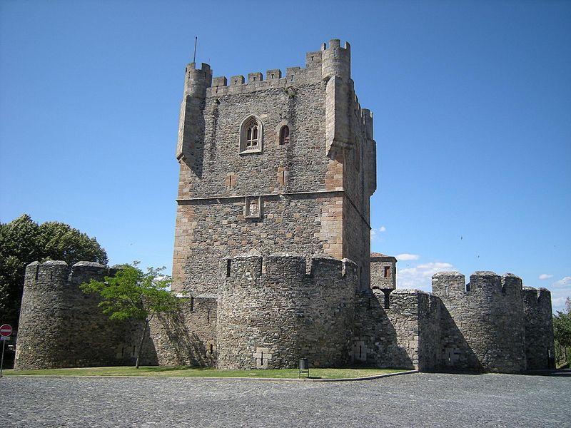
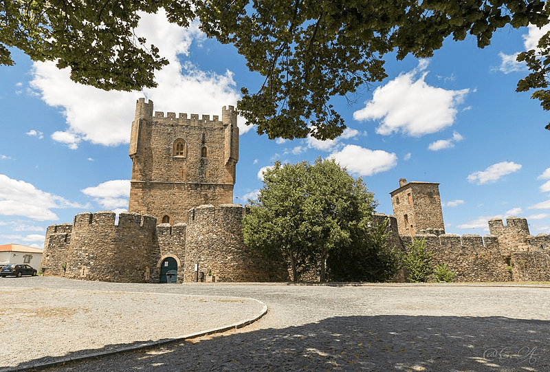
The castle stands at a height of 800 metres above sea level. The site floor plan indicates an ovoid plant with a battlement and a perimeter of 660 meters. The walls are reinforced by fifteen turrets. Walls two metres thick surround the historic core of the city, enclosing three hectares of land. The keep houses the Church of Santa Maria and the mediaeval pillory. The main San Antonion port is a round arch within two turrets and is defended by a barbican.
The walls are constructed using masonry shale rock that is abundant in the region. It can be found in the corners and every opening. Originally, a drawbridge was intended for the door, but it has decayed since and been replaced by a heavy door. On the southern side of the castle, there is a gun stone with the coat of arms of Avis House. The top is crowned by battlements with cruzetadas battlements, balconies with boulders, and four cylindrical watchtowers at the corners, dominating the eastern side and the south side, with two Maineladas Gothic windows. A fence, reinforced by seven turrets (three east, three west, and three south) of a circular plan, tops the exterior of the tower.
From its walls, one can see the mountains of Montesinho to the north, Sanabria to the west, and the Castle of Rebordões to the east.
Era of the middle ages Bragança Castle, 1509–1510, Book of Fortresses The fortress was referenced in a document dated July 7, 1128, claiming that it was brought under the administration of King Afonso I of Portugal (1112-1185). The settlement was moved to its current location for defensive reasons, close to the hill of Benquerença on the Fervença River’s bank, using recycled materials in the building of new residences and a castle for the populace’s defense. The town received its Foral charter from King Sancho I (1185–1211). The sovereign endowed the village with funds to construct a wall and castle in 1187. During this time, the conflict between Sancho I and León resulted in violence and saw Leonese forces take over the village. During the reign of King Denis (1279–1325), the village built a walled perimeter in 1293, indicating the village’s prosperity. His illegitimate brother’s assets were seized by his successor, King Afonso IV (1325–1357). In order to protect its interests, Afonso Sanches launched a rebellion, invading Braganza and causing extensive damage. The widow of King Denis restored peace. Conflicts between this sovereign and King Alfonso IX of León resulted in the region being invaded by forces from León (1199), prompting the Portuguese sovereign to respond.
from the twentieth century to the present
On June 23, 1910, the castle of Bragança was designated a national monument by decree. The walls were extensively restored and rebuilt by the General Directorate of National Buildings and Monuments. The keep’s grounds have served as the home of a historical military museum since 1936.
The castle stands at a height of 800 metres above sea level. The site floor plan indicates an ovoid plant with a battlement and a perimeter of 660 meters. The walls are reinforced by fifteen turrets. Walls two metres thick surround the historic core of the city, enclosing three hectares of land. The keep houses the Church of Santa Maria and the mediaeval pillory. The main San Antonion port is a round arch within two turrets and is defended by a barbican.
The walls are constructed using masonry shale rock that is abundant in the region. It can be found in the corners and every opening. Originally, a drawbridge was intended for the door, but it has decayed since and been replaced by a heavy door. On the southern side of the castle, there is a gun stone with the coat of arms of Avis House. The top is crowned by battlements with cruzetadas battlements, balconies with boulders, and four cylindrical watchtowers at the corners, dominating the eastern side and the south side, with two Maineladas Gothic windows. A fence, reinforced by seven turrets (three east, three west, and three south) of a circular plan, tops the exterior of the tower.
From its walls, one can see the mountains of Montesinho to the north, Sanabria to the west, and the Castle of Rebordões to the east.
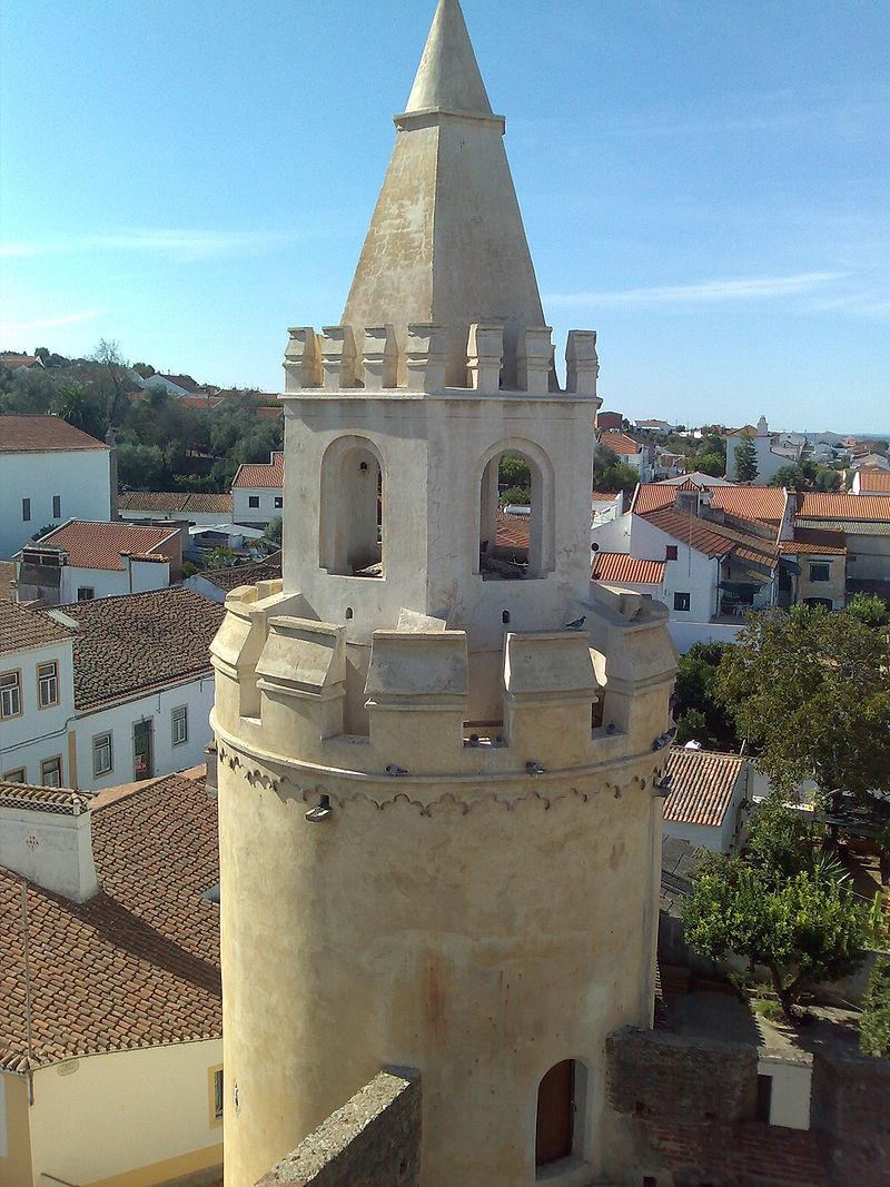
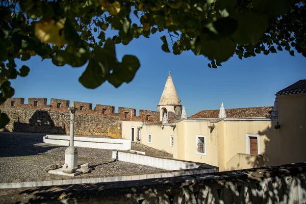
The Fortress of Viana do Alentejo (Portuguese: Castelo de Viana do Alentejo) is a gothic castle built during the reconquest and settlement of the central area of the Portuguese Alentejo. It is in the parish of Viana do Alentejo and the municipality of the same name. Compared to other buildings of the same time, like the Castle of Portel or the Castle of Feira, this one had a low profile. However, it did have a purpose during the conflict that happened because Portuguese forces and power were expanding into the southern Algarve.
Upon granting a foral (charter) to this village in 1313, King Denis ordered the construction of a 400-arm encirclement around the town, donating 100,000 pounds to public works. However, the stronghold in Viana do Alentejo “does not meet this regal goal,” and “the newest study points towards the idea that [his people] had not gotten around to building it.” Therefore, is it possible that the Castle of Viana do Alentejo dates to the late fifteenth or early sixteenth century?
In 1490, when the first mention of repairs to the walls, battlements, and pinnacles first appeared, the fortifications were referred to as being finished.
Architecture
The castle is located on the outskirts of Viana do Alentejo, on a little elevation on the northern flanks of the Serra de Viana. The parish church is situated along the south wall, and the Church of the Misericórdia is positioned along the northwest wall, with the historic cross of Viana do Alentejo located roughly in the centre.
The base is located in the south and points north. The shape of the building is an irregular pentagon with five walls and five cylinderal towers at each corner. The battlements defend the structure’s walls, which are composed of exposed brick with apertures and slots for ventilation. The two churches face their respective walls as a result of their placement.
Within these boundaries was built the Manueline-era parochial church (1521), credited to Diogo de Arruda, an important master craftsman in the Alentejo comarca at the time. Across from this structure is the Church of the Misericórdia, also credited to Arruda at the same period. It housed the municipal offices until the late 17th century.
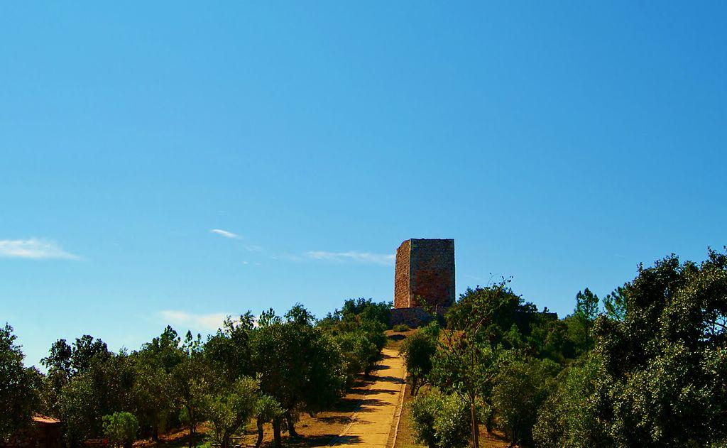
The Castle of Ródão (Portuguese: Castelo de Ródão) is a mediaeval castle in the civil parish of Vila Velha de Ródão, municipality of Vila Velha de Ródão, Castelo Branco, Portugal.
The Tapirs were the first agricultural and pastoral communities to settle on the moors surrounding the Tagus River in the Neolithic period (about 6,000 years ago), where they could practise agriculture and establish hundreds of towns and funeral structures. Along the river, people carved symbols of a very particular religion that together make up the Tagus rock art complex, which contains over 25,000 carvings.
These remains of ancient settlements are where the modern settlements of today originated, particularly in the parish of Fratel.
Alluvial gold extraction was a major focus of imperial Rome’s ambitions for riches and power, as seen by the massive conheiras that surround the Tagus and Ocreza rivers’ banks. These structures serve as a visual reminder of this activity. In the alluvial plains of Açafal and Lucriz, they assess the agricultural fields that sustain the slave armies used in gold and copper mining.
The fortress of Ródão and its mythical location are undeniable witnesses to the Muslim presence and Reconquista conflicts, with the river as a sign of the Christian frontier, carefully guarded by the Templars, proprietors and lords of a vast territory known as Herdade da Açafa donada to the Templars by King Sancho I in 1189.
The council’s settlement existed before nationalities were created and has no documented charter.
Its region served as a key strategic location in the demarcation of Christian borders with Muslims and in ensuring freedom of movement on the Tagus, necessitating the construction of its fortress, a watchtower enclosed in a walled enclosure and strategically placed atop Portas de Ródão.
Tradition says that the first building was made by the Visigoth king Vamba (who ruled from 672 to 680), but some modern authors think it may have been a watchtower from the time when the Muslims took over the Iberian Peninsula.
The mediaeval castle
The castle known as Castelo de Ródão, also known as Castelo do Rei Vamba, is situated in the Portuguese province of Beira Baixa, in the parish and municipality of Vila Velha de Ródão, in the district of Castelo Branco.
It consists of a watchtower built on a cliff overlooking the Tagus River and the so-called Portas de Ródão, a narrowing in the river’s flow.
Visitors can take in a breathtaking panoramic view of the Tagus valley from the top of its walls, which is a must-see location.
During the Christian Reconquest of the Iberian Peninsula and the war for independence from Portugal in the 12th century, this edifice was most likely restored by the Knights Templar. During the same period, a tiny chapel was constructed in honour of Our Lady.
The Curse of King Vamba
King Vamba was a Visigoth and built his castle near Portas de Ródão. A Moorish king lived on the other side of the Tagus River and fell in love with the Christian king’s wife. He built a tunnel beneath the Tagus to visit his beloved, but he made a calculation error, and the exit led to another location above the river, now known as Buraca da Moura.
The story takes on new twists and turns from here.Some say that the queen fled through the tunnel with the Moorish king and that King Vamba, disguised as a beggar, managed to discover her and ended up bringing her back.
Another version says that the Christian king found the way out of the tunnel and realised that his wife had returned the love of the Moorish king.
At the end of the story, forbidden love was punished by throwing the queen off one of the Portas de Ródão cliffs.
But before being projected to death, the queen dictated the curse:
Goodbye Rodão, goodbye Rodão, Surrounded by many myrtles, And land of many whores, Thou shalt not have honorable women, nor regaled horses, nor crowned priests.
It is said that where the body rolled, weeds never grew again.
All “true” facts… as well as the legend of Vamba being chosen as the Visigoth king After the death of his predecessor, Vamba was appointed, and he, seeking to legitimise the choice, exhorted God to confirm the succession, and the sign was the revitalization of the stick in his hand. He planted it in the middle of an olive grove, and it is still there. The rod blossomed, and he reigned between 672 and 680.
We use cookies on our website to give you the most relevant experience by remembering your preferences and repeat visits. By clicking “Accept All”, you consent to the use of ALL the cookies. However, you may visit "Cookie Settings" to provide a controlled consent.
This website uses cookies to improve your experience while you navigate through the website. Out of these, the cookies that are categorized as necessary are stored on your browser as they are essential for the working of basic functionalities of the website. We also use third-party cookies that help us analyze and understand how you use this website. These cookies will be stored in your browser only with your consent. You also have the option to opt-out of these cookies. But opting out of some of these cookies may affect your browsing experience.
Necessary cookies are absolutely essential for the website to function properly. These cookies ensure basic functionalities and security features of the website, anonymously.
Cookie
Duration
Description
cookielawinfo-checkbox-analytics
11 months
This cookie is set by GDPR Cookie Consent plugin. The cookie is used to store the user consent for the cookies in the category "Analytics".
cookielawinfo-checkbox-functional
11 months
The cookie is set by GDPR cookie consent to record the user consent for the cookies in the category "Functional".
cookielawinfo-checkbox-necessary
11 months
This cookie is set by GDPR Cookie Consent plugin. The cookies is used to store the user consent for the cookies in the category "Necessary".
cookielawinfo-checkbox-others
11 months
This cookie is set by GDPR Cookie Consent plugin. The cookie is used to store the user consent for the cookies in the category "Other.
cookielawinfo-checkbox-performance
11 months
This cookie is set by GDPR Cookie Consent plugin. The cookie is used to store the user consent for the cookies in the category "Performance".
viewed_cookie_policy
11 months
The cookie is set by the GDPR Cookie Consent plugin and is used to store whether or not user has consented to the use of cookies. It does not store any personal data.
Functional cookies help to perform certain functionalities like sharing the content of the website on social media platforms, collect feedbacks, and other third-party features.
Performance cookies are used to understand and analyze the key performance indexes of the website which helps in delivering a better user experience for the visitors.
Analytical cookies are used to understand how visitors interact with the website. These cookies help provide information on metrics the number of visitors, bounce rate, traffic source, etc.
Advertisement cookies are used to provide visitors with relevant ads and marketing campaigns. These cookies track visitors across websites and collect information to provide customized ads.




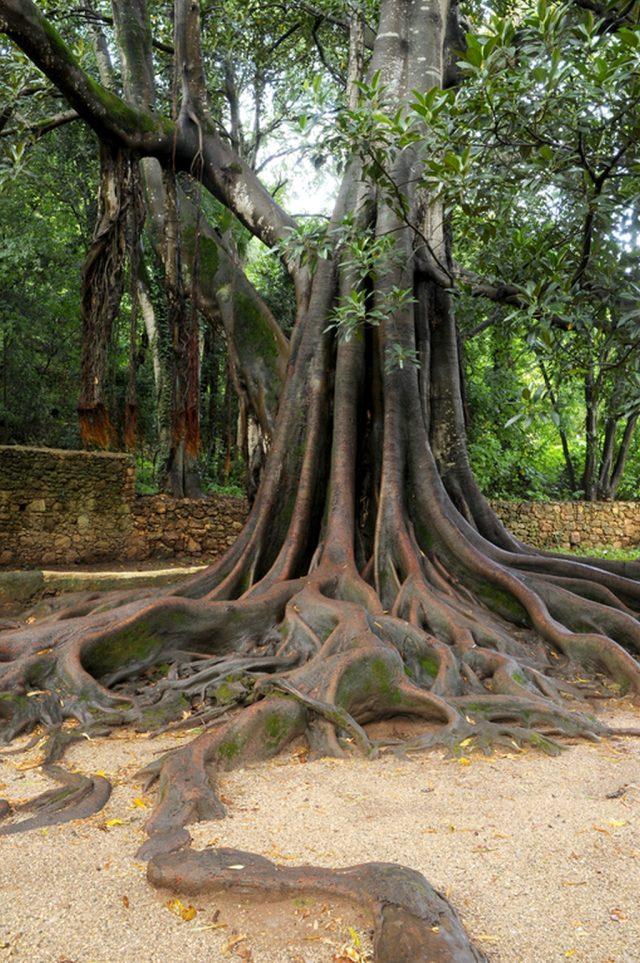

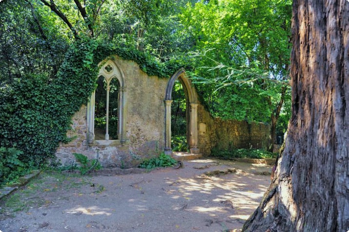
 The other spring on the property, which was given the name “Fountain of Tears” (Fonte das Lágrimas) by the poet Camões, is said to have been formed by Inês’s tears while she was being killed. After 650 years, Inês’ blood is still visible in the canal’s stones. … “Camões writes in “The Lusíadas,” “Tears are the water, and the name is love.” “
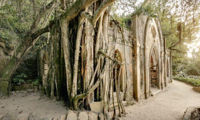
 Over the years, the surrounding gardens have attracted plant species from all over the world. Arranged by geographic area (perhaps most notably Mexico), the gardens showcase the diverse origins of plants that compose different landscape effects along paths through ruins, hidden nooks and crannies, and past lakes and waterfalls. It reflects. Monserrate Park grew to be what it is today thanks to the intervention of painter William His Stockdale and master gardener Francis Bart, but above all, thanks to the romantic spirit of Francis Cook. As you stroll the winding paths of the various gardens and interact with the native species of the region (strawberry trees, holly bushes, majestic cork oaks, etc.), Arocaria, palm trees, and tree ferns suddenly emerge. You can find amazingly contrasting landscapes that look ancient. From agave and yucca that reproduce in parts of Australia, New Zealand, and Mexico. As you stroll through the botanical gardens of five continents, you’ll also see camellias, azaleas, rhododendrons, and bamboo, which will bring back memories of Japanese gardens. In 1949, the estate and palace were purchased by the Portuguese government.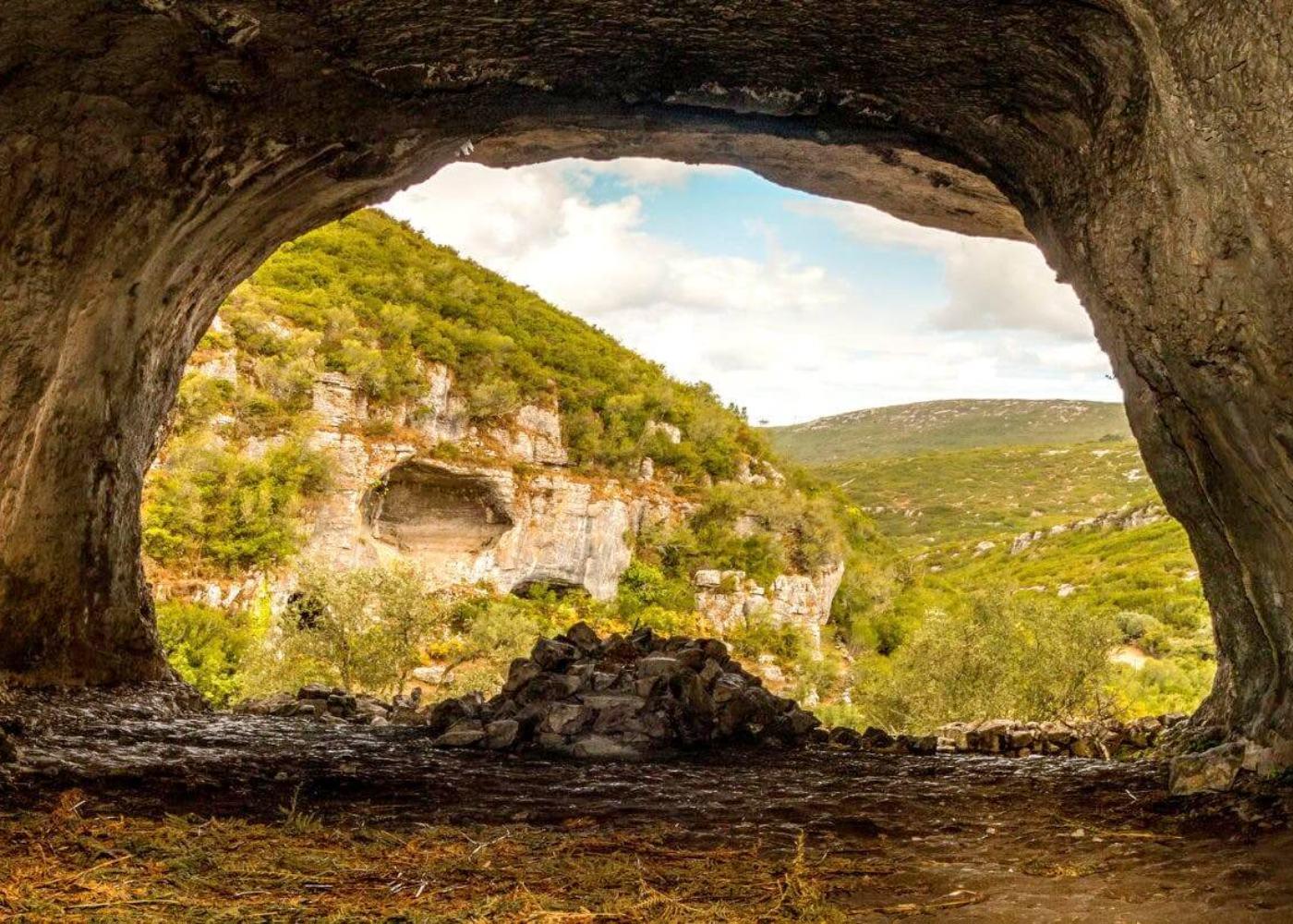










 Early history
Archaeological evidence suggests that early human settlers in the area built a fort of some sort. Later, during their occupation of the Iberian Peninsula, the Romans expanded and improved the stronghold. The fortification, however, was destroyed when the Muslims arrived. They reconstructed the castle.
A viewpoint of the ancient castle of Bragança
Paleolithic-era human settlement in this area can be determined by archaeological evidence. Neolithic settlements grew and became more productive as people focused on farming and taming animals. At the same time, a primitive religion began to form. These prehistoric societies left behind a wide variety of artifacts, including ceramics, forged-from-rock jewelry, weights, arrowheads, and farming tools. Many of these objects were found in grave mounds, like the tumulus of Donai (mostly destroyed). There are various indications of megalithic structures all across the area. Terra Fria is thought to have had bigger prehistoric villages, most likely in the second half of the Bronze Age (1000–700 BC). During this time period, the Castro culture of fortified urban constructions resulted in the construction of walled communities in elevated areas with panoramic views for defence. Subsistence farming was the main source of income for many communities.
Roman colonisation, which happened late in the Roman era, resulted in the development of private property and a migration away from the woodlands, as well as organisational changes brought about by administrative, material, and cultural evolution. In the Castros of Sacóias and Avelãs, remnants of the Luso-Roman castro societies are discernible. Modern archaeologists have unearthed funerary remains, money, and artefacts at these sites. The Castro of Avelãs (about three kilometres from Bragança) was an important centre on the military road to Astorga, despite the presence of several Roman remains (in Alfaião, Aveleda, Carrazedo, the Castro de Avels, Donai, França, Gostei, Meixedo, Pinela, Quintela Lampaças, etc.). The region was dominated by two distinct ethnic groups: the Zoelae, whose capital was Castro de Avelãs, and a Lusitanian civitas governed by the Baniense in the southern portion of the territory. A Latin map, Atlas de Gotha by Justus Perthes, noted three settlements in this region: Aquae Flaviae (Chaves), Veniatia (Vinhais), and Zoelae (its capital in Zoelas, today Castro de Avelãs), but made no mention of a place with a name similar to Bragança. During Roman colonisation, it was part of Gallaecia and administratively dependent on Astorga, which controlled the gold, iron, and silver trade and was located on the Atlantic axis of a Roman roadway from the Meseta. In the Vergancia-related acts of Council Lugo (569 AD), a village with a name similar to Bragança is mentioned. In 666 B.C., Visigoth King Wamba made a similar claim about Bregancia, which was said to be the birthplace of two Christian martyrs (John and Paul).
Early history
Archaeological evidence suggests that early human settlers in the area built a fort of some sort. Later, during their occupation of the Iberian Peninsula, the Romans expanded and improved the stronghold. The fortification, however, was destroyed when the Muslims arrived. They reconstructed the castle.
A viewpoint of the ancient castle of Bragança
Paleolithic-era human settlement in this area can be determined by archaeological evidence. Neolithic settlements grew and became more productive as people focused on farming and taming animals. At the same time, a primitive religion began to form. These prehistoric societies left behind a wide variety of artifacts, including ceramics, forged-from-rock jewelry, weights, arrowheads, and farming tools. Many of these objects were found in grave mounds, like the tumulus of Donai (mostly destroyed). There are various indications of megalithic structures all across the area. Terra Fria is thought to have had bigger prehistoric villages, most likely in the second half of the Bronze Age (1000–700 BC). During this time period, the Castro culture of fortified urban constructions resulted in the construction of walled communities in elevated areas with panoramic views for defence. Subsistence farming was the main source of income for many communities.
Roman colonisation, which happened late in the Roman era, resulted in the development of private property and a migration away from the woodlands, as well as organisational changes brought about by administrative, material, and cultural evolution. In the Castros of Sacóias and Avelãs, remnants of the Luso-Roman castro societies are discernible. Modern archaeologists have unearthed funerary remains, money, and artefacts at these sites. The Castro of Avelãs (about three kilometres from Bragança) was an important centre on the military road to Astorga, despite the presence of several Roman remains (in Alfaião, Aveleda, Carrazedo, the Castro de Avels, Donai, França, Gostei, Meixedo, Pinela, Quintela Lampaças, etc.). The region was dominated by two distinct ethnic groups: the Zoelae, whose capital was Castro de Avelãs, and a Lusitanian civitas governed by the Baniense in the southern portion of the territory. A Latin map, Atlas de Gotha by Justus Perthes, noted three settlements in this region: Aquae Flaviae (Chaves), Veniatia (Vinhais), and Zoelae (its capital in Zoelas, today Castro de Avelãs), but made no mention of a place with a name similar to Bragança. During Roman colonisation, it was part of Gallaecia and administratively dependent on Astorga, which controlled the gold, iron, and silver trade and was located on the Atlantic axis of a Roman roadway from the Meseta. In the Vergancia-related acts of Council Lugo (569 AD), a village with a name similar to Bragança is mentioned. In 666 B.C., Visigoth King Wamba made a similar claim about Bregancia, which was said to be the birthplace of two Christian martyrs (John and Paul).
 Era of the middle ages Bragança Castle, 1509–1510, Book of Fortresses The fortress was referenced in a document dated July 7, 1128, claiming that it was brought under the administration of King Afonso I of Portugal (1112-1185). The settlement was moved to its current location for defensive reasons, close to the hill of Benquerença on the Fervença River’s bank, using recycled materials in the building of new residences and a castle for the populace’s defense. The town received its Foral charter from King Sancho I (1185–1211). The sovereign endowed the village with funds to construct a wall and castle in 1187. During this time, the conflict between Sancho I and León resulted in violence and saw Leonese forces take over the village. During the reign of King Denis (1279–1325), the village built a walled perimeter in 1293, indicating the village’s prosperity. His illegitimate brother’s assets were seized by his successor, King Afonso IV (1325–1357). In order to protect its interests, Afonso Sanches launched a rebellion, invading Braganza and causing extensive damage. The widow of King Denis restored peace. Conflicts between this sovereign and King Alfonso IX of León resulted in the region being invaded by forces from León (1199), prompting the Portuguese sovereign to respond.