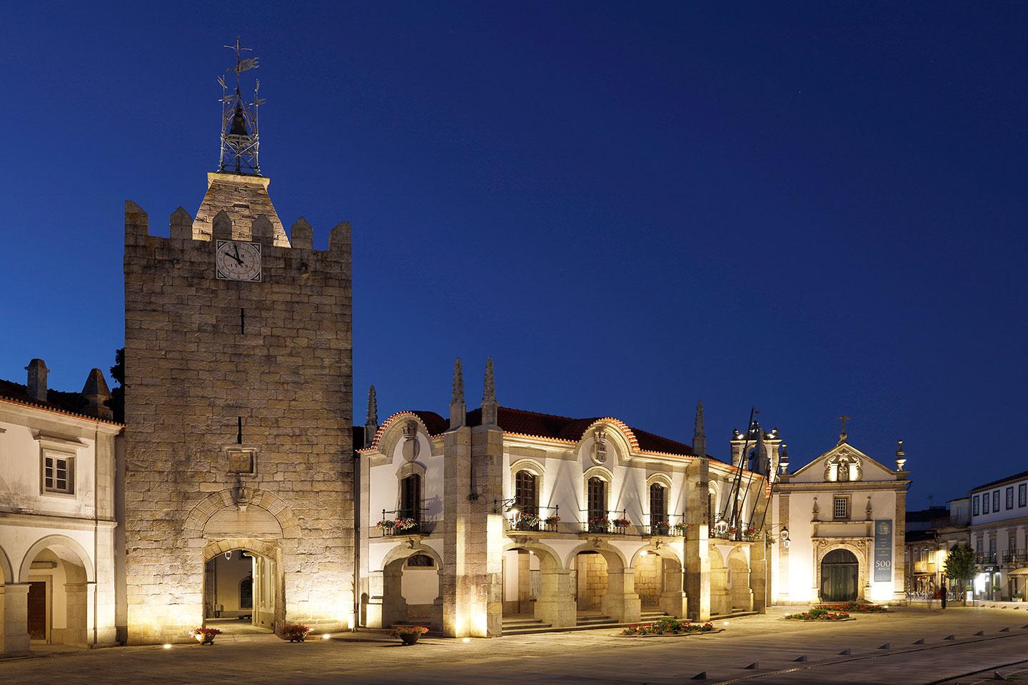
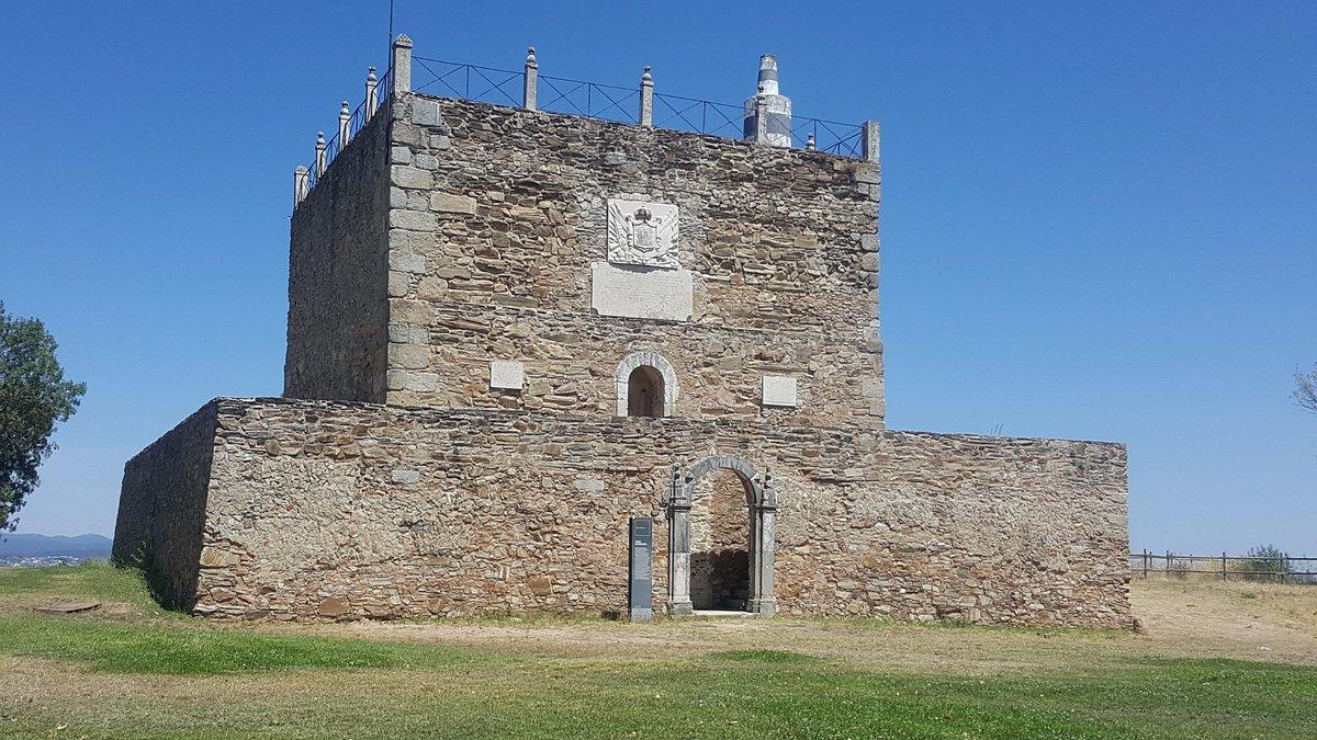
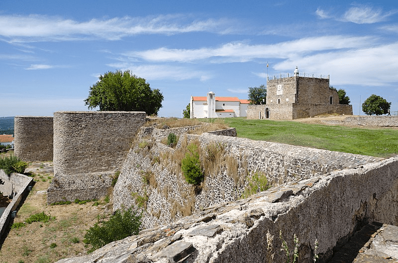
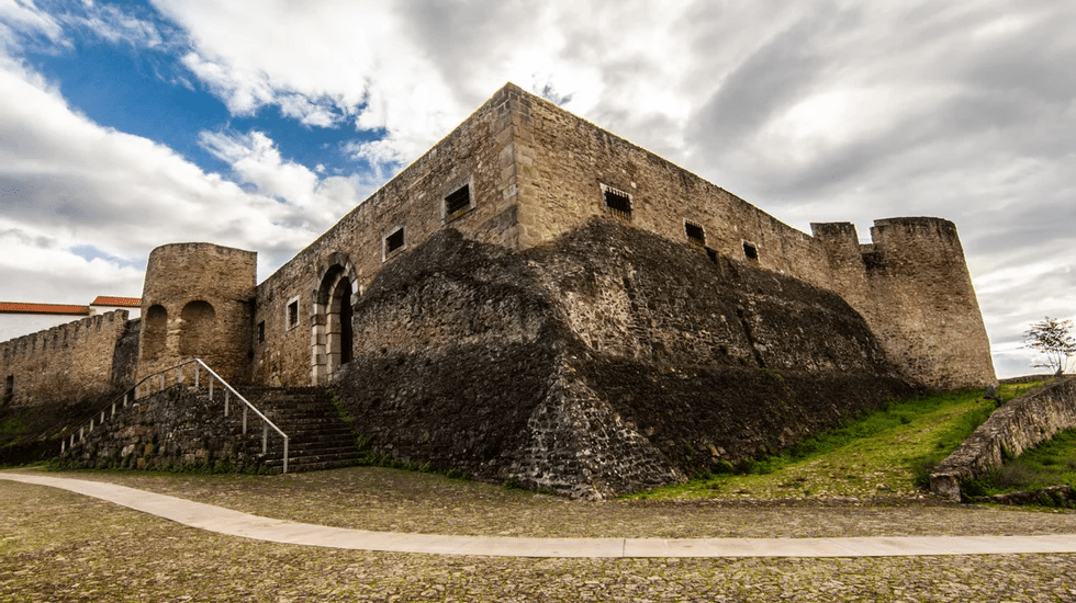
The Fortress of Caminha (Portuguese: Castelo de Caminha) is a medieval castle in the Portuguese district of Viana do Castelo, in the village and county of Caminha, in Northern Portugal.
Caminha, an old port on a sandy point between the Coura and Minho rivers, grew based on fishing and trade (river and sea) in the 12th century, when piracy on the coast was minimised, gaining prominence as a defensive bulwark on Portugal’s northwest frontier. This was understood by King D. Afonso III (1248–1279) as part of the reorganisation of the border of Entre Douro e Minho, who built a settlement from the ground up with a logical military and urban layout.
the medieval castle
Since 1967, all of the fortified parts of Caminha that are still standing have been considered to be of public interest. This was established in 1970.
Since Christians took back the peninsula, these defenses have been built up and kept up. Since the 10th century, Caminha has been known as a place name. This, however, refers to the area of the current parish of Vilarelho, which is east of the current Caminha. On the top of Coto da Pena, you can see the remains of the original castle, which was built between the 10th and 11th centuries. As security along the coast got better over time and the economy grew, the town grew near the mouth of the River Minho, where it was lower, more fertile, and had better access to the sea.
Due to its strategic importance to the kingdom, this nearby town was settled and protected during the reigns of D. Afonso III (1248–1279), D. Dinis (1279–1325), and D. João I (1346–1443), when the kingdom was fighting Castile.
With the nobility of northern Portugal siding with Castile at the end of the 1383-1385 crisis, the good men of Vila Nova de Cerveira, Caminha, and Monço sent messages to Constable Nuno lvares Pereira declaring themselves to be true Portuguese and coming to voluntarily surrender those settlements to him.
Fortress from the 18th century
When Portugal got its independence back, Caminha’s location on the border became important again from a strategic point of view.
Thus, King King João IV and the War Council (1640–1656) modernized its defenses by giving it a vast line of bulwarks and turrets:
to the northwest, with a new bulwark close to the Igreja Matriz de Caminha, and to the south, including works built during King D. João I’s rule.
Characteristics
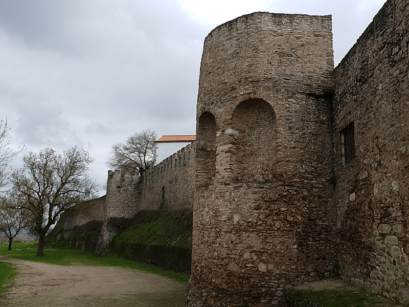
The remnants of Caminha’s walls, which were strengthened and expanded during the reigns of D. Afonso III, D. Dinis, and D. João I, exhibit the structural qualities of Roman defenses from the fourth and fifth centuries.
Ten towers were added as reinforcement to the roughly oval-shaped medieval wall that surrounded the settlement. It was pierced by three gates, each of which was guarded by an overlapping tower.
The so-called Porta do Sol connected the shipyards and the riverfront region to the east, and the Porta do Mar connected the harbor pier to the west. The so-called Porta de Viana, which was the town’s principal entrance and led to Viana do Castelo, was to the south.
The strongest of the group, with a square-shaped floor plan that was once the keep, was the tower that guarded the latter. On it was written the coat of arms, which is a symbol of royal power, and it had a sacred image, which is a sign of how people worship. Its name was changed to Torre do Relógio when it began housing the town’s public clock in the seventeenth century. This clock’s bell, which is kept inside the pyramid that later ascended to the top of the tower, was cast in 1610. D. João IV ordered the installation of a stone statue of Nossa Senhora da Conceição on this door as part of the repair.
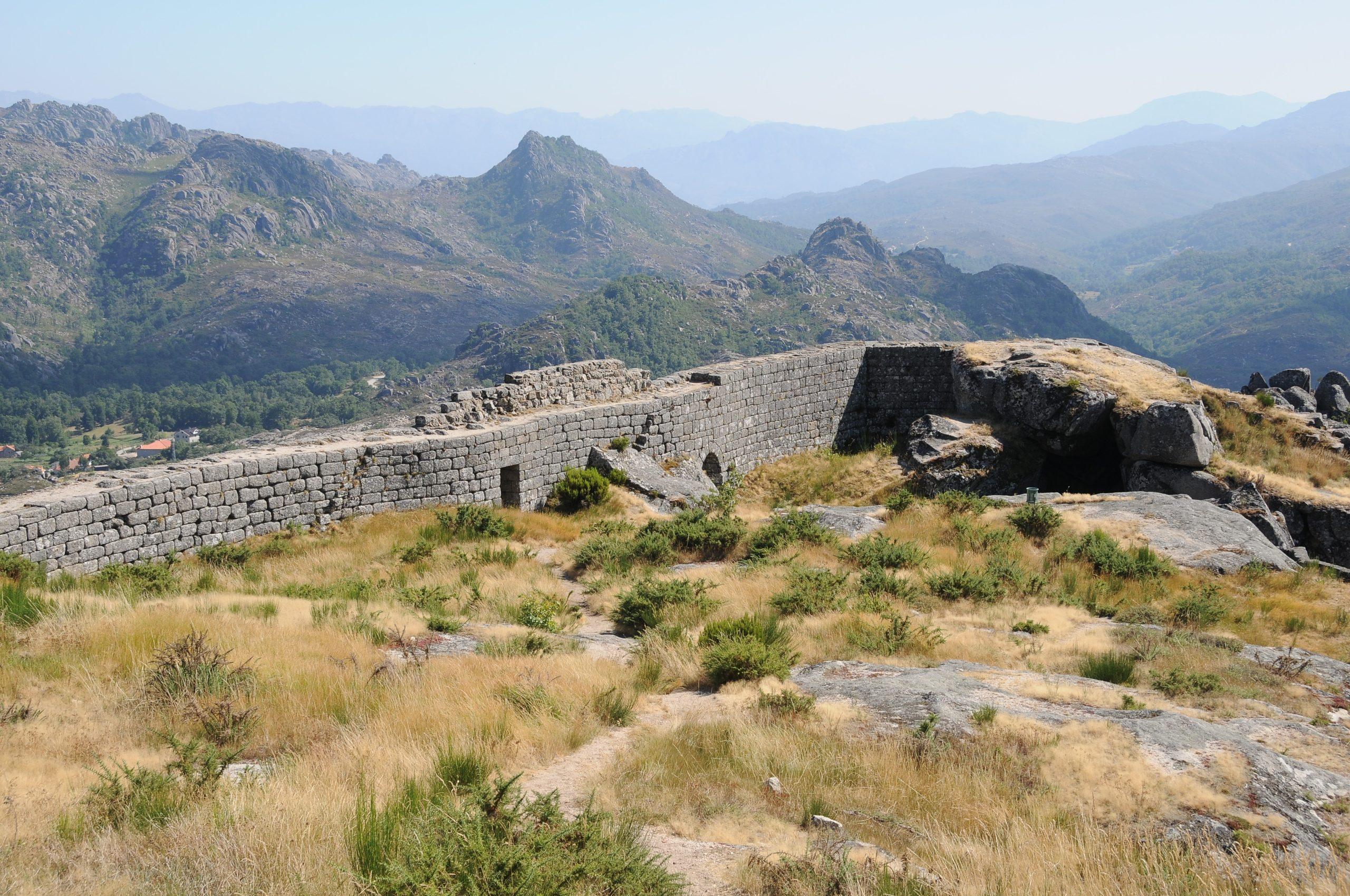
Castelo de Castro Laboreiro is a Portuguese castle in the civil parish of Castro Laboreiro in the municipality of Melgaco. It is the remains of a Romanesque castle with a cistern-equipped central keep surrounded by a ring of walls.
Style
Romanesque/Gothic
A perspective of the traitors’ gate, or “Gate of the Frog”
In Melgaço, there is a long tradition of tales about witches, enchanted moors, and Swabian princesses; Minho heroines like the legend of Inês Negra; and even tales and fables about fantastical beings like argans and other beings with magical abilities, which are similar to the sculptures of monsters and dragons made by Professor Paulo de Souza Pinto and discovered in Monte de Prado, on the riverside slope, and People have been telling each other about this popular culture for decades, but it is quickly dying out.
The mountainous region, specifically Castro Laboreiro, also has a distinctive human and cultural character that is of Celtic origin and has its own customs and habits. The local transhumance culture is distinct in the country for its mild and inverneiras, language, and local dress customs (castrejo costume).
The Castro Laboreiro dog, or “black mouth,” is an indigenous breed of dog that is one of the oldest on the Iberian Peninsula. It is of the mastinated type and makes a great guard dog and cattle guide.
The Peneda-Gerês National Park in Lamas de Mouro protects the municipality’s natural fauna and flora. The county is also home to many Roman bridges, Celtic (instead of Portos) megalithic monuments and alignments, mediaeval fortifications like Melgaco Castle and Castro Laboreiro Castle, as well as manor houses, Romanesque churches, the Peso thermal bath, museums, and walking or cycling trails.
Megalithic stones show that people have lived in the area since prehistoric times. These stones are on a plateau northeast of Castro Laboreiro.
Even though there isn’t much history about this place, it seems that people lived here because of how the Roman roads crossed the area’s rivers (Breiro de Barreiro, the river Laboreiro, the river Cainheiras, the river of Porto Seco, and others) with bridges.
During the Christian Reconquest of the Iberian Peninsula, Afonso III de Leo (848–910) gave the territory of Castro Laboreiro to Count D. Hermenegildo, the grandfather of São Rosendo, in exchange for defeating Vitiza, a local chief who had revolted.
During the count’s administration, the existing castro (which gave it its name) would have been converted into a castle before reverting to Muslim control.
Coordinates
42°1′22.55″N 8°9′29.69″W
In 1141, D. Afonso Henriques (1112-1185) seized Castro Laboreiro and fortified its defences (1145), which formed a part of Portugal’s frontier line.
According to the epigraphic inscription, this defence would have been finished during the reign of D. Sancho I, although its specifics are unknown (1185–1211).
Beginning with the reign of King Afonso III, forces from the kingdom of León invaded and badly devastated the castle (1212).
Castro Laboreiro was the town and county headquarters of the Barcelos region, which was part of the Barcelos county until 1834, as well as a commendation of the Order of Christ from 1319 to 1855. In the 1290s, during the reign of D. Dinis (1279–1325), its defences were reconstructed and assumed their modern configuration. At this time, the Gomes de Abreu family of Merufe was responsible for both the mayors of Castro Laboreiro and Melgaco. Later, during the reign of D. Fernando (1367–1383), the king granted Estevo Anes Marinho the position of mayor.
After the capture of Melgaco in the 14th century, D. João I (1385–1433) used Castro Laboreiro as a base to repel Castilian invaders from Galicia.
Martim de Castro lost his job as mayor in 1441 because of the protests of the peasants.
In his book Livro das Fortalezas, which was published in 1509, Duarte de Armas shows the castle with five square towers built into the walls to protect them.
The keep, which is likewise square in plan, is located in the centre, preceded by another building, with the cistern to the north. The village is located at a lower elevation and is secluded.
The castle has been a national monument since 1944, but the first projects to maintain and repair it did not begin until 1979.These projects included repaving the roads and getting rid of plants and landscaping, which went on for the rest of the year. In 2005, the town council improved the castle’s accessibility.
Architecture
The castle is situated on a secluded mountaintop 1,033 metres above the confluence of the Minho and Lima rivers. It features an oval layout, aligned north-south, with the ruins of walls built over cliffs and crags, often in a zigzag pattern that matched the ancient towers.
Located in the north is the “traitors’ gate,” the Gate of the Frog (Portuguese: Porta do Sapo), and to the east is the “Gate of the Sun” (Portuguese: Porta do Sol). The east-west courtyard is closed and only accessible by a footbridge that was used to round up livestock and property during invasions. Around these walls are all that remains of the ancient cistern’s ruins.
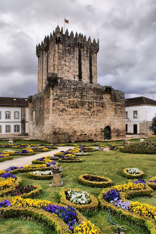
Chaves Castle, situated in a border region, was the site of several critical conflicts. It was constructed in the ninth century, before the formation of Portugal, during the Christian reconquest, and restored during the reigns of kings Afonso III and Dinis. This monarch completed the castle that has overshadowed the lovely city of Chaves for centuries.
The traces existing in the vicinity of Chaves, legacies of prehistory, compel us to recognise the existence of human activity in the Paleolithic. Numerous Neolithic artefacts have been discovered, including those from Mairos, Pastoria, and S.Lourenço, as well as those from protohistoric civilizations, namely in the numerous castros found atop the hills that encircle the entire Alto Tâmega region. The Roman soldiers that conquered those areas two millennia ago effectively settled in the lush Tâmega valley, exactly where the city now stands, and built fortifications on the edges, utilising some of the existing castros.
During the Roman invasion of the Iberian Peninsula, the Romans established themselves in the Tâmega River valley, where the city now stands, and built fortifications on the periphery, utilising some of the existing castros.
Walls were built to protect the populace, and Trajan’s bridge was built to span the river. They promoted the use of mineral-medicinal hot waters by establishing thermal spas, mining ores with a focus on gold veins, and utilising other natural resources. Trajan’s bridge is thought to have been erected with the assistance of Seventh Legion legionaries (Legio VII Gemina Felix).
Such was the prominence of this urban centre, which was promoted to the title of municipality in the year 79 AD when Tito Flávio Vespasiano, the first Caesar of the Flavian line, ruled.
The contemporary city of Chaves gets its gentilic name, flaviense, from the old appellation Aquae Flaviae.
According to the remains discovered, the city’s core and civic center were located on the heights around the location currently occupied by the Mother Church. The term “responsibility” refers to the act of determining whether or not a person is responsible for his or her own actions. The most important archaeological pieces, like a gravestone that suggests a gladiator fight, were found and are still on display at the Museu da Regio Flaviense.
According to the considerable archaeological evidence, the region’s basic human occupation dates back to prehistoric periods. Certainly dating back to a pre-Roman castro, at the time of the Roman invasion of the Iberian Peninsula, what is now Chaves was an important urban centre, as the archaeological remains indicate. The Roman road between Bracara Augusta (now Braga) and Asturica Augusta (now Astorga, in Spain) cut through the river, separating the two sides. The Ponte de Trajano was built in the 1st century to connect the two sides of the river. During this time, the first wall surrounding the settlement was extended to the modern city’s historic core when the Mother Church was constructed.
The invasion by the Suevi began in the third century, peaking with the battles between Remismundo and Frumário over who should rule. Because of this, the town was almost completely destroyed in 411. Frumário won, and Bishop Idácio de Chave was arrested. Come, King (713). Since conflict between Moors and Christians didn’t stop until the 11th century, the new rulers constructed further defenses for Chaves.
During the Christian reconquest of the Iberian Peninsula (866–912), Afonso III of León took Chaves from the Moors. He was also in charge of rebuilding the fortress.
In the ninth century, Count Odoário is credited with constructing the first fortress. During the first decade of the tenth century, however, the Moors retook control of Chaves.
Characteristics
Only parts of the wall and the keep are left of the mediaeval castle. This structure features a twelve-metre-wide by about twenty-eight-metre-high quadrilateral floor layout with a cistern on the bottom level and three stories with barrel-vaulted ceilings. Some holes are ripped in its granite walls, and on the east elevation there are wooden balconies. At the apexes, tiny, semicircular balconies are supported by stones and are crowned with merlons and battlements. It may be reached from the first level through an inclined stone stairway with guardrails made of the same material and a circular, arched entrance with a twisted frame that is topped by a royal coat of arms with nineteen castles.
The tower’s south-west facade features a perfectly arched gateway connected to the building by a barbican that is traversed by a darve.
A projecting, rectangular, boulder-lined balcony guards this entryway.
A similar balcony is seen on the northwest façade, as well as a balcony with a round corner at the intersection of these facades.
A balcony attached to a walkway on the second story of the tower provides access to the adarve. The set is partially encircled by an elegant garden, which is bordered by walls.
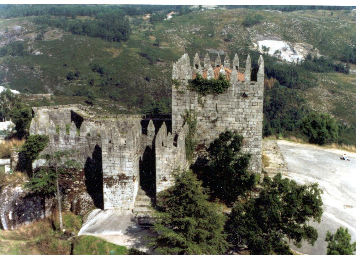
The Lanhoso Castle, which is at the northern entrance to the town of Póvoa de Lanhoso, is one of the most impressive castles in Portugal and a very popular place for tourists to visit in the area. It is on top of the Monte do Pilar, which is the biggest single piece of granite in the country. It is near where the basins of the rivers Ave and Cávado meet. Within its fortifications, a sixteenth-century sanctuary was constructed utilising the original walls’ stone. On the half-slope, next to the entrance, are the ruins of an ancient Romanized hamlet.
Archaeological evidence suggests that during the Chalcolithic period, people lived at the base of the hill where the castle now stands.
After the Romans took over the Iberian Peninsula, they built a military tower near the road that connected Bracara Augusta (now Braga), Aquae Flaviae (now Chaves), and Astorga to the south of the river Cávado.
Built on top of Monte do Pilar, the country’s biggest granite monolith, and isolating the Ave and Cávado river basins, a 17th-century sanctuary was constructed inside its walls, utilizing the original stone from the ancient walls. At the entrance, halfway up the hill, are the ruins of an old Roman castro. According to legend, Countess Teresa de Leão, the mother of King Afonso Henriques (1112-1185), sought sanctuary twice in this castle.
The mediaeval fortress
Between the tenth and eleventh centuries, the historic Roman fortress was razed to the ground.
Archbishop D. Pedro I of Braga (1071–1091) had the castle built according to the earliest inscription on a Portuguese castle’s ashlar, which was next to the foundations and the perimeter of the first fortification.
DNA sought refuge in this defense. Teresa de Leo, widow of Count D. Henrique (1093–1112) and mother of D. Afonso Henriques, was assaulted by D. Urraca, a member of the armies of the Queen of León. Here, surrounded by D. Urraca’s (1121) warriors, D. Teresa was able to negotiate the Treaty of Lanhoso, which allowed her to save her county’s leadership. Later, according to tradition, D. Teresa returned there after the Battle of São Mamede (1128), which is contested by current historians, who assert that she died in Galicia (1130).
In any event, the castle was renovated between the end of the 12th century and the beginning of the 13th century, when the keep was constructed. At the time, the castle was known as the land’s head, emphasising its regional prominence.
In this context, the castle was the site of a terrible passion crime in the 13th century: its mayor, D. Rui Gonçalves de Pereira, the great-great-grandfather of Constable D. Nuno lvares Pereira, who was outside the castle upon learning of his wife’s marital infidelity, Inês Sanches, who was in love with a friar from the monastery of Bouro, returned and, closing the doors, ordered the citadel set on fire. causing the death of the unfaithful woman and her lover, as well as the servants, who implicated as accomplices for not having reported the fact. Old reports say that no one escaped the fire alive, not even domestic animals.
From the twentieth century until the present
The castle was designated a national monument by a decree dated June 23, 1910. In 1938, the Directorate-General for National Buildings and Monuments (DGEMN) began consolidating and restoring the castle. This included archaeological prospecting, cleaning, rebuilding the two turrets on either side of the entrance gate, the arch of that gate, and parts of the walls, as well as building a road to the castle and making improvements to the Sanctuary of Nossa Senhora do Pilar. The same organ launched further campaigns in 1958–1959, 1973, and 1975–1976. When the castle was reopened to the public in 1996, the City Council, with help from the Adere-Lanhoso Association, cleaned and strengthened the structures and remodeled the inside floors of the tower.
Currently, visitors may visit the sanctuaries of Nossa Senhora do Pilar and Castro de Lanhoso in addition to the medieval castle, which has a modest museum with artifacts from the neighboring castro.
At a maximum elevation of 385 metres above sea level, the castle has an irregular hexagonal plan in Romanesque and Gothic style breaking into its walls to the south, next to the Torre de Menagem, the entrance gate, in a broken arch flanked by two crenellated quadrangular turrets. The wall is traversed by a parapet protected by a parapet topped by pyramidal battlements, some of which have openings with manholes.
At the highest level of the land, to the east, the Menagem Tower stands out, with a quadrangular plan built from the primitive Roman foundations (three equidistant turrets). Its walls, which rise to about ten metres in height, exceed one metre in thickness. A stone staircase provides communication between the tower door in a broken arch, opened three metres from the ground, and the main square, with a quadrangular area of approximately 500 square meters, where the mayor’s house and other dependencies were built, including the cistern.
The outside of the complex is protected by a barbican with an elliptical shape. The north entrance gate is reached by a staircase carved into the rock and is flanked by a turret with crenellations. A second turret rises to the east.
The Sanctuary of Our Lady of Pilar
As the Modern Era began, the kingdom’s borders got closer together, and the fortress slowly lost its strategic value and fell into ruin.
At the end of the 17th century, a wealthy Porto merchant named André da Silva Machado decided to build a copy of the Sanctuary of Bom Jesus de Braga. This sped up the process.
So that he could do this, he got permission to tear down the old castle and use the stones to build a shrine to Nossa Senhora do Pilar (1680).
So began the destruction of part of the barbican and its walls, as well as the building of the Sanctuary of Nossa Senhora do Pilar, which is a church, a staircase, and chapels for pilgrims.
In 1724, work on the sanctuary continued, while Craesbeeck (Resurrected Memories of the Province of Between Douro and Minho, 1726) described the castle’s state of ruin. This view was supported by the rector, Paulo Antunes Alonso (Parochial Memories, 1758), who stated that only the Torre de Menagem remained, whose southwest corner had been damaged by lightning.
Rising proudly above the Tagus River on a hill that once held strategic command over central Portugal, Abrantes Castle is a forgotten sentinel of centuries past. While Lisbon and Sintra often steal the spotlight, the quiet power of Abrantes offers something different—history without the crowds, views that go on forever, and a sense of rootedness that only places shaped by war, royalty, and resilience can provide.
Let’s take a journey into the heart of Ribatejo, where stones still whisper stories and where the air itself seems to carry the weight of medieval watchfulness. This is the story of Abrantes Castle—not just as a monument, but as a living memory of Portugal’s soul.
The First Impressions: A Fortress With a View
Approaching Abrantes from any direction, your eyes are naturally drawn uphill. The old town clings to the slope, rising gently to the crown of the hill where the castle sits like a stone guardian. But this isn’t just any lookout point—it’s a natural stronghold. And the architects who first built here knew it.
The Tagus River, once the lifeblood of inland trade and troop movements, winds far below. From the ramparts, you can see as far as Serra da Estrela on a clear day. The sense of height and space is vast. But the castle itself is intimate—more like a weathered old general than a showy prince. It’s solid, scarred, and rooted in place.
A Brief History: From Reconquest to Napoleon
Abrantes Castle traces its origins back to the 12th century, during the fervour of the Christian Reconquest. The site, previously settled by Romans and later fortified by the Moors, was retaken in 1148 by Afonso Henriques, the first King of Portugal. Recognising its strategic importance, he ordered the construction of a Christian fortification almost immediately.
Over the centuries, the castle was expanded and modified—particularly during the reign of King Dinis in the 13th century, who reinforced its military role with added walls and towers. It became one of the key defensive bastions guarding the Tagus corridor, a vital artery leading straight to Lisbon.
But it wasn’t just soldiers who walked these walls. In the 17th and 18th centuries, parts of the castle were transformed into a royal residence. It served as a noble retreat, complete with gardens and quarters fit for visiting dignitaries.
That all changed in 1807, when Napoleon’s armies crossed into Portugal. Abrantes was seized by General Junot, who made it his headquarters for a time, so much so that he was later awarded the title Duke of Abrantes by Napoleon himself. While the French left eventually, the scars of occupation lingered in the town’s memory.
Wandering the Grounds: What to See
Despite the layers of history, Abrantes Castle is not a museum in the traditional sense. There’s no single entry gate with a ticket booth, no roped-off galleries. Instead, you arrive and wander. You pass through stone arches and crumbling walls, discover viewpoints where soldiers once stood watch, and find corners where time seems to pool in the shadows.
Here’s what to pay attention to:
1. The Keep (Torre de Menagem)
The keep is the heart of the castle, though only parts remain today. Once the last refuge during sieges, it now offers a window into medieval engineering. Climb what’s left of the walls for panoramic views of the Ribatejo plains.
2. Military Quarters and Barracks
You’ll notice a few long, low buildings set back against the inner walls. These were 17th-century barracks, built to accommodate the troops stationed here to defend the kingdom’s interior. They’re unadorned, but somehow still commanding. It’s easy to imagine the clatter of boots and barked orders in the chilly morning fog.
3. The Church of Santa Maria do Castelo
This 13th-century church within the castle walls is one of the most atmospheric spots. Once the castle’s spiritual centre, it’s now a simple stone structure with Gothic arches and a sense of stillness that’s rare. Outside, a small cemetery holds the graves of local notables and soldiers.
4. The Garden Terraces
In the 18th century, when the fortress also served as a royal retreat, terraces and gardens were added. You’ll find manicured hedges and trees that feel almost too gentle for a place with such a militant past. They offer a soft balance—proof that even battle-worn walls can bloom.
Best Times to Visit
Abrantes Castle is open year-round, but it’s most rewarding in spring and early autumn. The Ribatejo region basks in golden light, and wildflowers carpet the hillsides from March through May. In late September and October, the weather cools and the harvest gives the town a lively hum.
Avoid high summer unless you’re prepared for heat. The stone absorbs and radiates sun like a furnace. If you do go in July or August, aim for early morning or late afternoon—and bring water.
Making a Day of It: What to Pair With the Castle
Abrantes Castle can be explored in an hour or two, but the town itself is worth lingering in.
Stroll Through the Old Town
Wander downhill into the historic centre, with its cobbled streets, whitewashed façades, and wrought-iron balconies. Stop at a café for a bica (Portuguese espresso) and take in the rhythm of a town that still moves at its own pace.
Museu D. Lopo de Almeida
Set just outside the castle, this museum offers a more structured take on local history. It holds archaeological finds from the region, religious art, and even a few curious Napoleonic artefacts. It helps place the castle in the broader story of Portugal’s interior.
Tagus Riverside Walk
Down by the river, you’ll find quiet paths perfect for walking or cycling. The town has invested in recent years in making the riverfront accessible and beautiful, and it’s a peaceful contrast to the hilltop heights.
Food and Drink: Where to Refuel
One of the best things about visiting small-town Portugal is the food. No fuss, no frills—just honest plates made with love and local pride.
Santa Isabel – A local favourite near the old town, serving seasonal Ribatejo cuisine like cabrito assado (roast goat) and ensopado de borrego (lamb stew).
O Alpendre – A more rustic option, with hearty portions and a terrace. Go for the bacalhau à lagareiro or grilled meats.
Pastelaria Palha de Abrantes – Stop here for the town’s famous sweet: the Palha de Abrantes. It’s a golden, delicate dessert made from egg threads and almonds, rooted in the conventual sweets tradition. You won’t find this in Lisbon.
Pair it with a local wine from the Tejo region, or try the traditional ginjinha (cherry liqueur) if you’re in the mood for something stronger.
Why It’s Worth Your Time
Let’s be honest—Abrantes Castle isn’t going to wow you with glittering palaces or pristine restoration. This is not the Pena Palace. And that’s precisely why it matters.
This is a place where the stones are still allowed to breathe, to decay naturally, and to remind you of what they’ve seen. It’s unpolished. Raw. Real.
For travellers tired of the tourist loop, or for those who want to get deeper into Portugal’s layered identity, Abrantes offers something that can’t be bottled or sold in a brochure: presence. The kind of stillness you only get when time is allowed to take root.
Final Thoughts: A Place Between Worlds
There’s something magnetic about standing on the ramparts of Abrantes Castle. You feel caught between land and sky, between the past and the present. The wind carries the memory of war, and yet the sun warms the ancient stones like an old friend.
Abrantes may not be on your list yet—but it should be. Because sometimes, it’s in the quieter places, the overlooked corners, where the true pulse of a country beats.
Practical Tips
Getting There: Abrantes is just under 2 hours from Lisbon by car or train. The train station sits below the town centre, so prepare for an uphill walk or take a short taxi ride.
Entry: Free to wander. The church and museum may have limited hours; check locally.
Accessibility: The castle grounds are uneven and partially unpaved. Not ideal for limited mobility visitors.
Language: English is spoken in some places, but a few words of Portuguese go a long way.
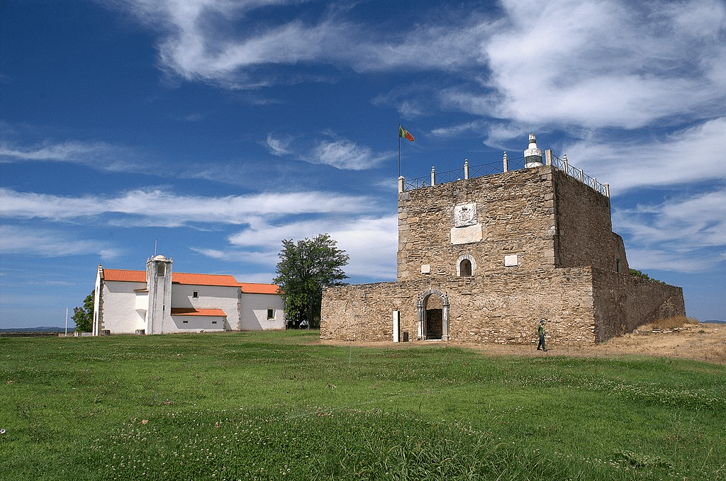
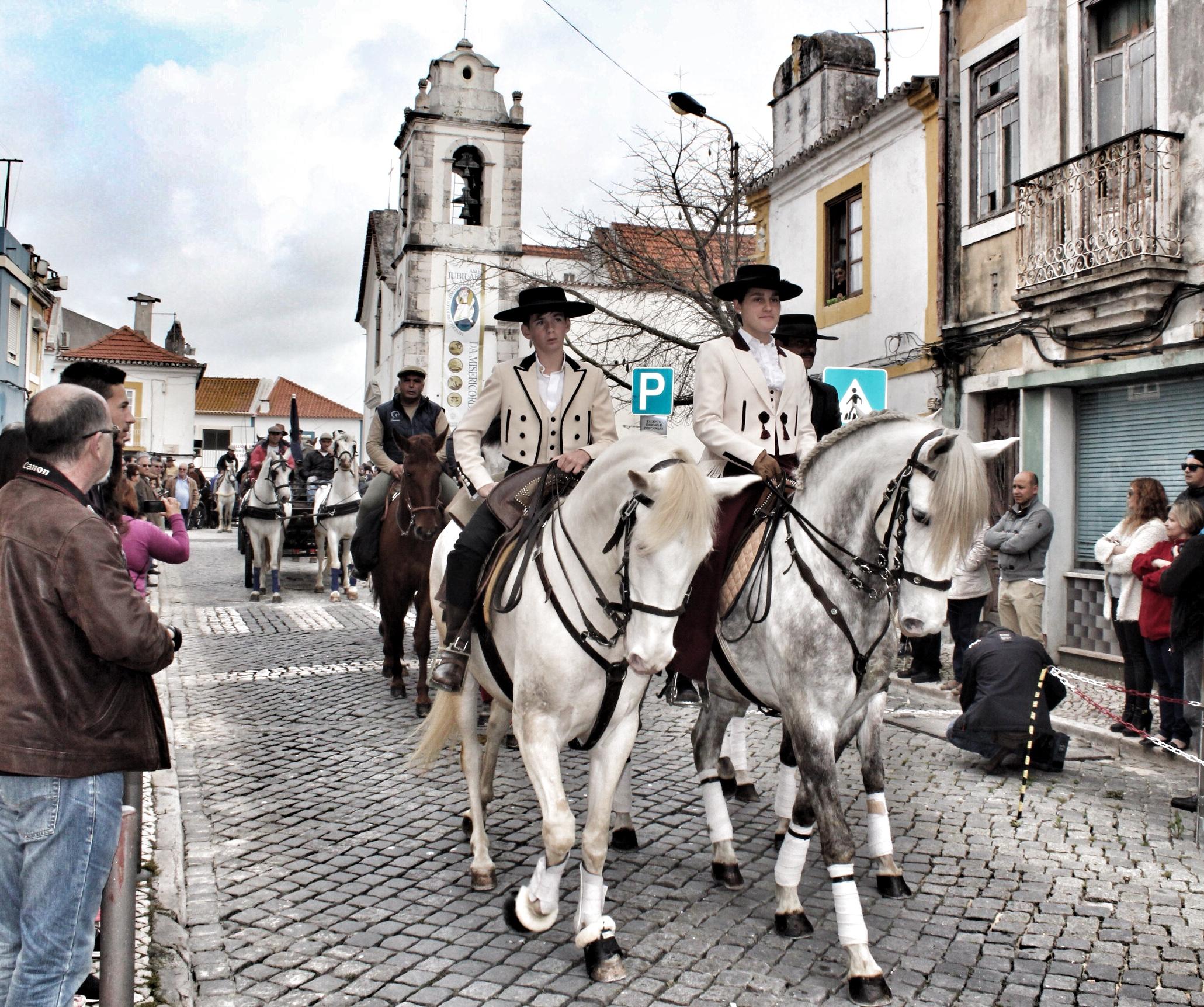
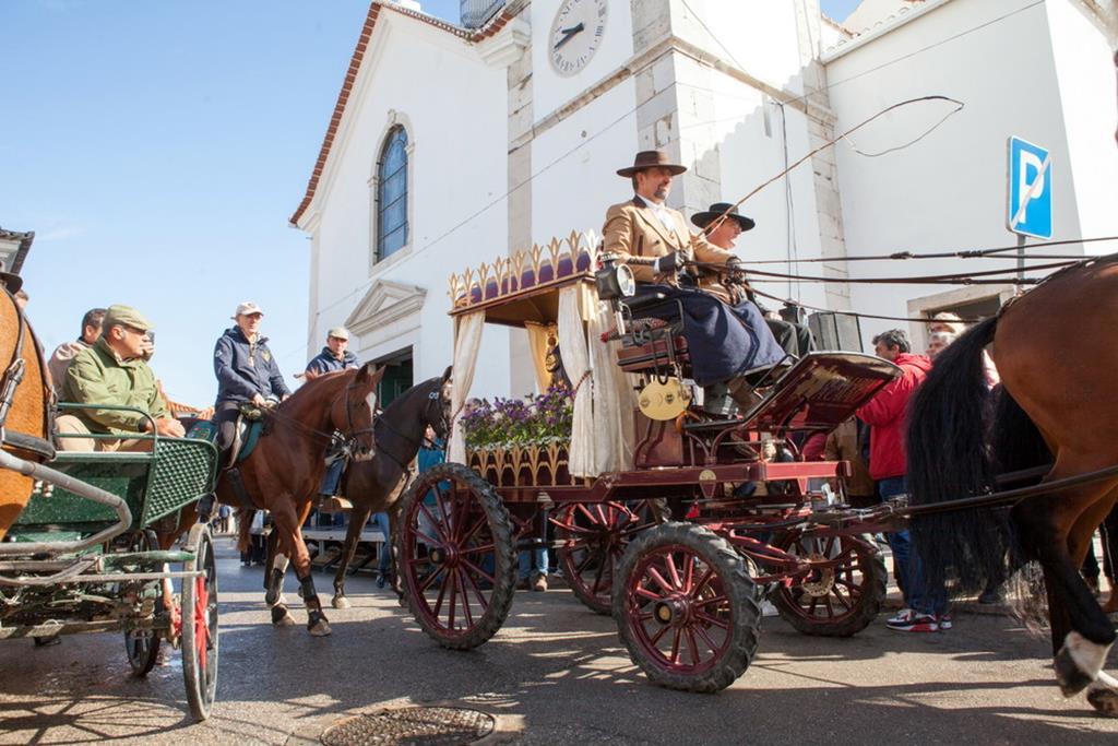
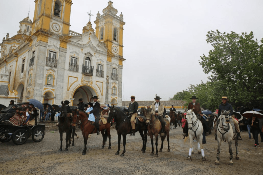
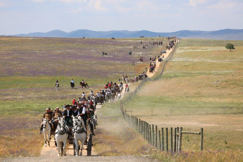
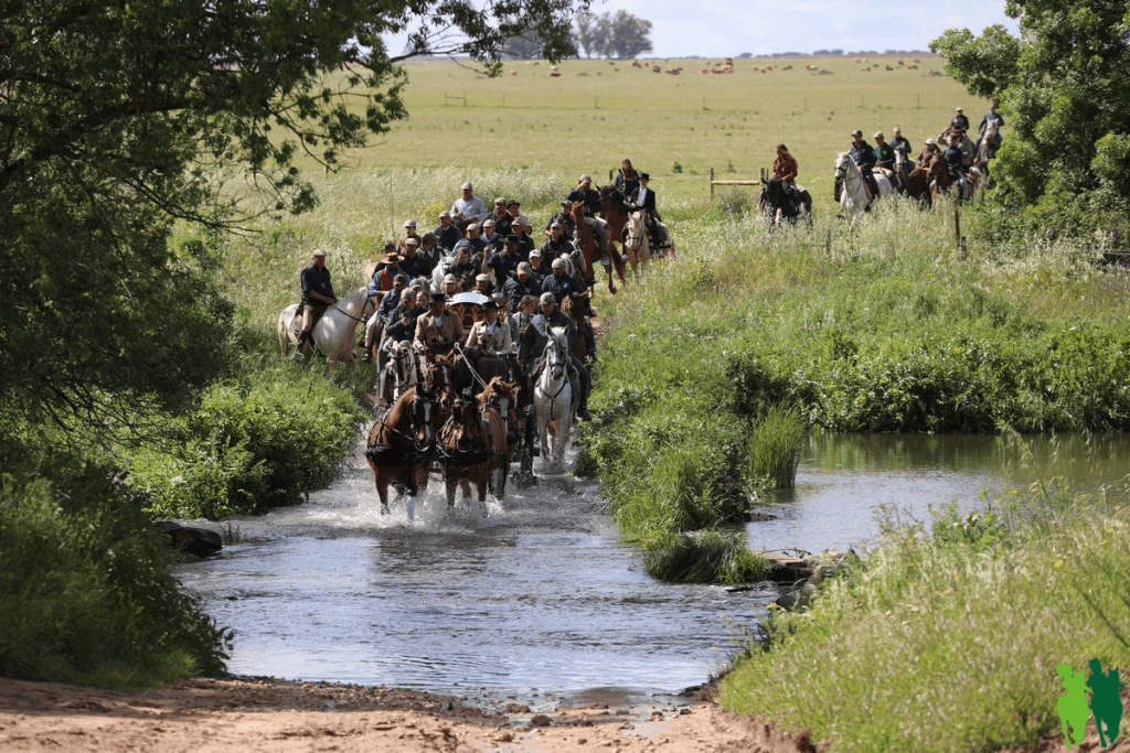
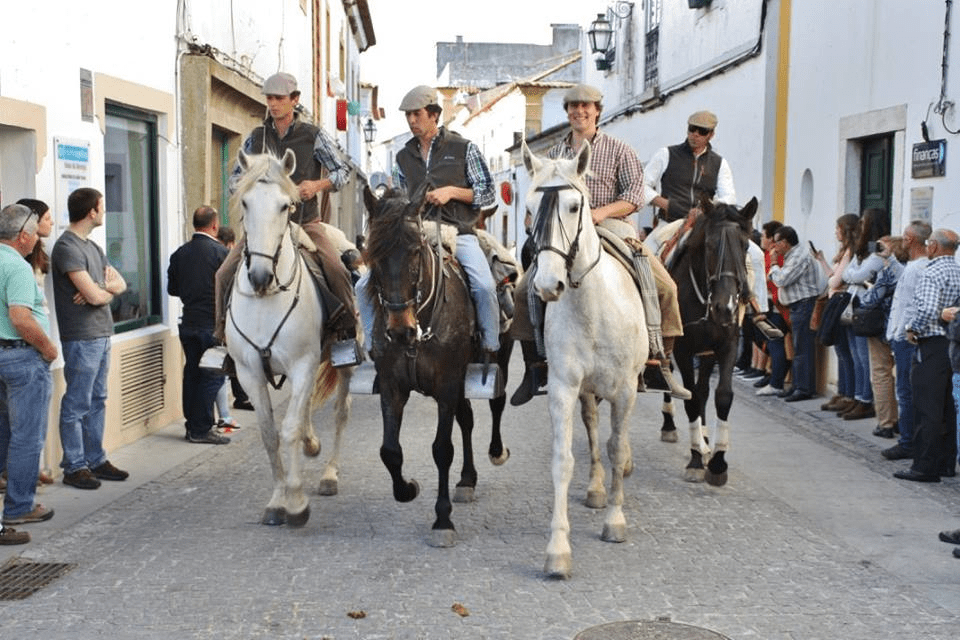
The Pilgrimage on Horseback, which connects the towns of Moita and Viana do Alentejo, is a centuries-old tradition shared by the two counties and one of the largest equestrian events in the country.
At that time, Moita’s farmers moved to the Nossa Senhora D’Aires Sanctuary with their animals, making the journey through the old Canada Real, through farms and dirt roads, to be blessed and to pray for abundant crops.
For four days, hundreds of pilgrims travel around 150 kilometers across the fields, behind the carriage carrying the image of N.a. Sr.a. da Boa Viagem, patron of Moita, which joins, on arrival in Viana do Alentejo, the image of N.a. Sr.a. D’Aires.
Pilgrimage has always been a religious event, but now it has a more playful side that emphasizes the camaraderie among the people who take part. This event combines religion with a special atmosphere and camaraderie.
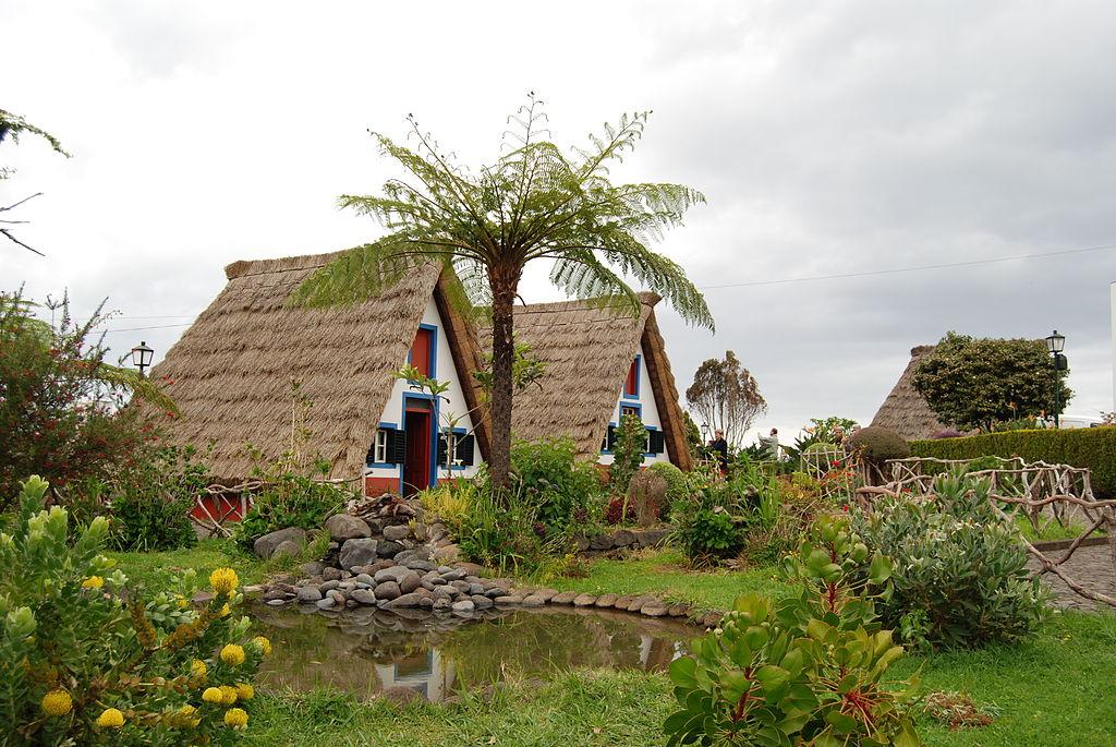
On the Portuguese island of Madeira’s northern shore lies a municipality called Santana. It is renowned for its traditional stone buildings called Casas Tpicas de Santana, which have high, triangular-shaped thatched roofs. The Madeira Theme Park, which has displays about the island’s history, culture, and customs, also has examples of the houses on display. A golden altarpiece may be found in the white, baroque-style Igreja de Santana church.
Things to see and do
Madeira Theme Park in Santana
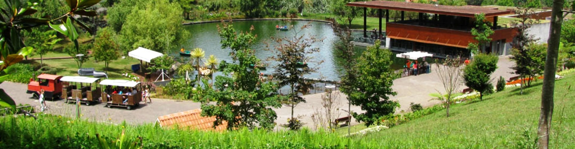
The “Theme Park” in Santana, which opened its doors to the public in October 2004, comprises various nucleuses with several attractions related to the archipelago’s traditions, culture, and history that will delight the young and the old, whether they are tourists or locals.
It covers an area of around 145,000 m2 where visitors can find themed attractions, such as four themed pavilions, one of which is a machine that simulates the island’s discovery, a “zoom-in, zoom-out” circuit (with several references to local monuments or garments, like the typical Madeiran hat “gorro de orelhas”—a cap with long earflaps—in small and huge sizes), a smaller replica of the Monte train making the connection between these attractions, beautiful gardens filled with colourful flowers and endemic plants, a bullock cart, and a trip in one of the mini boats reminiscent of the Câmara de Lobos fishing boats.
In other parts of this themed village, visitors can practise extreme sports (like cable sliding, bungee jumping, wall climbing, etc.). There are also two restaurants and a bar, a car park, and a souvenir shop.
The Madeira Theme Park is unique because of its attractions and shows, its themes, and the quality and variety of the services it offers. It is a place where fun and learning about and appreciating nature go hand in hand.
Enjoy a great day outdoors and learn something about Madeira’s culture and traditions at the same time!
Opening hours: Every day from 10:00 to 19:00 h (April – September) or from 10:00 to 18:00 h (October – March). Closed on Christmas Day.
Cable car at Rocha do Navio
On Madeira’s north coast, in the Santana municipality, is the location of the Rocha do Navio cable car station. It is breathtaking to travel the five minutes down to Fajã da Rocha do Navio, where you will see banana plantations, vineyards, and Rocha do Navio, one of Madeira’s designated natural reserves.
In order to provide local farmers with easier access to their land plantings, this cable car was erected in 1997. Visitors may now explore and take in the breathtaking scenery and environment of “Teleférico da Rocha do Navio.”
The name “Rocha do Navio” given to this location is connected to the 19th-century shipwreck of a Dutch ship.
Every day of the week, between 9:00 and 17:00, this cable car is in operation.
Levada do Caldeirão Verde (PR9) Walking Trial
.
The journey is incredibly lush, a beautiful fairy tale in a green paradise that starts at Casa das Queimadas and continues until you reach the spectacular waterfall. The vast mountains and the São Jorge village are visible in magnificent views.
Along the walk, water is constantly present, sprouting out of the walls and calmly flowing along the levada. Any time of year is a great opportunity to hike this wonderful and secure trail.
Along the route, there will be various tunnels, so be sure to bring a torch.
Allow yourself to be captivated by the stunning sight of the large waterfall cascading over the chilly, crystalline lagoon as soon as you arrive at the Caldeiro Verde waterfall. Allow the soothing sounds of the water falling to calm you. Before returning, you might want to take a picnic.
Beaches
Beach at Foz da Ribeira do Faial
The bathing area in Foz da Ribeira do Faial is fully equipped for guests to enjoy the swimming season in complete safety and pleasure.It is designated as a Blue Flag beach.
The bathing area is equipped with a sand-floored playground, a solarium, a children’s saltwater pool, a children’s playground, a first-aid station, and a café.
Beach at Foz da Ribeira de São Jorge
The beach near the mouth of the Ribeira de São Jorge consists of a small lagoon and a bathing facility with three swimming pools, a solarium, changing facilities, and a café.
Matriz De Santana Mother Church.
The Igreja Matriz de Santana is located in the centre of the city of Santana. This church was built at the end of the 16th century.
The church has a baroque style, and it is possible to observe a main altar with a gilded altarpiece and a screen in the centre of the temple, which represents Santa Ana and São Joaquim.
Primitive Nucleus of the Parish of São Jorge
On the pebbles of São Jorge, you can find the Primitive Nucleus of the parish of São Jorge.
These ruins belong to the old sugar cane mills that were built there at the beginning of the settlement. The stone entry arch is one of the most prominent historic structures.
São Jorge lighthouse
In addition to guiding marine navigation, the Lighthouse of São Jorge, located at Sítio da Vigia in São Jorge, is a lovely spot from which you can see the local parish, as well as Achada do Gramacho and Pico da Boneca in neighbouring Santana.
Faials Old Bridge
At the start of the 20th century, the bridge was built to connect the two sides of the parish that were separated by Ribeira do Faial. It was opened in 1904.
With a total length of 130 metres, the Faial Bridge was the longest bridge in Madeira, earning the nickname “Bridge of Seven Mouths” due to its seven arches. Bad weather on May 1, 1984, collapsed four of the seven arches that comprised the bridge, leaving the remaining structure as a parish and city monument.
Chapel of Our Lady of Penha de França
Built in the parish of Faial in the 17th century, more precisely in the year 1685, the chapel of Penha is a small chapel excavated in a huge boulder of reddish stonework on the site of Difference.
Inside, we can see the irregular barrel vault coverage and a small altar in Mannerist stonework. Tradition has it that it was a refuge for escaped Canary Island slaves. Currently, the chapel of Nossa Senhora da Penha de França hosts an annual pilgrimage, which takes place on the third Sunday of October.
Vilas Boas is an old Portuguese parishin the municipality of Vila Flor, with an area of 28.57 km2 and 550 inhabitants (2011). Its population density was 19.3 inhab/km2. It was united with the parish of Vilarinho das Azenhas, forming the Union of the Parishes of Vilas Boas and Vilarinho das Azenhas, with headquarters in Vilas Boas
Vilas Boas, a rural community that includes the municipality of Vila Flor and the Regional Park of Vale do Tua, gets its name from the Romans: Boas indicated that the soils of this parish were extremely fruitful since vilas, which date back to Roman times, were agrarian units. The antiquity of this village, however, is also demonstrated by archaeological remains, namely on the hill of Nossa Senhora da Assunção, where there is a castro that was later romanized.
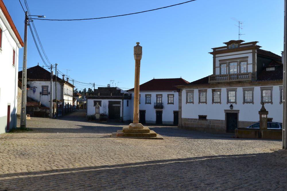
The parish church dedicated to Santa Maria Madalena, built in the 16th century (XVIII), but with a frieze from the Manueline period at the back of the sacristy, and the Sanctuary of Nossa Senhora do Assunço, with a main church, several little scattered chapels, and a grand stairway, are both worthy of pride and a visit. Several manor homes with coats of arms, a fountain, a cross, and the Pelourinho, a designated monument, are all included in this parish’s built estate.
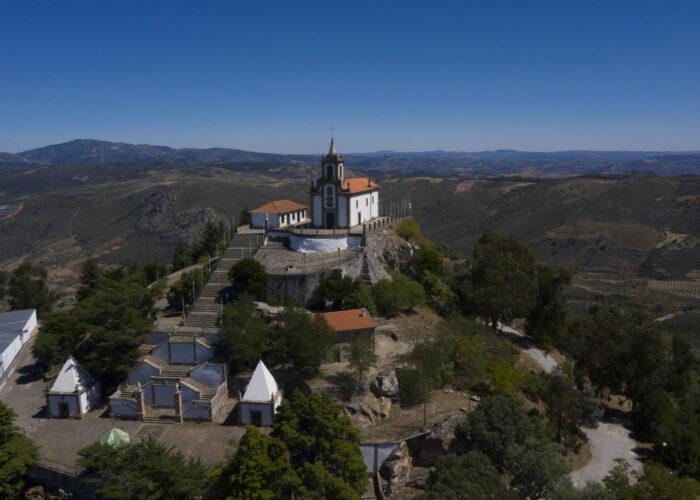
The Shrine of Nossa Senhora da Assunção, perched on top of a hill (cabeço) where it was formerly a castro, afterwards occupied by the Romans, is the largest Marian sanctuary in Trás-os-Montes. It contains a large church in the centre, several smaller chapels located all over, and a grand staircase. The main churchyard is a magnificent 360-degree vista from which, on clearer days, it is possible to see the country of Spain.
Capela Nossa Senhora da Assunção em Vilas Boas, Vila Flor
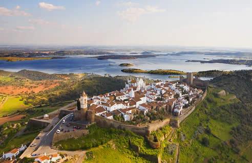
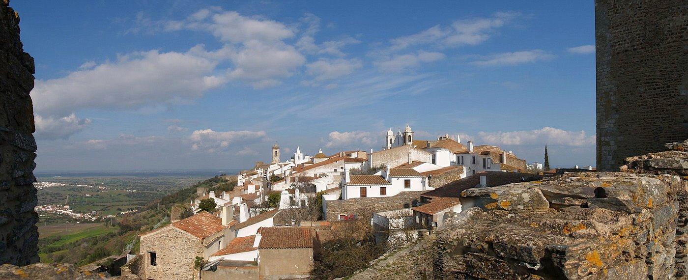
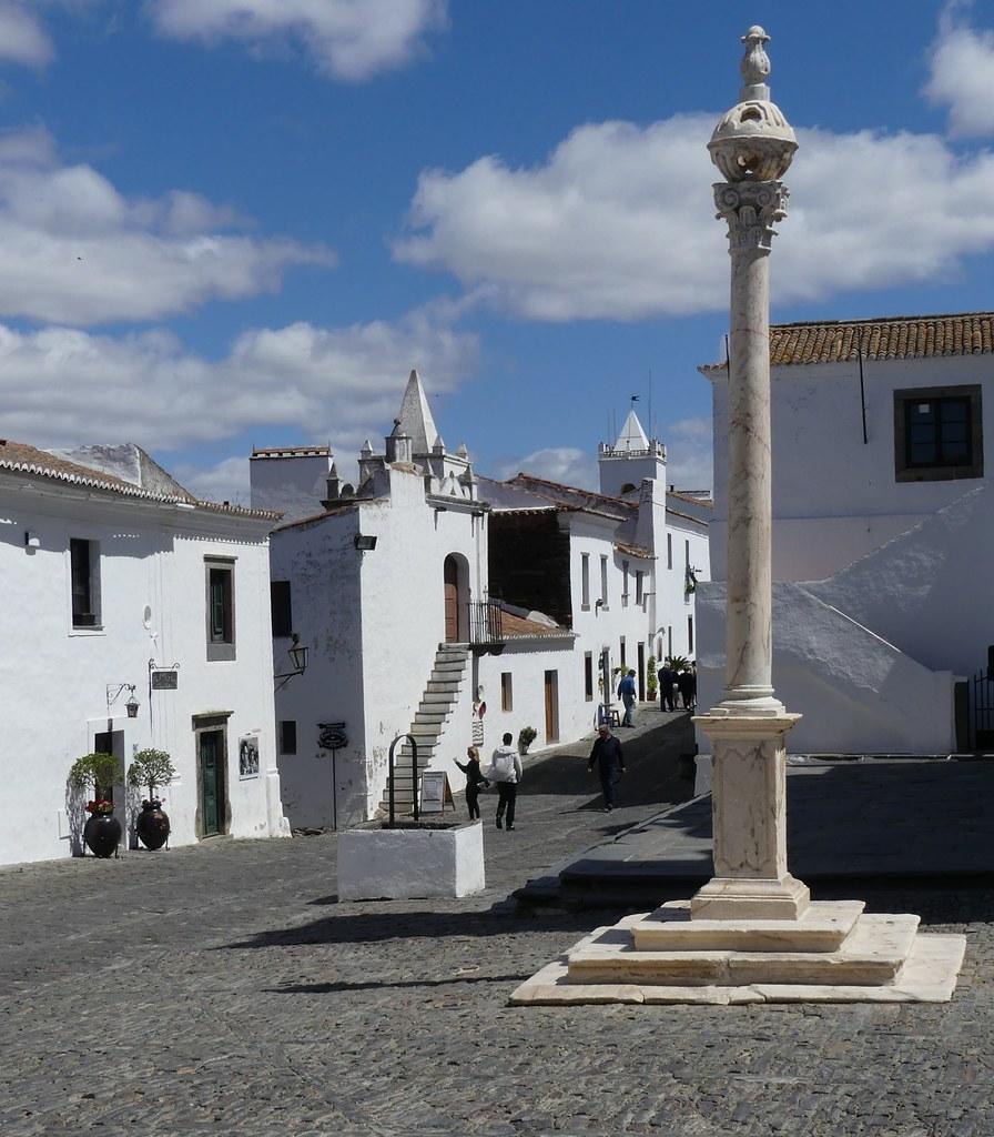
One of the most fascinating spots in the entire Alentejo region is the mediaeval walled village of Monsaraz, which is located east of Évora and perched high above the River Guadiana. It is perched on a hill above the river and not far from the Spanish border.
One of the oldest cities in southern Europe offers visitors a chance to experience the authentic spirit of mediaeval Portugal with its winding cobblestone streets, modest homes, and picture-book castle.
Since prehistoric times, humans have lived in Monsaraz, where the Celts, Romans, Visigoths, and Moors all made the most of the hill’s natural defences.
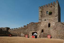
The town was given to the Knights Templar after it was taken back from the Moors in 1167, and in the 14th century, King Dinis erected the castle and fortified walls.
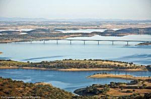
You may look east over the Guadiana to neighbouring Spain or west across the vast Alentejo plains from the walls. In recent years, the town has become a popular place for boaters to stop on their way to or from the huge Alqueva reservoir, which is one of the largest man-made lakes in Europe.
An elaborate marble monument from the 13th century is kept in the Igreja Matriz de Santa Maria do Castelo, the parish church in Monsaraz. A 14th-century fresco in the religious museum next door shows Christ’s power and justice saving a judge from the devil’s temptation.
The surroundings around Monsaraz are home to a number of fascinating prehistoric ruins, notably the magnificent Menhir of Outeiro, which is about 6 metres tall.
Twelve kilometres to the west, in the little community of São Pedro do Corval, are known for their pots, plates, and other locally made ceramic items.
There are four must-see and do activities in Monsaraz, Portugal.
Explore Castelo de Monsaraz and the village.
This magnificent hilltop castle was constructed in the thirteenth century to defend the village of Monsaraz. Its perch on top of a hill provides breathtaking views of the village and the Alentejo region. Additionally, it is a national monument.
See Alqueva Lake.
Alqueva Lake is one of the largest artificial lakes in Europe, with a 250-square-kilometer surface area (97 square miles). Here, you can engage in water sports, take boat trips to the surrounding islets, or simply enjoy the scenery and connect with nature. Worth the trip!
Look at the megaliths.
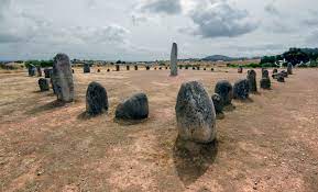
The ancient megalithic monument at Cromeleque do Xerez was discovered around the beginning of the fourth century. These megalithic structures are comprised of fifty large granite stones. Amazing ancient history at our smaller Stonehenge version.
Alqueva Lake Observatory.
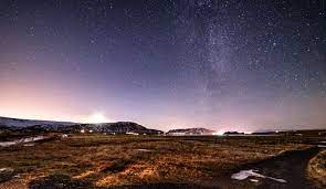
This is an astronomical observatory near the town of Monsaraz where you can observe the night sky and learn about the legends of the stars. The experience of stargazing is extraordinary.
Where in Portugal is Monsaraz?
Monsaraz is in the Portuguese region of Évora/Alentejo, in the municipality of Reguengos de Monsaraz. It is 113 miles (180 km) from Lisbon.
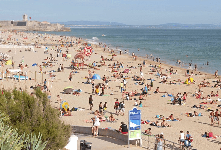
Praia de Carcavelos | Photo Copyright: Paul Bernhardt
There is no doubt that many tourists visit Portugal in search of beach time. With an abundance of sunshine, the beach should be a must-see for all tourists.
But what about Portugal’s river beaches? There are numerous beautiful rivers inland that are well worth a visit, despite the fact that the coast receives more attention.
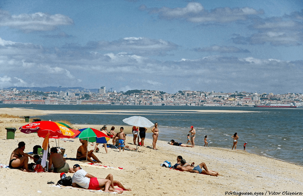
In the summer, the beaches are crowded with holidaymakers who like to swim in the ocean and sunbathe. There are river beaches in close proximity to Lisbon that could serve as an alternative.
Clube Naval Beach
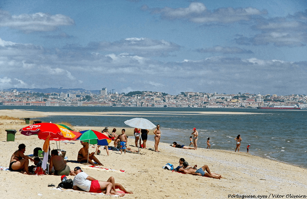
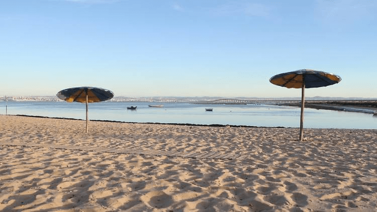
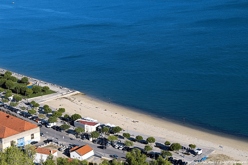
Praia do Clube Naval, also called Praia do Bico Mexilhoeiro or “the beach of Barreiro,” was one of the most popular beaches south of Lisbon in the 1800s and the first 10 years of the 1900s. It is part of a group of three river beaches called the Circuito Ribeirinho do Barreiro. It is a peaceful and beautiful place where you can sit on the sand or on the restaurant’s terrace and watch the river landscape with Lisbon in the “background.”
Location – 38° 39′ 24.7′′N 9° 05′ 32.2′′W
Alburrica beach
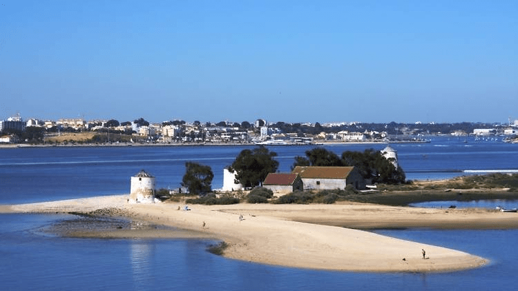
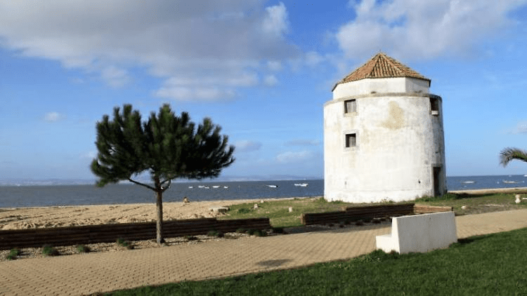
This river beach, formed by a small peninsula, was once an important milling center, which is why it still has a spectacular collection of three windmills: erected in 1852, the Gigante, Nascente, and West are evidence of the historic and prosperous activity of milling and husking cereals that came from the southern plains. The expansive sand beach contains a bar with a terrace and a parking lot immediately adjacent to it.
Location – 38° 39′ 19.97′′ N, 9° 04′ 57.94′′ W
Ponta dos Corvos beach
This river beach, known locally as Praia dos Tesos or Ponta de Mato, and located close to Corroios in the municipality of Seixal, was the first classified beach in the Tagus estuary to allow bathing. According to a press release, the municipality of Seixal will conduct the requalification that will “transform the Praia dos Seixalenses into an innovative space that will include the natural beach and a small artificial island, which can accommodate a small hotel, a dock, or restoration spaces” as part of the Portugal 2020 project. There is support infrastructure, such as a picnic area with grills, outdoor showers and toilets, and even a fire department.
GPS geographic coordinates: lat 38.6472625, lon -9.0976049
Address: Miratejo, Portugal
Samouco Beach
Photo Credit: Parish Council of Samouco
A day trip to Samouco Beach and pink flamingos awaits you on the ferry from Lisbon to Montijo.
Location: away from the masses, on the south bank of the Tagus.
On the way out of Samouco, there is a river beach with a picnic area, picnic tables, grills, restrooms, a grassy area, and a playground for children. Before you get to the beach, there is public sports equipment and a mini-skate park along the pedestrian circuit.
How to get to Praia Do Samouco Beach, with a length of 816 meters near Alcochete GPS geo-coordinates: lat 38.7350471, lon -9.0094746.
Praia dos Moinhos
Praia dos Moinhos is a beach in Alcochete with a restaurant or cafe where you can enjoy a drink and look out over the Tagus while taking in the scenery.
Praia dos Moinhos, also known as Praia de Alcochete, is known not only for its three decommissioned windmills, but also for its calm, warm, and shallow water, which provides ideal conditions for wind sports such as kitesurfing and paddlesurfing. Kite flying is an option for the less daring. There is also a section with various exercise equipment, such as rowing machines, bicycles, treadmills, and a suspension arch.
Location – 37°05’23.3′′N 8°11’26.0′′W
Praia da Saúde
The river and the beach are two uses for the same space. The Atlantic Ocean’s tides and currents, in addition to the river Sado that flows into it, supply its water. Setúbal, at the base of Serra da Arrábida, is a popular tourist destination thanks to its convenient location in the heart of Portugal. However, be wary as the rocks can be hazardous when the tide is low. The Rockalot is a café-bar with a terrace, serving quick meals and an extensive cafeteria menu at affordable prices, and is conveniently located near the Parque Urbano da Albarquel and Jardim da Sade.
Location – 38.5169° N, 8.9060° W
Rosario Beach
Praia do Rosário, located in the municipality of Moita, is the last river beach on the Tagus and boasts the longest stretch of sand, measuring around one kilometre and strewn with oyster shells. The support infrastructures stand out, such as the Baía Tejo seafood restaurant with a riverside terrace, the children’s playground, and the two shaded picnic spaces with grills. Don’t forget to appreciate the late-afternoon light in the churchyard of the Manueline chapel on Mar do Palha.
Location – Rosario Beach Largo das Forças Armadas 20 thicket 2860-626
Valada Beach
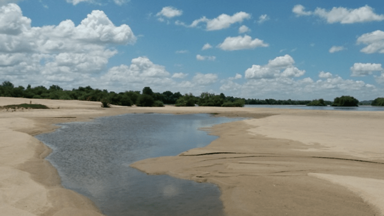
Instead of going to the beaches on the Lisbon waterfront on weekends when the temperature is high, try a little harder and head to the village of Valada in Cartaxo. On this river beach with a picnic area, you can swim in the Tagus; on the opposite bank, you can observe the village of Escaroupim with its traditional “avieiros” houses (nomadic fishermen from Vieira de Leiria). In order to support the river beach and the pier, there is one bar with a terrace.
Patacão Beach
This river beach is situated on the banks of the Tagus River in Ribatejo territory, close to an abandoned fishing village. Despite the deterioration, the wooden stilt buildings, which were constructed with the winter floods in mind, still retain their charm, and the area is incredibly peaceful, spacious, and home to many other features. You may choose to go swimming or park the car and have a picnic.
Penedo Furado Beach
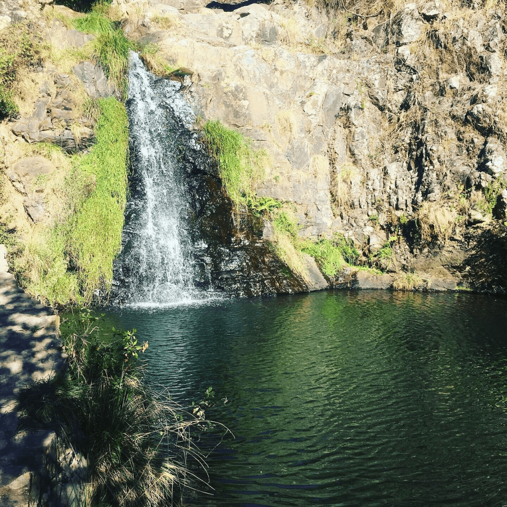
Swimming area with a picnic tables & BBQ areas, plus a nearby waterfall.
This is one of the most well-known locations in the municipality of Vila de Rei, due to the natural passage in the rock and the stream dividing the rocky massif from the start. The waterfalls that form Penedo Furado’s natural pools are known as “snorts.” The beach’s shallow depth makes it ideal for family outings, though camping is also popular there. The beach has toilets, a bar, and sand. Everything supports a kid-friendly pool that has just the right temperature.
At the highest point, there is an impressive rock with a large funnel-shaped opening that gives the beach its name and was the inspiration for the Penedo Furado Viewpoint. From there, you can view the landscape of pine-covered mountains and hills, the Codes river, the reservoir of the Castelo de Bode dam, and the surrounding villages.
It’s almost two hours by car, but it’s worth it.
Latitude. 39.6254° or 39° 37′ 32″ north ; Longitude. -8.1625° or 8° 9′ 45″ west
We use cookies on our website to give you the most relevant experience by remembering your preferences and repeat visits. By clicking “Accept All”, you consent to the use of ALL the cookies. However, you may visit "Cookie Settings" to provide a controlled consent.
This website uses cookies to improve your experience while you navigate through the website. Out of these, the cookies that are categorized as necessary are stored on your browser as they are essential for the working of basic functionalities of the website. We also use third-party cookies that help us analyze and understand how you use this website. These cookies will be stored in your browser only with your consent. You also have the option to opt-out of these cookies. But opting out of some of these cookies may affect your browsing experience.
Necessary cookies are absolutely essential for the website to function properly. These cookies ensure basic functionalities and security features of the website, anonymously.
Cookie
Duration
Description
cookielawinfo-checkbox-analytics
11 months
This cookie is set by GDPR Cookie Consent plugin. The cookie is used to store the user consent for the cookies in the category "Analytics".
cookielawinfo-checkbox-functional
11 months
The cookie is set by GDPR cookie consent to record the user consent for the cookies in the category "Functional".
cookielawinfo-checkbox-necessary
11 months
This cookie is set by GDPR Cookie Consent plugin. The cookies is used to store the user consent for the cookies in the category "Necessary".
cookielawinfo-checkbox-others
11 months
This cookie is set by GDPR Cookie Consent plugin. The cookie is used to store the user consent for the cookies in the category "Other.
cookielawinfo-checkbox-performance
11 months
This cookie is set by GDPR Cookie Consent plugin. The cookie is used to store the user consent for the cookies in the category "Performance".
viewed_cookie_policy
11 months
The cookie is set by the GDPR Cookie Consent plugin and is used to store whether or not user has consented to the use of cookies. It does not store any personal data.
Functional cookies help to perform certain functionalities like sharing the content of the website on social media platforms, collect feedbacks, and other third-party features.
Performance cookies are used to understand and analyze the key performance indexes of the website which helps in delivering a better user experience for the visitors.
Analytical cookies are used to understand how visitors interact with the website. These cookies help provide information on metrics the number of visitors, bounce rate, traffic source, etc.
Advertisement cookies are used to provide visitors with relevant ads and marketing campaigns. These cookies track visitors across websites and collect information to provide customized ads.












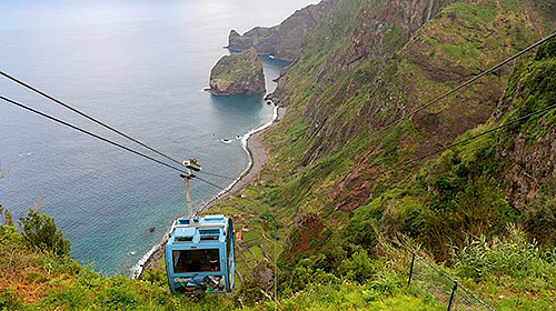 On Madeira’s north coast, in the Santana municipality, is the location of the Rocha do Navio cable car station. It is breathtaking to travel the five minutes down to Fajã da Rocha do Navio, where you will see banana plantations, vineyards, and Rocha do Navio, one of Madeira’s designated natural reserves.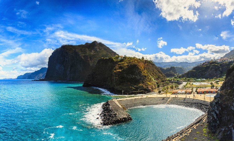

 .
.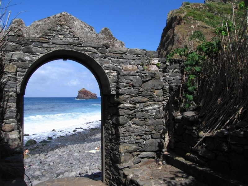 On the pebbles of São Jorge, you can find the Primitive Nucleus of the parish of São Jorge.
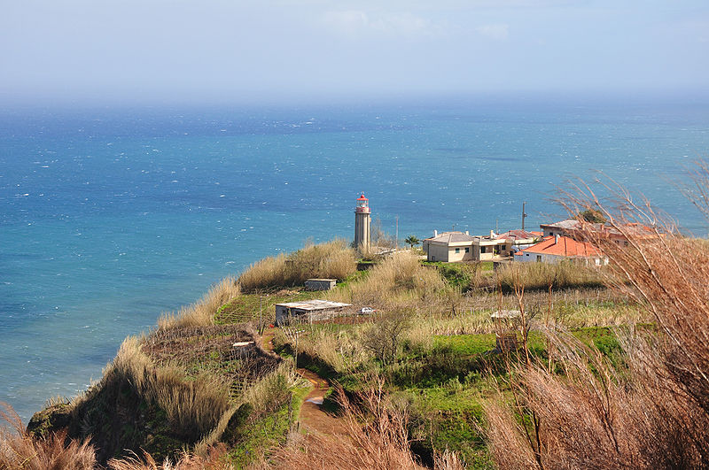 In addition to guiding marine navigation, the Lighthouse of São Jorge, located at Sítio da Vigia in São Jorge, is a lovely spot from which you can see the local parish, as well as Achada do Gramacho and Pico da Boneca in neighbouring Santana.
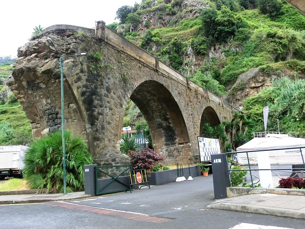 At the start of the 20th century, the bridge was built to connect the two sides of the parish that were separated by Ribeira do Faial. It was opened in 1904.
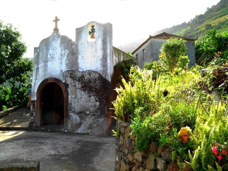 Built in the parish of Faial in the 17th century, more precisely in the year 1685, the chapel of Penha is a small chapel excavated in a huge boulder of reddish stonework on the site of Difference.