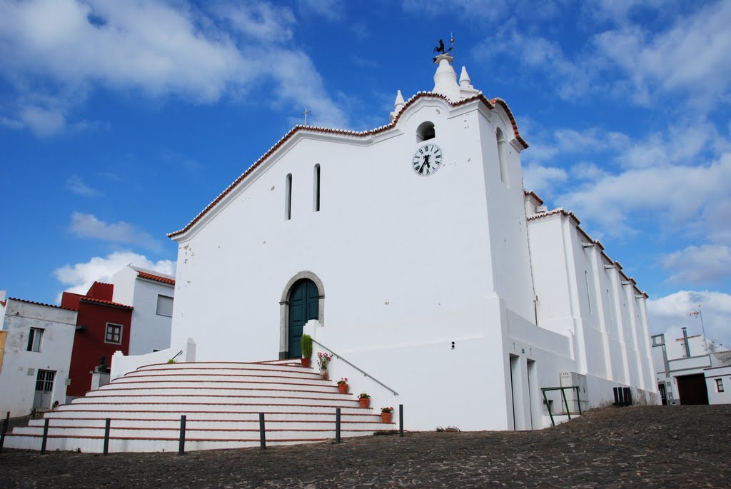
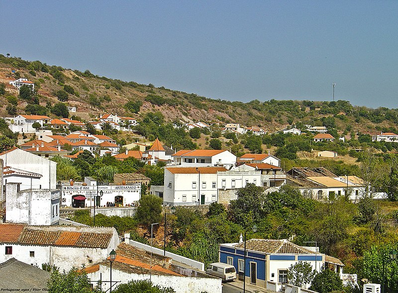
Cachopo, a mountain village nestled in the Serra do Caldeirão of Algarve, offers visitors a glimpse into authentic rural Portugal. Known for its schist houses and artisanal heritage, the village thrives on agriculture, beekeeping, cork, and linen production. Explore Cachopo’s winding streets, visit the ethnographic museum and historic windmills, or hike scenic trails through valleys and wildflower meadows. Local restaurants serve hearty game dishes and mountain specialties, while seasonal markets showcase traditional crafts and flavors. A hidden gem just outside Tavira, Cachopo invites travelers to discover the unspoiled heart of the Algarve.
Alte is a village and civil parish in the municipality of Loulé, in the Algarve region in the south of Portugal.
Alte is a small village located in the Algarve region of Portugal. It has a rich history, dating back to Roman times. The village is known for its beautiful whitewashed houses, narrow streets, and traditional chimneys. It was also a major centre for the production of cork during the 19th century. Alte is a popular tourist destination due to its picturesque scenery, traditional architecture, and charming atmosphere. Visitors can explore the village’s historical landmarks and museums, taste the local cuisine, and participate in cultural events. Overall, Alte is a must-visit destination for those who want to experience the authentic Portuguese way of life.
Alte waterfall (Cascata Queda do Vigário)
Let me share with you a hidden gem that you must visit during your trip to Alte Village: the breathtaking waterfall. This mesmerising waterfall is surrounded by lush green meadows that create a serene and idyllic atmosphere. It’s no wonder that this natural wonder has become one of the most popular destinations in the area.
The waterfall itself, with its crystal-clear waters, provides the perfect spot for a refreshing swim. If you visit during the rainy season, you’ll be treated to an impressive display of nature’s power and beauty as the waterfall cascades down from the rocks.
Even if the waterfall is not flowing when you visit, there are still plenty of activities to enjoy in the area. You can take a leisurely walk through the fields, have a fun family picnic, or organise a barbeque with friends.
As someone who loves to explore new places, I highly recommend adding the Alte waterfall to your travel itinerary. The peaceful and natural surroundings offer the perfect setting for relaxation, rejuvenation, and reconnecting with nature. So don’t forget to pack your swimsuit and prepare for an unforgettable experience at Alte’s stunning waterfall!
Church of Our Lady of the Assumption
Our Lady of the Assumption Church (“Igreja de Nossa Senhora da Assunção”) is located in the village center. The church was originally built in the 13th century as a private chapel but was renovated in 1518 as Igreja de Nossa Senhora da Assunção.
The church is designed in the traditional Manueline and Rococo styles popular in 16th-century Portugal. The interior of the church is beautifully rendered in this manner, making it a very magnificent monument in Alte. The church is one of Alte’s earliest historical references; it is well worth a visit!
Fonte Grande and Fonte Pequena
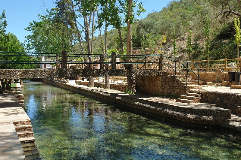
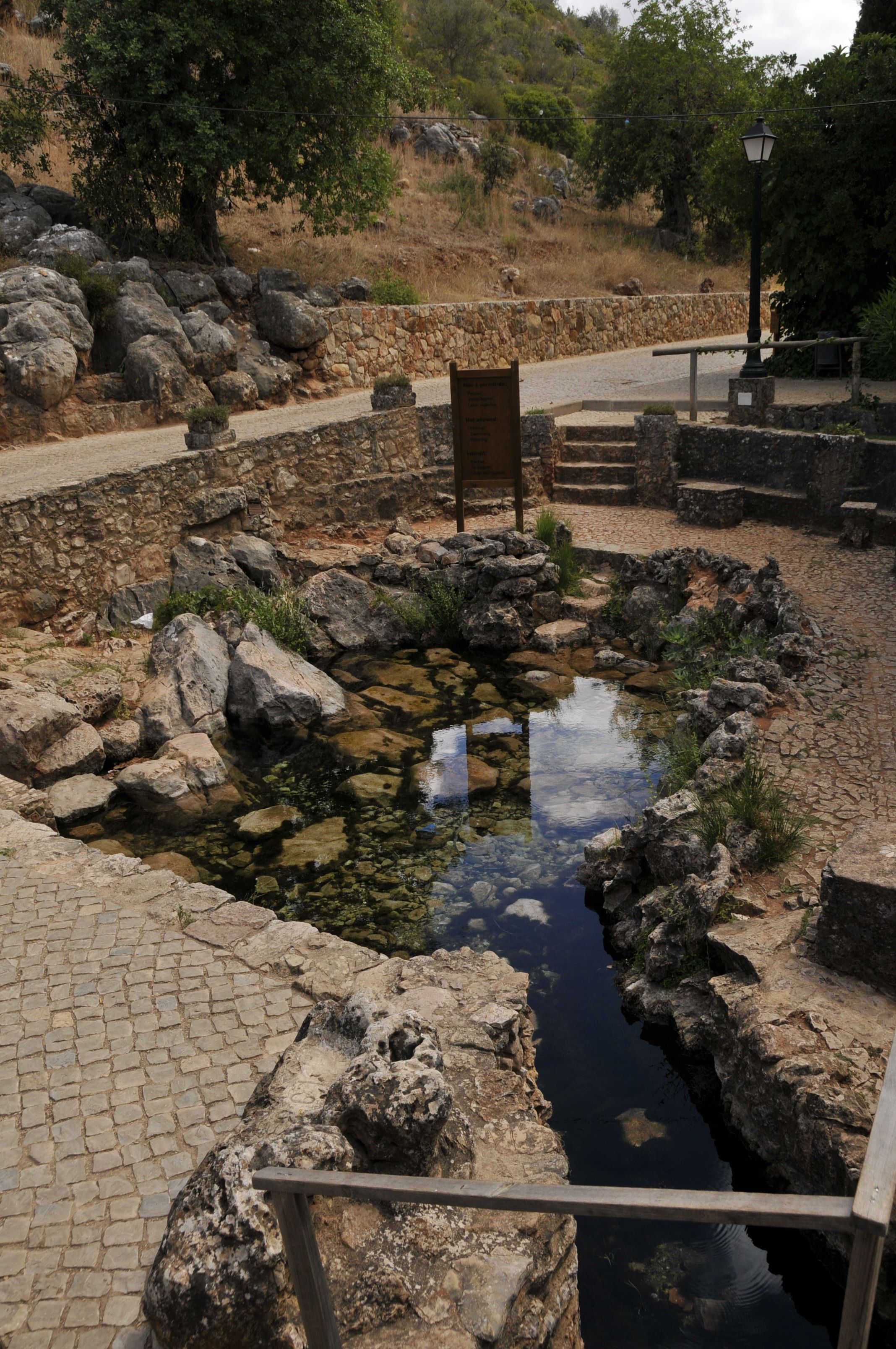
In ancient times, these “Fontes” served as a central location for village women to obtain water and wash their laundry; today, they serve as a lovely area to unwind. The springs feature crystal-pure water that pours from the Alte River, forming a pool popular with summer visitors. Additionally, the spring’s surrounding area is a pleasant spot for picnics and leisure activities.
In Alte, there are a number of restaurants and bars that serve both traditional Portuguese food and food from around the world.
Alte has a variety of places to stay for the night, including hotels, guesthouses, and vacation homes.
Alte has something for every taste and price, whether you want a quick bite to eat or a quiet place to sleep. So, make plans to visit this beautiful town right away and see for yourself its charm and friendly people.
How to get to Alte:
There are several ways to get to Alte, depending on your starting point and mode of transportation.
If you’re flying in, the nearest airport is Faro Airport, which is approximately 30 kilometres away from Alte. From there, you can either rent a car or take a taxi or shuttle service to Alte.
If you’re travelling by car, you can take the A22 highway from Faro or any other major city in the Algarve region. Once you arrive in Alte, there is plenty of parking available in and around the village.
If you prefer public transportation, there are bus services that operate between Alte and other cities in the Algarve region. The Faro bus station is the main hub for regional and national bus services, with frequent connections to Alte.
If you’re travelling from Lisbon, you can take a train from Lisbon to Tunes station and then switch to a regional train or bus to Alte. Alternatively, you can take a bus or drive from Lisbon to Alte, which takes approximately 3 hours.
No matter which mode of transportation you choose, the journey to Alte is worth it for the natural beauty and charm of the village and its surroundings.
If you’re using GPS to navigate to Alte, the coordinates for the village are:
Latitude: 37.2373° N Longitude: 8.1824° W
These coordinates will take you to the center of the village, where you can explore the beautiful streets and alleys and discover the hidden treasures of Alte. However, it’s always a good idea to have a detailed map or directions, especially if you’re driving, to ensure that you arrive at your destination safely and efficiently.
Throughout the year, Alte hosts several cultural traditions and festivals that showcase the rich heritage of the region. Let’s take a look at some of the unique festivals and traditions that take place in Alte.
Festa de São Luís – This is one of the most popular festivals in Alte and takes place on August 25th every year. The festival is dedicated to São Luís, the patron saint of the village. The celebration includes a procession of the saint’s statue, music, dance, and traditional food. The festival attracts visitors from all over the region and is a great way to experience the local culture.
Feira da Serra: This is the largest annual fair in the Algarve region and takes place in August in the nearby town of Loulé. The fair features traditional crafts, food, and music from the region, including Alte. Visitors can sample local delicacies such as fig cakes and almond sweets, watch folk dancing performances, and purchase handmade crafts.
Festival da Juventude: This festival is organised by the local youth association and takes place in July every year. The festival features live music performances, street art, and a variety of workshops and activities for young people. It is a great way to experience the energy and creativity of the local youth culture.
Festival da Batata Doce: This festival celebrates the sweet potato, which is a staple food in the region. The festival takes place in November and includes cooking demonstrations, food tastings, and a market selling sweet potato products. Visitors can sample sweet potato dishes such as roasted sweet potatoes, sweet potato soup, and sweet potato pie.
Carnaval de Alte: This is a popular carnival celebration that takes place in February. The carnival features colourful parades, music, and dancing and is a great way to experience the festive spirit of the village.
Overall, Alte is a village that is rich in cultural traditions and festivals throughout the year. These events provide visitors with an opportunity to experience the local culture and learn more about the history and heritage of the Algarve region.
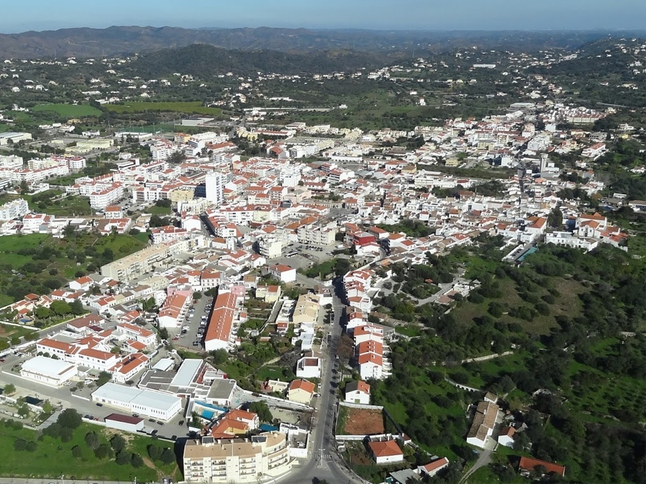
São Brás de Alportel is a town in the Portuguese region of Algarve, in southern Portugal.
São Brás de Alportel is a town in the municipality of Tavira, surrounded by the towns of Olhão, Faro, and Loulé. The community developed into a significant commercial centre in the nineteenth century as a result of its cork oak plantations. These plantations facilitated economic development and elevated the community to prominence as Portugal’s and the world’s leading producer of cork. São Brás de Alportel is located in a prime location, surrounded by woods and mountains, and boasts a wonderful view of the sea and surrounding countryside.
Things to do and see
Bengado Windmill
Old windmills are a continuous presence above the hills.
Moinho do Bengado, recently restored, awaits your arrival to tell you the old legends of a period when its candles provided the inhabitants with their daily bread.
This mill, erected in 1850, is of Mediterranean style, fixed, stone-built, cylindrical in shape, and has a 42.50 m2 area. Consists of a ground floor and a two-story house. It has a door, facing east and two windows. The flat and circular terrain where it is located is delimited by 10 landmarks. It is an example of a halter mill, the first kind of traction utilising rope and landmarks to rotate the roof in search of the finest quadrant.
Rua Gago Coutinho, nº 18150-151 São Brás de Alportel
Tel: 289 840 000 / 289 840 210
E-mail: camara@cm-sbras.pt / turismo@cm-sbras.pt
Museu do Traje
This is a gem of a museum. Beautifully set out with excellent displays of the passing of time (including some lovely costumes) and the cork industry. No information overload like some museums just nicely done. Well worth a visit.
Museu do TrajeMuseu do TrajeMuseu do TrajeMuseu do Traje
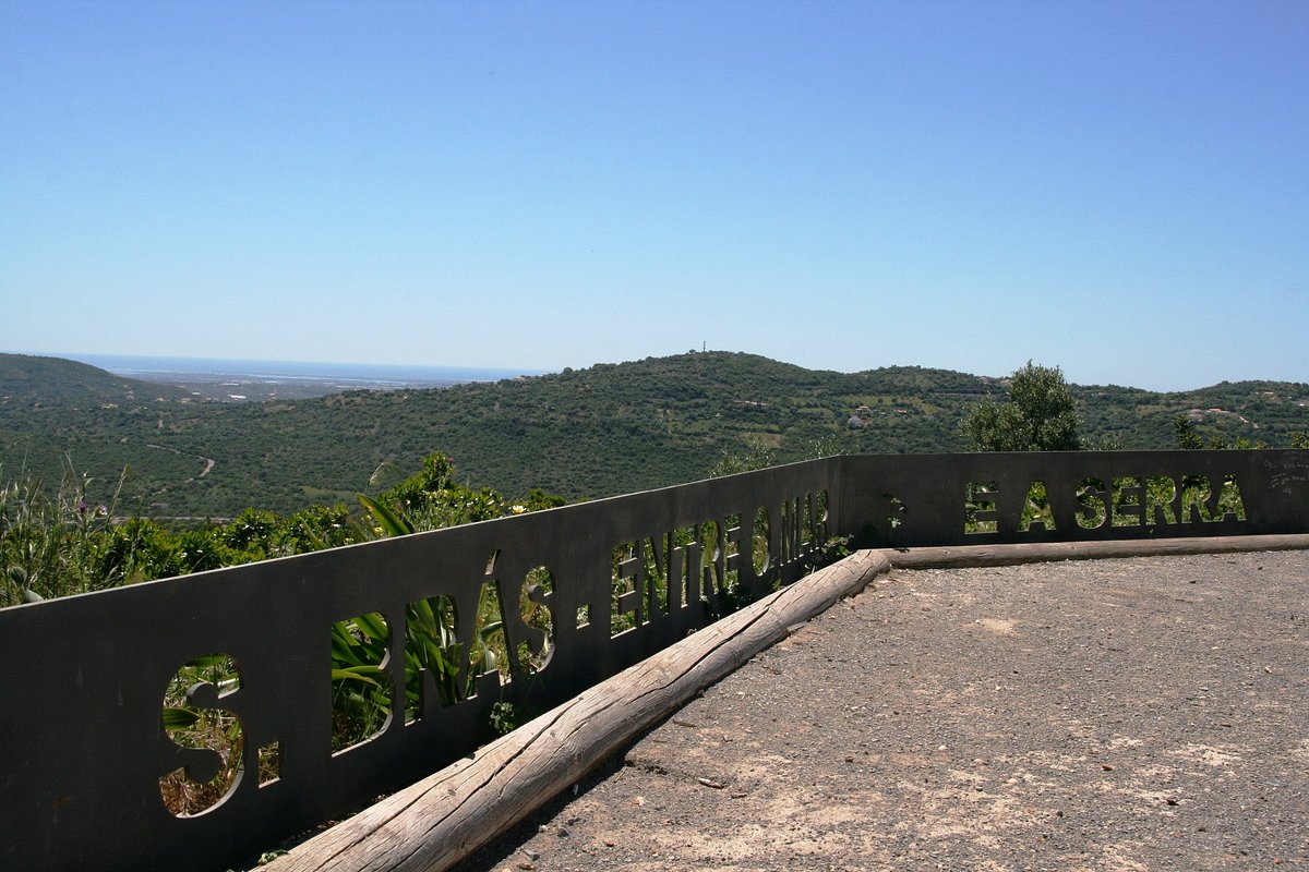
Miradouro do Alto da Arroteia (Lookout Point)
Miradouro do Alto da Arroteia
Igreja Matriz De Sao Bras De Alportel
Church with longitudinal drawing, composed by three naves and five roof trusses. Worthy of notice, inside, is the baroque baptistery dated from the XVIII century with a marble altar piece, unique in the Algarve region.
Igreja Matriz De Sao Bras De Alportel
Novacortica Cork Factory
On these fascinating behind-the-scenes cork factory tour, you’ll learn about the tree’s life cycle, harvesting and the manufacturing process, from drying to the production of wine and champagne corks. It also showcases other uses for the versatile material, such as clothing, footwear, bags and even furniture. Guided tours last 90 minutes and are in English and Portuguese.
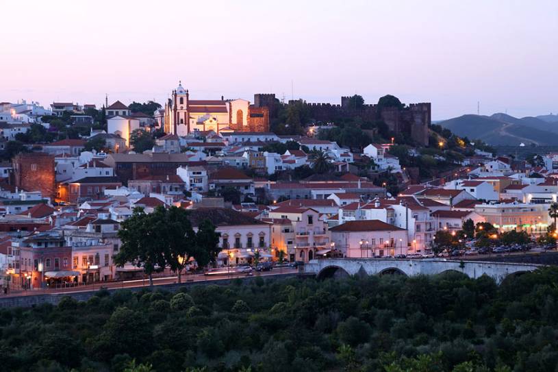
Silves is a town in the Portuguese region of Algarve, in southern Portugal.
Silves is a charming town with a long history, located on the banks of the Arade River. Historically, the river was navigable and served as a vital link between the interior and the shore. The town, which is built on top of one of the greatest underground aquifers in southern Portugal, the Querenca-Silves aquifer, crosses the river and maintains a medina-style gate, the Porta de Loule, and remnants of the Moorish-era poured concrete walls.
Although the area has been inhabited since Paleolithic times, the town flourished during the Moorish conquest of the Iberian Peninsula in 713. By the eleventh century, Silves, then known as Xelb, had risen to prominence as the capital of Al-Gharb, the region that is today known as the Algarve. In 1189, with the assistance of Danish crusaders, King Sancho I regained the town for the Portuguese.
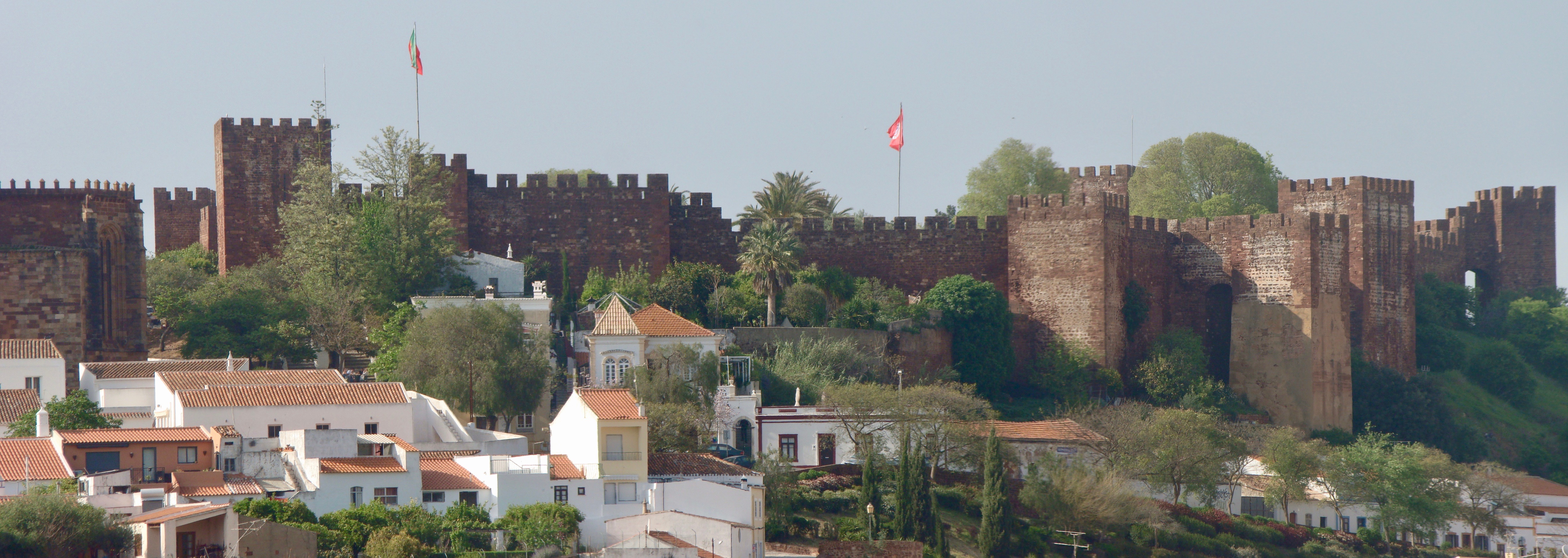
Today, Silves is an attractive, crumbling town filled with outdoor cafes and fragrant orange orchards, dominated by one of the Algarve’s best-preserved castles. The Moorish Fortaleza, which consists entirely of sandstone walls and detached towers, covers an area of twelve thousand square metres on the hill overlooking the town. Iron Age relics, a well, a governor’s residence, and the Cisterna Grande, a thirteenth-century water cistern that formerly serviced the entire town, have been discovered. The Cisterna is 10 metres high, with six columns supporting it, and is supposed to be haunted by the ghost of a Moorish maiden. A Moorish-style garden has been recently restored and is open to visitors every day, as is the rest of the Fortaleza, whose walls offer excellent views of the town and surrounding countryside.
Silves Cathedral, or Sé, is located beneath the Fortaleza. It was erected on the site of a great mosque and is flanked by wide Gothic towers. Despite the devastation caused by the great earthquake of 1755, as well as decades of degradation and patchwork restoration, the cathedral preserves some of its original splendour. The cathedral’s walls are lined with the tombs of bishops and crusaders who died reclaiming Silves from the Moors. The Igreja da Misericordia is just across from the cathedral, with much of its architecture dating from the eighteenth century.
The Fabrica do Ingles (Englishman’s factory) is a former cork factory that currently houses a couple of museums and a cluster of pubs, cafes, and fountains that come alive in August for the town’s annual beer festival. Every morning from Monday through Saturday, a market is held on the riverbank, beside a narrow thirteenth-century bridge.
Silves is included in this list of rural areas due to its rustic and wild aspect, which renders the city unfamiliar to the majority of tourists visiting the Algarve.
Castro Marim is a town and a municipality in the southern region of Algarve, in Portugal. It’s set in a rolling green setting overlooking the river Guadiana’s expansion. Castro Marim, located near the Atlantic Ocean and directly over this natural border with Spain, has been strategically significant throughout history. As early as Roman times, the river here served as a demarcation between what was then Lusitania and Baetica, which would eventually become Spain and Portugal.
Castro Marim
However, Castro Marim’s history precedes the Romans, with traces of Stone Age occupation going as far back as 5,000 BC. In those days, the landscape was somewhat different, with the settlement located closer to the sea and actually on a small island surrounded by the estuary’s shallow waters. Later, during the age of metals, Castro Marim became a harbour for Phoenician ships going up and down the coast from Alcoutim, transporting metal ores and other goods. Only in the 17th century did the village become landlocked, cut off from the river that provided its livelihood.
Castro Marim, like the majority of the Algarve, was occupied by the Moors. They protected the settlement for five centuries from a crude hilltop castle. However, in 1242, the Reconquests stormed over the province, and Afonso III’s Christian soldiers recaptured Castro Marim.
Castro Marim’s reputation as a fortress-town was cemented in the years that followed. The king’s policy was to repopulate and defend the kingdom’s recovered lands. For a strategically vital location such as Castro Marim, this meant erecting an enormous fortress, which today towers over the town. Not only physically, but also spiritually, the settlement was fortified when it became the headquarters of the Order of Christ, which was founded in 1319 to replace the Order of the Knights Templar.
Much of the Order’s activity took place at the chapel (the Igreja de Santiago) within the castle walls, and Henry the Navigator is said to have been a frequent visitor. Indeed, there is an inscription on the walls indicating that Henry, who was once the Order’s head, resided here. Regrettably, as was the case with many of the region’s historic structures, the chapel was almost completely destroyed by the 1755 earthquake.
Castro Marim Castle
Although the Order of Christ relocated to Tomar and the river changed course, Castro Marim’s fortunes improved somewhat in the 16th and 17th centuries with the construction of a second castle, the Fort of São Sebastião, on a neighbouring hilltop. As a result, the hamlet became the Algarve’s most significant military outpost. While entry to this fort is restricted, the final weekend of August hosts a Medieval festival that welcomes tourists.
Apart from the castles, Castro Marim is a picturesque Algarvian village with cobblestone streets, whitewashed buildings, and terracotta roofs. On the exterior of the immaculate tiny homes, you’ll notice an abundance of bright blue painted themes and geometric shapes.
Molino de Viento
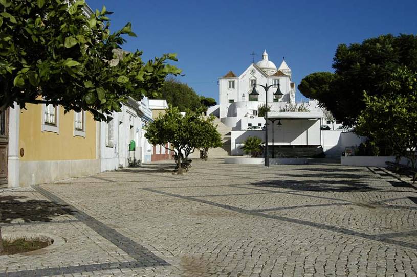
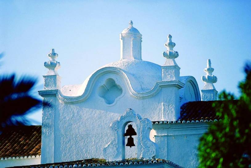
Apart from the castle, perhaps the most famous structure is the 18th-century church, Igreja de Nossa Senhora dos Mártires. The church, which is painted brilliant white in the Algarvian style, has several notable characteristics, most notably the spectacular dome and bell tower. The community also has another church, the Igreja de Misericórdia, which, while unattractive from the outside, has an excellent interior.
flamingos
Castro Marim is surrounded by saltpans and the 2,000-hectare Reserva Natural do Sapal. This one-of-a-kind biological ecosystem is well known for the flamingos that visit to feed. However, it is also home to a variety of other animal and plant species. There are literally hundreds of additional bird species here, including storks, avocets, and spoonbills, several of which are year-round residents. While the shellfish are of primary relevance from a scientific standpoint, it is the rare Mediterranean chameleon that captivates the attention.
From the blue of the sky to the emerald green of the sea, from the chirping of birds to the crashing of waves, from the perfume of the hills’ pines to the scent of seaweed and saltwater carried by the sea breeze… Salir do Porto is an oasis of natural beauty and tranquillity that is conveniently located near the Silver Coast’s most popular attractions!
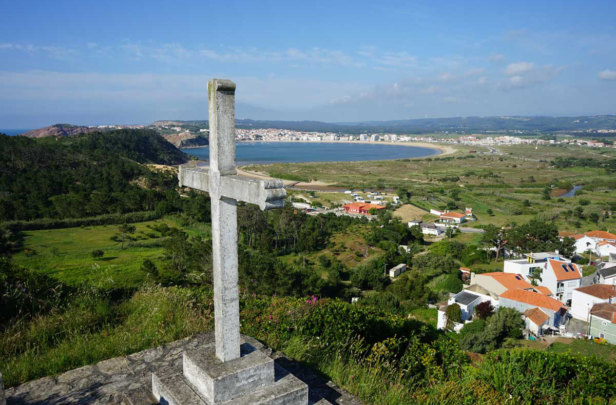
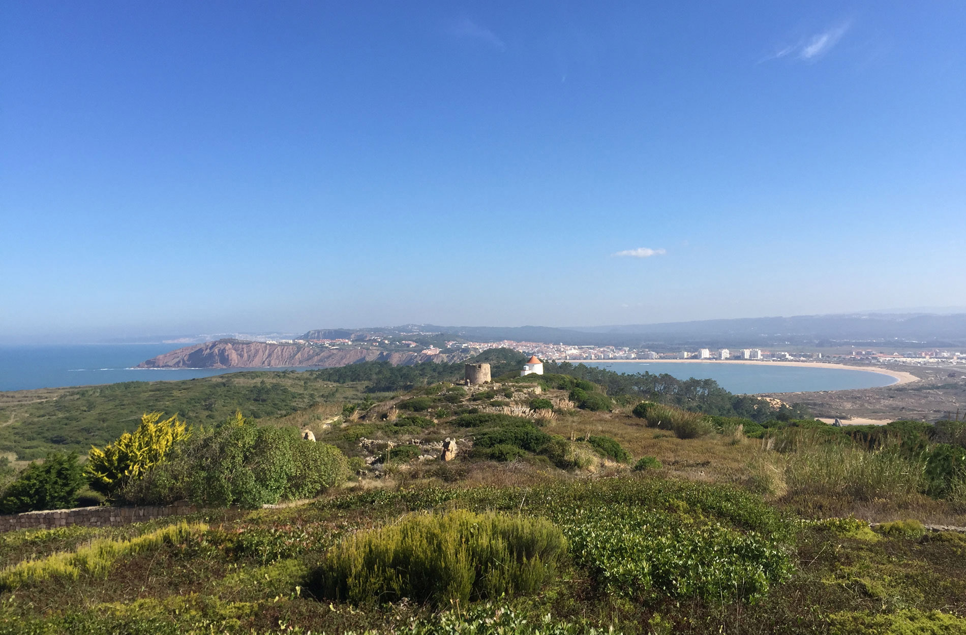
There are few locations where one may exist in such perfect harmony with nature. One of these locations is Salir do Porto. Salir do Porto, located on the south side of the stunning shell-shaped bay of S. Martinho do Porto, is known for its natural beauty. A blend of countryside and sea, Portugal shows its simple pleasures in vibrant hues and enables you to let your imagination go wild.
Salir do Porto is a typical Portuguese village, serene and tranquil. A traditional fishing and sailing village, the village retains a strong sense of community today, notably during its annual August events, when the village streets are illuminated and inhabitants share their heritage, handicrafts, and regional foods around joyous tables. Dancing to live music during the evening concerts or taking part in the procession in honour of Our Lady of Conception is without a doubt the highlights of the festivities… a fusion of ancient customs and religion in which the town joins together to honour century-old traditions.
There is a great deal to see and do… Salir do Porto is home to a thriving Portuguese resident community that has a strong connection to the water. Salirenses (people of Salir) are famed for their cheerful demeanour, which is attributed to the fact that they awake with the sun on their faces. Even in the winter, the sun shines on the majority of days, and there is never a shortage of sights and activities!
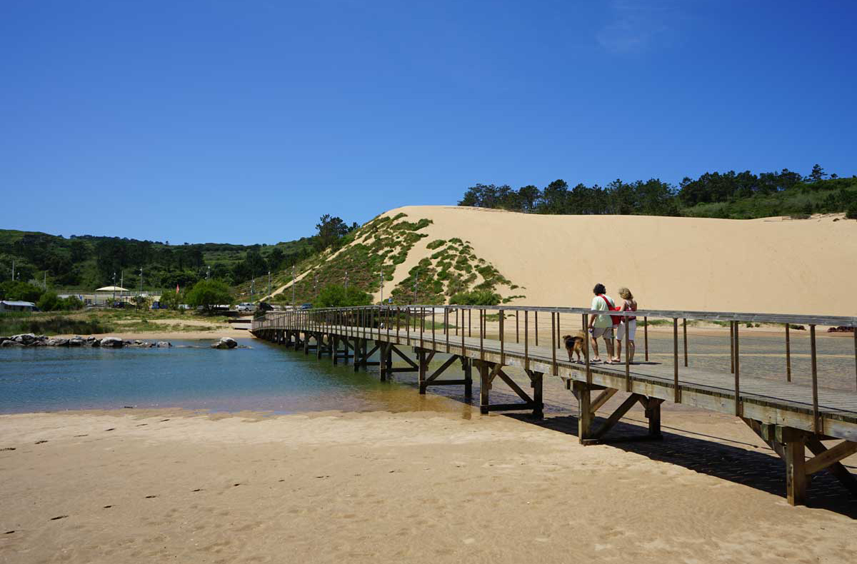
The wooden paths connecting Salir do Porto and São Martinho do Porto beach are popular sites for a peaceful stroll or jog. The dunes surrounding the bay are a wonderful area to interact with nature, with the fresh ocean wind and sound of the waves providing companionship.
If you prefer more remote locations, the hilltops connecting the village to Serra do Bouro are covered with various hiking trails ideal for wandering through the marine scenery, passing several historic windmills and the occasional herd of goats and sheep.
On the cliffs near the village, fishermen and locals occasionally stroll along the slopes that lead to several secluded pebbled beaches known as “Quebradas.”
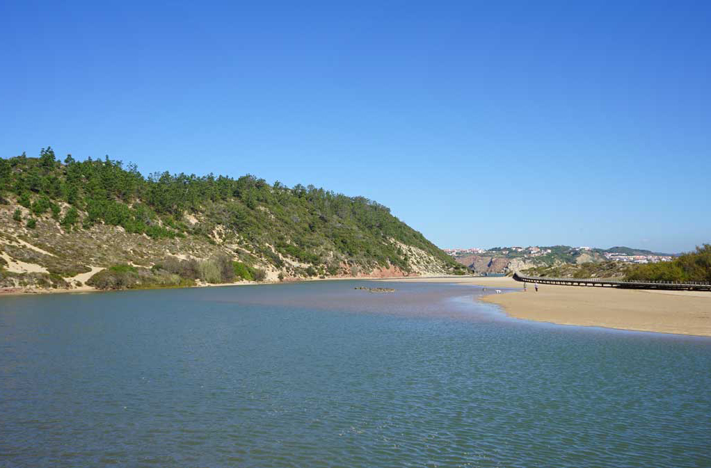
Salir do Porto’s river beach is idyllic for people who enjoy swimming and water sports! From paddle boarding to canoeing, the bay’s quiet waters invite you to unwind while taking in the surrounding scenery.
The beach is normally peaceful, except in July and August when it is increasingly crowded with holidaymakers. And even then, it is the ideal location for people seeking a retreat from large tourist resorts.
A modest parking area and cafés are located directly across from the beach, where you can have an ice cream or snack following your dive! In the summer, you may also spend the day at the oceanic pool located directly above the café and adjacent to the beach entrance.
However, one of Salir do Porto beach’s ex-libris is clearly its massive dune. With a height of more than 50 metres, only a select handful are capable of ascending the dune without pausing for air! However, the climb is definitely worth it, not only for the stunning views from the summit but also for the enjoyment of the descent. Some locals choose to roll or slide down the dune, while others prefer to run and finish with a dip in the waters at the bottom!
Surrounded by history and tradition… Salir do Porto is also steeped in history, with legends passed down from generation to generation recounting tales of faith and bravery from local elders.
Salir’s historic Customs House, dubbed “alfândega,” is located midway between the beach and the bay’s edge. Today, all that remains are the ruins from the sixteenth century. The path to the remains is narrow but well worth it for the beautiful view over the bay provided by the old stone walls.
This is where the caravels of D. Afonso V and D. João II were built, enabling the Portuguese to discover the world. According to legend, several of the caravels used in the most significant Portuguese nautical discoveries of the time were built here, including the famed ‘Nau So Gabriel,’ which captained Vasco da Gama’s armada to India and also participated in the discovery of Brazil.
Continue down the shoreline towards another pilgrimage destination, the “Pocinhas de Salir” freshwater spring. These mineral-rich spring waters have long been prized for their therapeutic benefits. Not only for drinking and treating digestive disorders but also for bathing in the freshwater pools that occur on the rocks during low tide.
However, it is on the walk to the Chapel of Sant’ Ana, which is located on Salir’s northernmost tip, where the bay meets the sea, that the residents’ religion is revealed in all its beauty.
The church is reached by a dirt trail that begins on the left side of the small swimming pool in Salir do Porto. The journey to get there is around a kilometre long and is surrounded by greenery and birds chattering. You can also access it by car along a dirt road on the left side of the town church that leads near to the chapel (the final section of the track requires around 500 metres of walking). Whichever route you take, the arrival is always remarkable, presenting a breathtaking view of the open Atlantic sea on the western side and the bay and settlement of So Martinho do Porto on the eastern side.
This chapel is one of the region’s oldest, dating from the 12th century. For hundreds of years, families travelled to this hallowed location in prayer to bid farewell to fishermen and sailors, and boats manufactured at the customs site were blessed here prior to heading out to sea. Until the early twentieth century, religious processions led by villagers from Salir do Porto to the chapel continued.
Another wonderful location to appreciate the views is at the summit of the town of Salir do Porto. The “miradouro” provides an excellent vantage point for viewing the bay and adjacent valley, which was formerly a lagoon that extended all the way up to the neighbouring settlement of Alfeizero.
Salir do Porto is also popular with adventure enthusiasts, particularly mountain bikers and hikers. The route connecting the settlement to Foz do Arelho provides ideal conditions for various sports, as well as breathtaking natural scenery.
Salir do Porto is close to several famous Silver Coast locations: to the north, the famous Nazare beach with its giant waves; to the south, the beautiful beach of Foz de Arelho and the Obidos Lagoon; to the west, the vibrant city of Caldas da Rainha with its unique outdoor farmers’ market; and to the east, the mediaeval town of Obidos, surrounded by history and home to some of Portugal’s best cultural and leisure events!
Albufeira, located in the heart of the Algarve and only 40 minutes from Faro airport, has been the most popular holiday resort in southern Portugal since the 1970s. Originally a fortified Roman town and for centuries a typical Algarvian fishing village awash with simple white houses and the aroma of grilled sardines, this picturesque location is now a thriving tourist town offering activity and entertainment day and night, and surrounded by a slew of beautiful beaches.
The central area’s tiny alleyways have been carefully kept and connected to the major square, Largo Duarte Pacheco. Near here is a tunnel that leads to the town’s main beach, the tourist information centre, and a wonderful spot to hang out and observe the town’s everyday activities. Albufeira expands outside from the centre into a plethora of tourist projects and hotels, and vibrant new structures surround the freshly constructed marina.
Igreja Matriz de AlbufeiraIgreja de São Sebastião
Among the town’s cultural attractions is the Manueline gateway of the Church of San Sebastio and the archway in the Travessa da Igreja Velha, both of which bear witness to the town’s Moorish past. The street’s name, ‘old church,’ refers to what was formerly a mosque but was later converted into a Christian church and destroyed in the 1755 earthquake. The clock tower in Rua Bernardino de Sousa is a local gem, and on festival days, its filigree iron bell support is lit. Another noteworthy tower is the Matriz Church’s nineteenth-century bell tower. It complements the neoclassical white church below, which features a priceless painting by local painter Samora Barros over the main altar. The municipal art gallery hosts a variety of exhibitions, while the local museum features a collection of old Ming pottery.
Praia dos Pescadores
Without a doubt, the area’s beaches are the biggest appeal, with their golden sand, breathtaking colours and curves of the cliffs, and consistently pleasant weather. Aquatic activities and boat cruises are extremely popular here, and Zoomarine, located just 10 kilometres away, is a marine park where visitors may learn about nature through interaction with dolphins. Olhos de Agua and Falesia are the closest beaches with enough tourist infrastructure and, as a result, are frequently the most congested, notwithstanding their beauty. Praia da Galé and So Rafael is located a few kilometres further along the coast, but provide a more private experience while still providing required amenities and the added bonus of some spectacular rock formations.
Places to visit in Albufeira
Igreja Matriz de Albufeira – The parish church (Igreja Matriz) in Albufeira is one of the finest examples of neoclassical architecture in the Algarve. Built-in the late 18th century it stands on the site of an earlier church which was converted from a pre-existing mosque
Church of São Sebastião – The aesthetically pleasing, whitewashed church of São Sebastião (Saint Sebastian) on Praça Miguel Bombarda is thought to date back to the early 18th century, having been rebuilt on the site of a 16th-century church.
Zoomarine Algarve – Promoting conservation, environmental education and FUN! Zoomarine combines an important message with hands-on shows and a huge water park.
Parderne’s castle – Built from sandstone and earth the castle sits on a promontory overlooking the Quarteira River around 10 kilometres inland from Albufeira.
Aqualand – One of Europe’s largest outdoor water parks and features a range of chutes and slides suitable for all ages.
Albufeira Archaeological Museum – Located in Albufeira’s old town, just behind the beach, is this archaeological museum. The Museu Municipal de Arqueologia de Albufeira is housed in, what was until the late 1980s, the town hall.
Museu de Cerro da Vila – The Cerro de Vila museum is located near the Quarteira suburb of Vilamoura, on the Algarve coastline. Some pretty interesting Roman archaeological excavations are to be found here.
Estoi is a pretty tiny town located less than 10 kilometres from Faro and the coast. It’s well worth a visit if you’re staying on the coast, however, it’s unlikely to qualify as a day trip in of itself.
The town is characterised by cobblestone streets, whitewashed buildings, and terracotta roofs, as is typical of the Algarve. However, living only a few kilometres inland creates a world that is markedly different and considerably more easygoing than the neighbouring seaside. As charming as the village is, the majority of people travel to Estoi to see the village’s two major attractions: the Palácio de Estoi and the Roman Villa of Milreu.
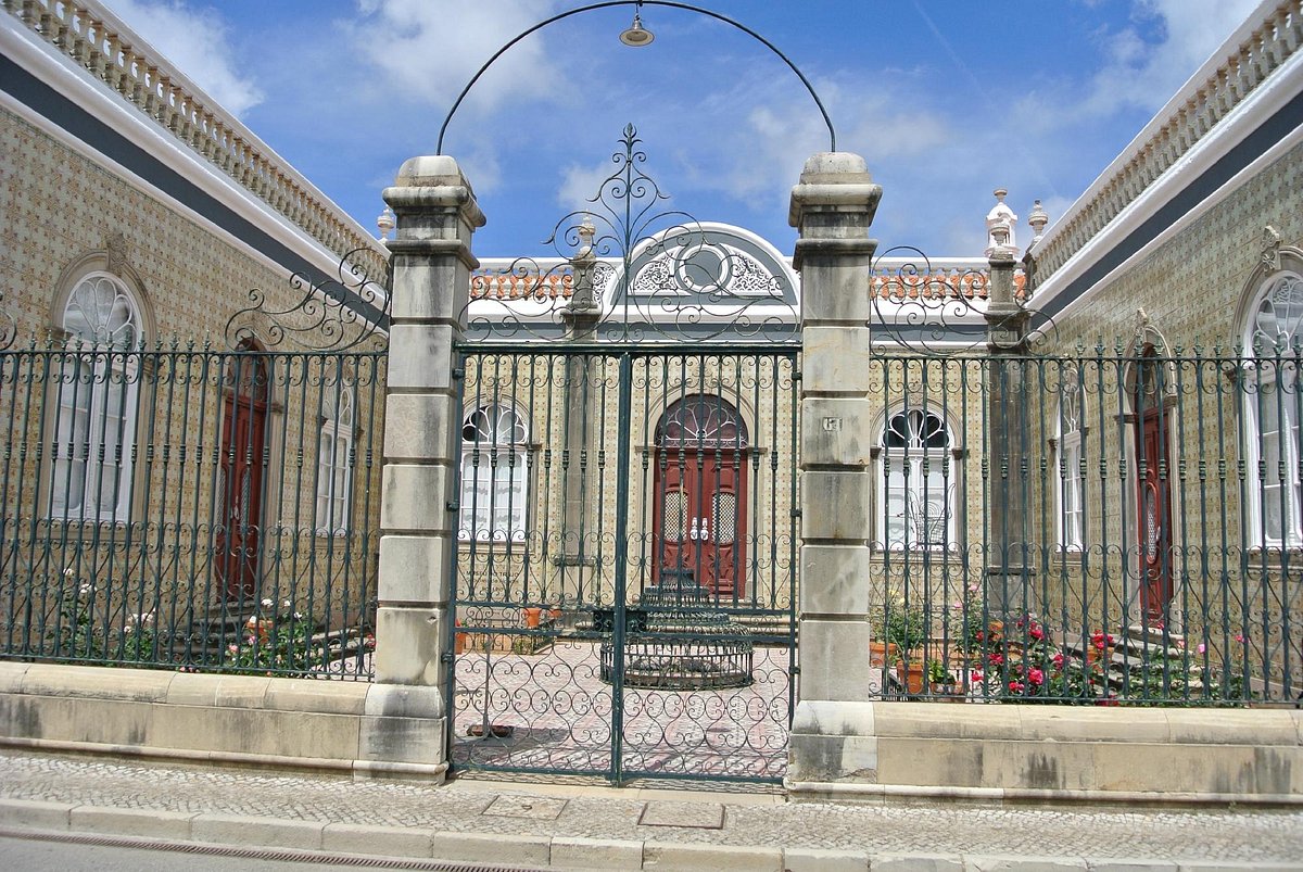
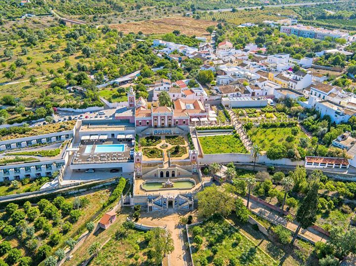
The Palácio do Visconde de Estoi is located in the village’s main square, just a short walk away. This recently rebuilt nineteenth-century palace, with its exquisite pink Rococo front, has been transformed into an exclusive pousada. It had previously been abandoned and allowed to fall into disrepair and near ruin. The gardens of the palace are where guests spend the majority of their time, strolling among the palm trees and fountains.
The ruins of the ancient Roman complex of Milreu are nearby (about a 15-minute walk). The site is centred on the well-preserved ruins of a second-century AD Roman villa. Here you’ll find weathered columns, a huge temple, and many mosaics from a former bathhouse.
While you’re here, be sure to check out Estoi’s main church, the Igreja Matriz. Within the neoclassical church is an alter reputedly fashioned from wood salvaged from boats.
This premier seafood restaurant is a local’s secret. Hidden among the Port of Lisbon’s shipping container cranes, it attracts locals with its brilliantly simple grilled fish combined with top Alentejan and Douro wines. Mara do Céu oversees a parking-lot-style barbecue, framed by shipping containers and departmental port buildings. Located next to the Gare Marítima de Rocha Conde d’Óbidos (the Maritime Station of Rocha Conde d’Óbidos), it’s hidden amongst shipping containers, separated from the port by a barbed-wire fence.
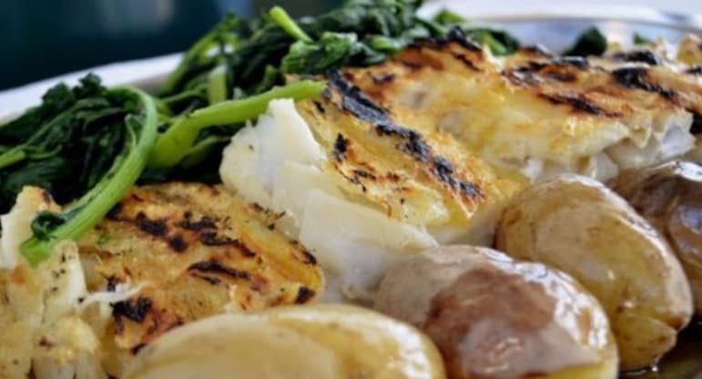
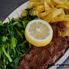
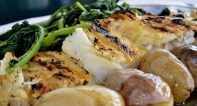
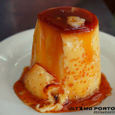
Último Porto has remained a stronghold for grilled fish, surviving trends and feeding business people, port workers and young crowds from the co-working building nearby.
The fish and seafood are primarily from Ribeira, but there is another key to their freshness: the manner they are cooked. Maria do Céu, the grill master, has been doing this for 15 years and still smiles. At 10:30 a.m., she starts the fire, and two hours later, the first orders arrive horse mackerel, grouper, cuttlefish, salt cod, hake roe, and, of course, the popular summer sardines. She grills the gleaming silverfish over low heat, merely seasoning with sea salt, and the fragrance (and smoke) of the grill fills the patio
Seabass, cuttlefish, grouper, and sole are grilled to perfection and served with boiled potatoes and grelhos (rapini greens), all without a single tourist in sight.
To locate it, walk along Rua Cintura Porto Lisboa along the marina’s edge, turn left, and proceed to the dock’s end.
Estação Marítima da Rocha do Conde de Óbidos 1350-355 Lisbon, Portugal
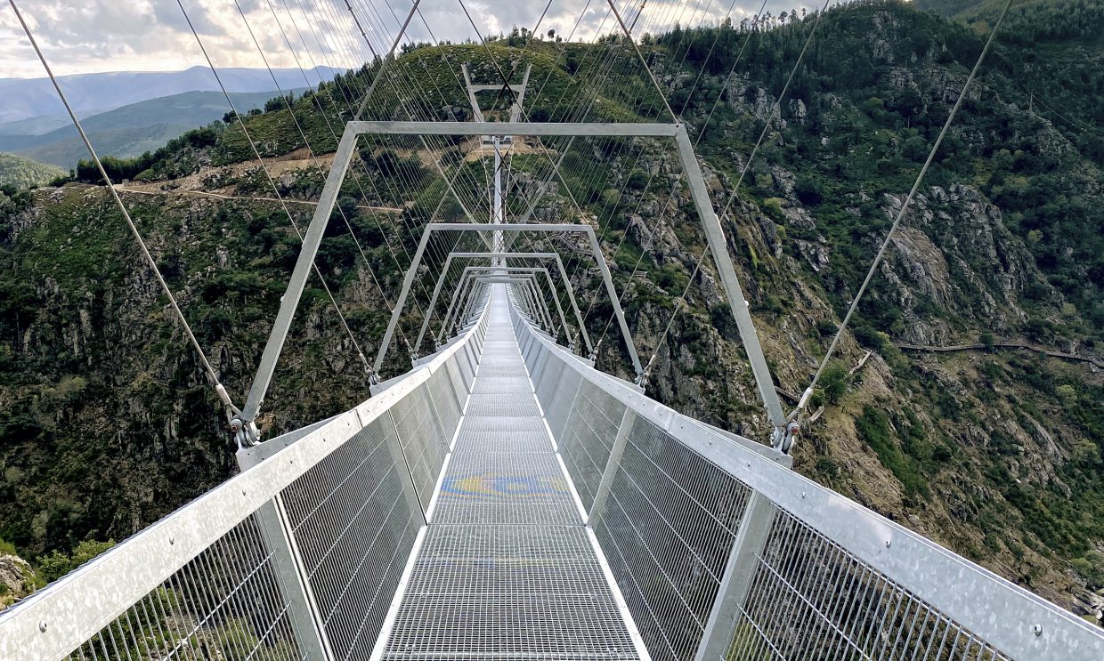
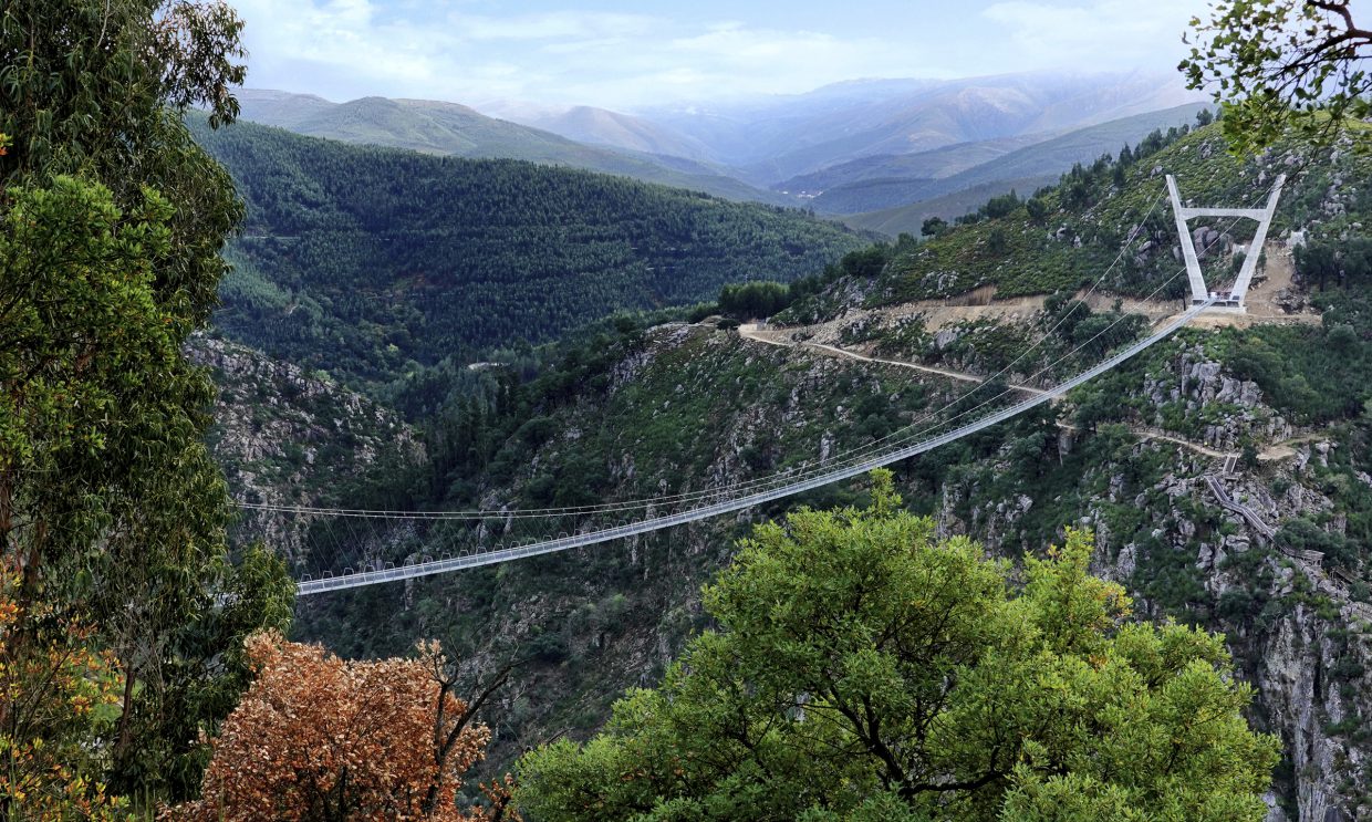
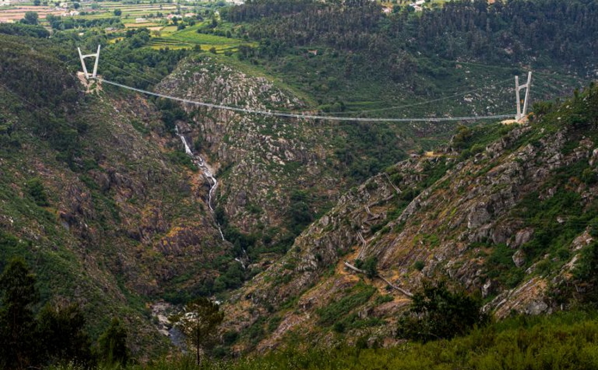
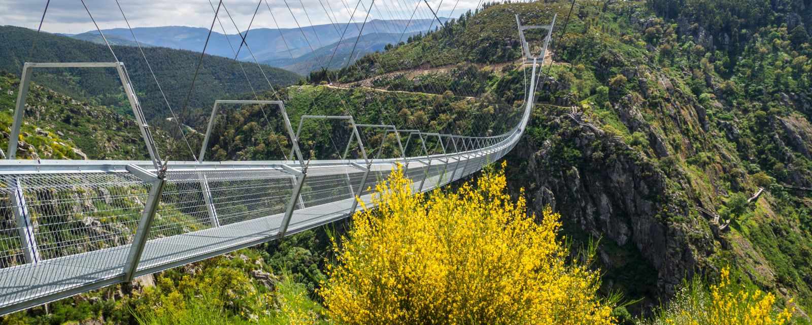
The 516 Arouca is the world’s longest suspension footbridge, consisting of railings and steel cables, with a span of 516 metres, a width of 1.20 metres, and a height of 175 metres over the Paiva River, Portugal.
While crossing the 516 Arouca bridge is an amazing experience in and of itself, there is much much more to enjoy. Whether viewed from the bridge’s apex or the trails leading to its entrances, the surrounding landscape, which is primarily in its natural state, captures the eye.
In this Rede Natura 2000 area, more observant visitors can see a variety of magnificent species, from the great short-toed eagle to the small strawberry butterfly, as well as roe deer, wild rabbits, red squirrels, otters, Iberian wolves, and round-winged eagles. Hundreds of creatures, many of them endangered, find ideal habitats here. A location with a diverse and abundant flora that thrives throughout the year.
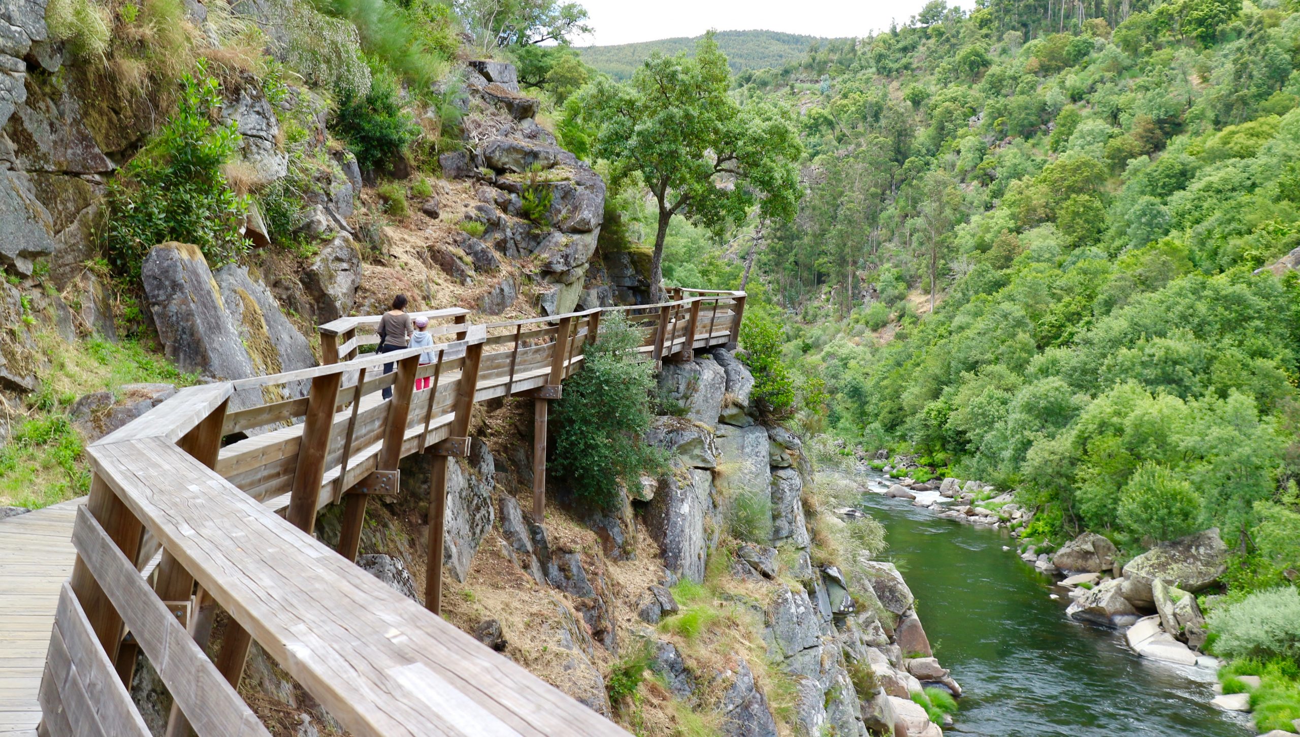
A picturesque setting that includes the well-known Paiva Walkways, the Aguieiras waterfall, and the recreational areas of Areinho and Vau, which are prime locations for whitewater sports.
A one-of-a-kind environment that adds to the charm of the 516 Arouca.
To get there, either walk the Paiva Walkways, which are more concrete at Areinho’s entrance or take a less strenuous route through the parish of Alvarenga. There, you may park your car in one of the Feira parks or at the football field and walk the remainder of the way over old paths that traverse fields and through charming towns like Vila and Chieira.
The crossing can be completed in either direction – round trip or one-way – by proceeding to the Paiva Walkways (access to this infrastructure is included in the bridge ticket) or by proceeding to the historic centre of Alvarenga, depending on the input you have selected.
Directions to the location:
You can begin the 516 Arouca bridge journey in either Canelas (Areinho) or Alvarenga.
Whichever entrance you select, you must park in the designated parking lots.
To begin the tour at Canelas through Passadiços do Paiva (Areinho), leave your vehicle adjacent to the Areinho river beach, around 1200 metres from the bridge, and go to 516 Arouca by the Passadiços do Paiva trail. This pedestrian route is quite demanding, needing 500 steps to reach the entry point and taking up to an hour to complete.
If you prefer to begin in Alvarenga, you should park your car at Albisqueiros, around 1000 metres from the bridge, and follow the signs to 516 Arouca. This path is moderately challenging and should take no more than 20 minutes.
Consider the distance you will need to cover on foot in order to be on time for your visit!
We use cookies on our website to give you the most relevant experience by remembering your preferences and repeat visits. By clicking “Accept All”, you consent to the use of ALL the cookies. However, you may visit "Cookie Settings" to provide a controlled consent.
This website uses cookies to improve your experience while you navigate through the website. Out of these, the cookies that are categorized as necessary are stored on your browser as they are essential for the working of basic functionalities of the website. We also use third-party cookies that help us analyze and understand how you use this website. These cookies will be stored in your browser only with your consent. You also have the option to opt-out of these cookies. But opting out of some of these cookies may affect your browsing experience.
Necessary cookies are absolutely essential for the website to function properly. These cookies ensure basic functionalities and security features of the website, anonymously.
Cookie
Duration
Description
cookielawinfo-checkbox-analytics
11 months
This cookie is set by GDPR Cookie Consent plugin. The cookie is used to store the user consent for the cookies in the category "Analytics".
cookielawinfo-checkbox-functional
11 months
The cookie is set by GDPR cookie consent to record the user consent for the cookies in the category "Functional".
cookielawinfo-checkbox-necessary
11 months
This cookie is set by GDPR Cookie Consent plugin. The cookies is used to store the user consent for the cookies in the category "Necessary".
cookielawinfo-checkbox-others
11 months
This cookie is set by GDPR Cookie Consent plugin. The cookie is used to store the user consent for the cookies in the category "Other.
cookielawinfo-checkbox-performance
11 months
This cookie is set by GDPR Cookie Consent plugin. The cookie is used to store the user consent for the cookies in the category "Performance".
viewed_cookie_policy
11 months
The cookie is set by the GDPR Cookie Consent plugin and is used to store whether or not user has consented to the use of cookies. It does not store any personal data.
Functional cookies help to perform certain functionalities like sharing the content of the website on social media platforms, collect feedbacks, and other third-party features.
Performance cookies are used to understand and analyze the key performance indexes of the website which helps in delivering a better user experience for the visitors.
Analytical cookies are used to understand how visitors interact with the website. These cookies help provide information on metrics the number of visitors, bounce rate, traffic source, etc.
Advertisement cookies are used to provide visitors with relevant ads and marketing campaigns. These cookies track visitors across websites and collect information to provide customized ads.